TopoQuest Logo
Do you find TopoQuest useful?
Help keep TopoQuest running and adding new maps/features by donating!
Bitcoin:  19c7KJd3qBynnjoSw5npx9KScwjBe4ifkT
Litecoin:  LXs6TkuXGGXo1vDsWCkWVdjQX94eUKd6ui
Home View Maps Find Maps Find Places Resources & Links


New Haven, Illinois Topographic Map

USGS Map Title: New Haven, IL
USGS Map MRC: 37088H2
DRG (GeoTIFF) Download: o37088h2.tif


Neighboring USGS Topographic Map Quads:


  Enfield, IL  
38088A3
 

  Carmi, IL  
38088A2
 

  Maunie, IL  
38088A1
 

  Norris City, IL  
37088H3
 

  New Haven, IL  
37088H2
 

  Emma, IL  
37088H1
 

  Ridgway, IL  
37088G3
 

  New Haven SW, IL  
37088G2
 

  Wabash Island, KY  
37088G1


Map MRC Location:

N38°
W89°
N38°
W88°
H8 H7 H6 H5 H4 H3 H2 H1
G8 G7 G6 G5 G4 G3 G2 G1
F8 F7 F6 F5 F4 F3 F2 F1
E8 E7 E6 E5 E4 E3 E2 E1
D8 D7 D6 D5 D4 D3 D2 D1
C8 C7 C6 C5 C4 C3 C2 C1
B8 B7 B6 B5 B4 B3 B2 B1
A8 A7 A6 A5 A4 A3 A2 A1
N37°
W89°
N37°
W88°

New Haven, IL USGS 1:24K Topographic Map Preview:
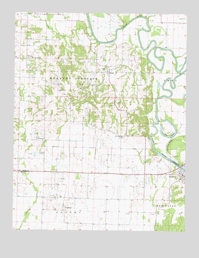
New Haven, IL USGS Topographic Map
Click on map above to begin viewing in our Map Viewer.

This topographic map contains these locations and features:
Feature Name Type Latitude Longitude GNIS ID View Map
Chapman Grove ChurchChurchN37.9553°W88.2178°405974View Map
CottonwoodPopulated PlaceN37.8892°W88.2131°406627View Map
Cottonwood Presbyterian ChurchCemeteryN37.8898°W88.2111°1820765View Map
Garrison Family CemeteryCemeteryN37.9975°W88.1256°408911View Map
Goose Pond SwampSwampN37.9255°W88.1366°409187View Map
Green CemeteryCemeteryN37.9739°W88.2356°409375View Map
HeraldPopulated PlaceN37.9664°W88.1814°410088View Map
Herald CemeteryCemeteryN37.9681°W88.1845°410089View Map
IronPopulated PlaceN37.9739°W88.2414°410922View Map
Lick CreekStreamN37.9889°W88.1945°412051View Map
Moore CemeteryCemeteryN37.9848°W88.2423°413778View Map
New HavenPopulated PlaceN37.9087°W88.1292°414405View Map
New Haven Fire DepartmentBuildingN37.9055°W88.1288°2681821View Map
New Haven Post OfficePost OfficeN37.9067°W88.1255°2788406View Map
Perry ChurchChurchN37.9667°W88.2395°415560View Map
Plain View CemeteryCemeteryN37.9264°W88.2281°1823978View Map
Plainview ChurchChurchN37.9270°W88.2292°415755View Map
Sutton AirportAirportN37.9316°W88.2368°2770526View Map
Sutton AirportAirportN37.9316°W88.2368°427634View Map
Swan CemeteryCemeteryN37.8942°W88.2142°419450View Map
The BayouLakeN37.9302°W88.1405°419625View Map
Township of AsburyCivilN37.8864°W88.2092°428604View Map
Township of Heralds PrairieCivilN37.9742°W88.2086°429130View Map
Union Ridge CemeteryCemeteryN37.9289°W88.1717°1823983View Map
Union Ridge ChurchChurchN37.9295°W88.1711°420091View Map
Village of New HavenCivilN37.9025°W88.1279°2399464View Map
Winners BendBendN37.9670°W88.1311°1725541View Map

Note: Coordinates in the location and feature list above are referenced to NAD83 datum.


Copyright (C) 2008-2025 Ryan Niemi / Sunset Dynamics ... All Rights Reserved