TopoQuest Logo
Do you find TopoQuest useful?
Help keep TopoQuest running and adding new maps/features by donating!
Bitcoin:  19c7KJd3qBynnjoSw5npx9KScwjBe4ifkT
Litecoin:  LXs6TkuXGGXo1vDsWCkWVdjQX94eUKd6ui
Home View Maps Find Maps Find Places Resources & Links


New Haven SW, Illinois Topographic Map

USGS Map Title: New Haven SW, IL
USGS Map MRC: 37088G2
DRG (GeoTIFF) Download: o37088g2.tif


Neighboring USGS Topographic Map Quads:


  Norris City, IL  
37088H3
 

  New Haven, IL  
37088H2
 

  Emma, IL  
37088H1
 

  Ridgway, IL  
37088G3
 

  New Haven SW, IL  
37088G2
 

  Wabash Island, KY  
37088G1
 

  Equality, IL  
37088F3
 

  Shawneetown, IL  
37088F2
 

  Grove Center, KY  
37088F1


Map MRC Location:

N38°
W89°
N38°
W88°
H8 H7 H6 H5 H4 H3 H2 H1
G8 G7 G6 G5 G4 G3 G2 G1
F8 F7 F6 F5 F4 F3 F2 F1
E8 E7 E6 E5 E4 E3 E2 E1
D8 D7 D6 D5 D4 D3 D2 D1
C8 C7 C6 C5 C4 C3 C2 C1
B8 B7 B6 B5 B4 B3 B2 B1
A8 A7 A6 A5 A4 A3 A2 A1
N37°
W89°
N37°
W88°

New Haven SW, IL USGS 1:24K Topographic Map Preview:
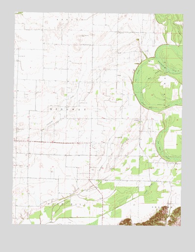
New Haven SW, IL USGS Topographic Map
Click on map above to begin viewing in our Map Viewer.

This topographic map contains these locations and features:
Feature Name Type Latitude Longitude GNIS ID View Map
Asbury CemeteryCemeteryN37.8634°W88.1731°1820764View Map
Asbury ChurchChurchN37.8639°W88.1725°403651View Map
Black BranchStreamN37.8406°W88.1353°404482View Map
Callicott CemeteryCemeteryN37.8020°W88.1698°405368View Map
Cattail SloughSwampN37.7734°W88.1472°405709View Map
Cattail SloughSwampN37.8687°W88.1303°405710View Map
Cow Pond SloughSwampN37.7946°W88.1418°406680View Map
Crackle DitchCanalN37.8214°W88.1317°406715View Map
Cypress DitchCanalN37.7631°W88.1656°406919View Map
Downen HeliportAirportN37.8417°W88.1725°427729View Map
Gallatin CountyCivilN37.7627°W88.2305°424231View Map
Goose PondSwampN37.8409°W88.1310°409185View Map
InmanPopulated PlaceN37.8378°W88.1731°422838View Map
Jackson CemeteryCemeteryN37.8059°W88.2473°410998View Map
Joes SloughSwampN37.8252°W88.1553°411130View Map
Jones CemeteryCemeteryN37.8281°W88.2336°411203View Map
New Hope ChurchChurchN37.8492°W88.2467°414419View Map
New Market (historical)Populated PlaceN37.7917°W88.2384°1811002View Map
New Zion CemeteryCemeteryN37.8220°W88.2003°414474View Map
Old Cottonwood CemeteryCemeteryN37.8614°W88.2006°415009View Map
Old Cottonwood ChurchChurchN37.8564°W88.1931°415010View Map
Pond Settlement DitchCanalN37.7928°W88.1803°416005View Map
Riley CemeteryCemeteryN37.7831°W88.1898°416672View Map
Saint Patrick Catholic CemeteryCemeteryN37.8131°W88.1592°1820775View Map
Saint Patricks ChurchChurchN37.8120°W88.1564°417681View Map
Township of RidgwayCivilN37.8209°W88.2096°429640View Map

Note: Coordinates in the location and feature list above are referenced to NAD83 datum.


Copyright (C) 2008-2025 Ryan Niemi / Sunset Dynamics ... All Rights Reserved