TopoQuest Logo
Do you find TopoQuest useful?
Help keep TopoQuest running and adding new maps/features by donating!
Bitcoin:  19c7KJd3qBynnjoSw5npx9KScwjBe4ifkT
Litecoin:  LXs6TkuXGGXo1vDsWCkWVdjQX94eUKd6ui
Home View Maps Find Maps Find Places Resources & Links


Belle Prairie City, Illinois Topographic Map

USGS Map Title: Belle Prairie City, IL
USGS Map MRC: 38088B5
DRG (GeoTIFF) Download: o38088b5.tif


Neighboring USGS Topographic Map Quads:


  Bluford, IL  
38088C6
 

  Wayne City, IL  
38088C5
 

  Boyleston, IL  
38088C4
 

  Dahlgren, IL  
38088B6
 

  Belle Prairie City, IL  
38088B5
 

  Bungay, IL  
38088B4
 

  Macedonia, IL  
38088A6
 

  McLeansboro, IL  
38088A5
 

  Thackeray, IL  
38088A4


Map MRC Location:

N39°
W89°
N39°
W88°
H8 H7 H6 H5 H4 H3 H2 H1
G8 G7 G6 G5 G4 G3 G2 G1
F8 F7 F6 F5 F4 F3 F2 F1
E8 E7 E6 E5 E4 E3 E2 E1
D8 D7 D6 D5 D4 D3 D2 D1
C8 C7 C6 C5 C4 C3 C2 C1
B8 B7 B6 B5 B4 B3 B2 B1
A8 A7 A6 A5 A4 A3 A2 A1
N38°
W89°
N38°
W88°

Belle Prairie City, IL USGS 1:24K Topographic Map Preview:
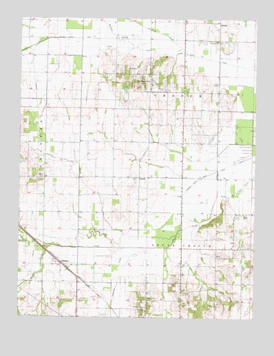
Belle Prairie City, IL USGS Topographic Map
Click on map above to begin viewing in our Map Viewer.

This topographic map contains these locations and features:
Feature Name Type Latitude Longitude GNIS ID View Map
Aden Lookout TowerTowerN38.2409°W88.5195°424556View Map
Auxier CreekStreamN38.2381°W88.5653°403752View Map
Auxier Creek DrainCanalN38.2342°W88.5295°403753View Map
Belle Prairie CityPopulated PlaceN38.2225°W88.5553°404138View Map
Black BranchStreamN38.1837°W88.5292°1812449View Map
Blooming Grove ChurchChurchN38.1292°W88.5584°404575View Map
Buckingham School (historical)SchoolN38.2348°W88.6195°1705510View Map
Burnt Hill School (historical)SchoolN38.1948°W88.6117°1705513View Map
Cabbage Patch DrainCanalN38.1773°W88.5373°405325View Map
Cherry Grove CemeteryCemeteryN38.1500°W88.5198°406015View Map
Crouch CemeteryCemeteryN38.2209°W88.5489°406841View Map
DelafieldPopulated PlaceN38.1478°W88.6028°407101View Map
Delafield School (historical)SchoolN38.1395°W88.5939°1705517View Map
Dry Island DrainCanalN38.2445°W88.5531°407430View Map
Elm Grove School (historical)SchoolN38.1320°W88.5417°1705519View Map
GarrisonPopulated PlaceN38.2484°W88.5192°422731View Map
Garrison School (historical)SchoolN38.2489°W88.5201°1705523View Map
Karchers Post Oak Woods Nature PreserveParkN38.2070°W88.6181°1993501View Map
Kennedy-Voris Main DrainCanalN38.2392°W88.5812°411404View Map
Mason School (historical)SchoolN38.1398°W88.5023°1705530View Map
Maulding School (historical)SchoolN38.2087°W88.5292°1705531View Map
Middle CreekStreamN38.1550°W88.6076°413485View Map
Opossum CreekStreamN38.1548°W88.5456°415144View Map
PiopolisPopulated PlaceN38.1837°W88.5614°415732View Map
Rally Hill School (historical)SchoolN38.1689°W88.5112°1705544View Map
Rawls CemeteryCemeteryN38.2295°W88.5675°416420View Map
Shelton CreekStreamN38.2417°W88.6062°418346View Map
Smith ChapelChurchN38.1684°W88.5053°418632View Map
Town of Belle Prairie CityCivilN38.2234°W88.5558°2396587View Map
Township of CrouchCivilN38.2240°W88.5000°428861View Map
Township of South CrouchCivilN38.1589°W88.5283°429762View Map

Note: Coordinates in the location and feature list above are referenced to NAD83 datum.


Copyright (C) 2008-2024 Ryan Niemi / Sunset Dynamics ... All Rights Reserved