TopoQuest Logo
Do you find TopoQuest useful?
Help keep TopoQuest running and adding new maps/features by donating!
Bitcoin:  19c7KJd3qBynnjoSw5npx9KScwjBe4ifkT
Litecoin:  LXs6TkuXGGXo1vDsWCkWVdjQX94eUKd6ui
Home View Maps Find Maps Find Places Resources & Links


Bungay, Illinois Topographic Map

USGS Map Title: Bungay, IL
USGS Map MRC: 38088B4
DRG (GeoTIFF) Download: o38088b4.tif


Neighboring USGS Topographic Map Quads:


  Wayne City, IL  
38088C5
 

  Boyleston, IL  
38088C4
 

  Burnt Prairie, IL  
38088C3
 

  Belle Prairie City, IL  
38088B5
 

  Bungay, IL  
38088B4
 

  Springerton, IL  
38088B3
 

  McLeansboro, IL  
38088A5
 

  Thackeray, IL  
38088A4
 

  Enfield, IL  
38088A3


Map MRC Location:

N39°
W89°
N39°
W88°
H8 H7 H6 H5 H4 H3 H2 H1
G8 G7 G6 G5 G4 G3 G2 G1
F8 F7 F6 F5 F4 F3 F2 F1
E8 E7 E6 E5 E4 E3 E2 E1
D8 D7 D6 D5 D4 D3 D2 D1
C8 C7 C6 C5 C4 C3 C2 C1
B8 B7 B6 B5 B4 B3 B2 B1
A8 A7 A6 A5 A4 A3 A2 A1
N38°
W89°
N38°
W88°

Bungay, IL USGS 1:24K Topographic Map Preview:
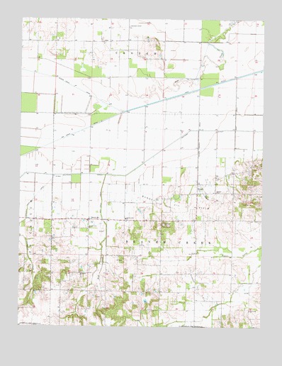
Bungay, IL USGS Topographic Map
Click on map above to begin viewing in our Map Viewer.

This topographic map contains these locations and features:
Feature Name Type Latitude Longitude GNIS ID View Map
AdenPopulated PlaceN38.2417°W88.4584°422386View Map
Beaver Creek Church (historical)ChurchN38.1464°W88.4087°1705507View Map
Beaver Creek Elementary SchoolSchoolN38.1689°W88.4453°404058View Map
Big CreekStreamN38.2123°W88.4475°404390View Map
Big Creek DrainCanalN38.2006°W88.4806°404395View Map
BlairsvillePopulated PlaceN38.1684°W88.4642°404546View Map
Buckskin School (historical)SchoolN38.1737°W88.3903°1705511View Map
BungayPopulated PlaceN38.1792°W88.4087°405193View Map
Bungay Oil FieldOilfieldN38.1628°W88.4123°424688View Map
Bunker Hill School (historical)SchoolN38.1684°W88.4206°1705512View Map
Christian ChapelChurchN38.1798°W88.3989°406092View Map
Doeskin School (historical)SchoolN38.1875°W88.3903°1705518View Map
Ferguson CreekStreamN38.1862°W88.4831°408328View Map
Ferguson Creek DrainCanalN38.1764°W88.4934°408329View Map
Jefferson City (historical)Populated PlaceN38.1503°W88.4617°1812460View Map
Lower Aden School (historical)SchoolN38.2339°W88.4350°1705527View Map
Lower Mill Post Office (historical)Post OfficeN38.2342°W88.4278°1812464View Map
Moulton Farms Airport (historical)AirportN38.2464°W88.4406°427004View Map
Mount Pleasant ChurchChurchN38.1470°W88.4687°414053View Map
New Hope ChurchChurchN38.1662°W88.4264°414422View Map
New London (historical)Populated PlaceN38.1684°W88.4056°1812468View Map
Pleasant Union ChurchChurchN38.1653°W88.4648°415894View Map
Raders BranchStreamN38.2217°W88.4078°416343View Map
Raders Branch DrainCanalN38.2050°W88.4081°416344View Map
South Mount Pleasant School (historical)SchoolN38.1392°W88.4634°1705549View Map
Southern OutletCanalN38.1945°W88.4314°1725519View Map
Springer CemeteryCemeteryN38.1667°W88.4256°418998View Map
Thomas School (historical)SchoolN38.1395°W88.4278°1705554View Map
Township of Beaver CreekCivilN38.1684°W88.4274°428648View Map
West Union ChurchChurchN38.1317°W88.3806°420933View Map
Wolf CreekStreamN38.1867°W88.4559°421366View Map
Wolf Creek DrainCanalN38.1750°W88.4578°421385View Map
York School (historical)SchoolN38.1398°W88.3903°1705562View Map

Note: Coordinates in the location and feature list above are referenced to NAD83 datum.


Copyright (C) 2008-2024 Ryan Niemi / Sunset Dynamics ... All Rights Reserved