TopoQuest Logo
Do you find TopoQuest useful?
Help keep TopoQuest running and adding new maps/features by donating!
Bitcoin:  19c7KJd3qBynnjoSw5npx9KScwjBe4ifkT
Litecoin:  LXs6TkuXGGXo1vDsWCkWVdjQX94eUKd6ui
Home View Maps Find Maps Find Places Resources & Links


Salt Spring Valley, California Topographic Map

USGS Map Title: Salt Spring Valley, CA
USGS Map MRC: 38120A6
DRG (GeoTIFF) Download: o38120a6.tif


Neighboring USGS Topographic Map Quads:


  Valley Springs, CA  
38120B7
 

  San Andreas, CA  
38120B6
 

  Calaveritas, CA  
38120B5
 

  Jenny Lind, CA  
38120A7
 

  Salt Spring Valley, CA  
38120A6
 

  Angels Camp, CA  
38120A5
 

  Bachelor Valley, CA  
37120H7
 

  Copperopolis, CA  
37120H6
 

  New Melones Dam, CA  
37120H5


Map MRC Location:

N39°
W121°
N39°
W120°
H8 H7 H6 H5 H4 H3 H2 H1
G8 G7 G6 G5 G4 G3 G2 G1
F8 F7 F6 F5 F4 F3 F2 F1
E8 E7 E6 E5 E4 E3 E2 E1
D8 D7 D6 D5 D4 D3 D2 D1
C8 C7 C6 C5 C4 C3 C2 C1
B8 B7 B6 B5 B4 B3 B2 B1
A8 A7 A6 A5 A4 A3 A2 A1
N38°
W121°
N38°
W120°

Salt Spring Valley, CA USGS 1:24K Topographic Map Preview:
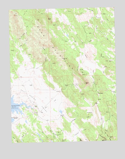
Salt Spring Valley, CA USGS Topographic Map
Click on map above to begin viewing in our Map Viewer.

This topographic map contains these locations and features:
Feature Name Type Latitude Longitude GNIS ID View Map
Bar XX RanchLocaleN38.0177°W120.6408°1804911View Map
Bear CreekStreamN38.1141°W120.6522°218802View Map
Bear Mountain RanchLocaleN38.0455°W120.6266°218864View Map
Bear MountainsRidgeN38.0919°W120.6999°233467View Map
Bear Trap GapGapN38.0774°W120.6877°218884View Map
Bernascon RanchLocaleN38.1016°W120.6308°1702110View Map
Big Seven MineMineN38.0038°W120.6349°219252View Map
Carmen CityPopulated PlaceN38.0474°W120.6908°252644View Map
Carmen PeakSummitN38.0546°W120.6622°220617View Map
Cherokee CreekStreamN38.1199°W120.6510°233657View Map
Circle XX RanchLocaleN38.0749°W120.6310°1702111View Map
Copperopolis Fire Protection District Station 3BuildingN38.0776°W120.6659°2624500View Map
Elkhorn StationLocaleN38.0521°W120.6255°233846View Map
FelixPopulated PlaceN38.0283°W120.7158°1658531View Map
Gooseberry SpringSpringN38.0265°W120.6554°224329View Map
Heiser CanyonValleyN38.0721°W120.7130°225119View Map
Inks RanchLocaleN38.0869°W120.6777°1702113View Map
KCSO-TV (Modesto)TowerN38.1185°W120.7241°1663182View Map
Kuhn RanchLocaleN38.0213°W120.7172°1702114View Map
Lost CityPopulated PlaceN38.0866°W120.7497°1659019View Map
Maxwell CreekStreamN38.0910°W120.6685°228247View Map
McCarty 500 DamDamN38.0266°W120.6910°1663915View Map
McCarty RanchLocaleN38.0246°W120.6913°228287View Map
Mount AraratSummitN38.1152°W120.7047°218333View Map
Mountain King MineMineN38.0085°W120.6960°229185View Map
Nassau CreekStreamN38.0913°W120.6324°234353View Map
Pools StationLocaleN38.0446°W120.6474°230928View Map
Red House RanchLocaleN38.0538°W120.7244°231338View Map
Royal MineMineN38.0008°W120.6910°231991View Map
Salt CreekStreamN38.0335°W120.7230°232296View Map
Salt Spring ValleyBasinN38.0380°W120.7197°232339View Map
Salt Spring Valley School (historical)SchoolN38.0413°W120.7299°1702116View Map
San Domingo CreekStreamN38.1199°W120.6508°248834View Map
Steele CreekStreamN38.1238°W120.6577°235425View Map
Thorpe ProspectMineN38.1224°W120.6255°1675755View Map
Tower RanchLocaleN38.0344°W120.7210°236476View Map
Waterman CreekStreamN38.0833°W120.6260°237337View Map

Note: Coordinates in the location and feature list above are referenced to NAD83 datum.


Copyright (C) 2008-2025 Ryan Niemi / Sunset Dynamics ... All Rights Reserved