TopoQuest Logo
Do you find TopoQuest useful?
Help keep TopoQuest running and adding new maps/features by donating!
Bitcoin:  19c7KJd3qBynnjoSw5npx9KScwjBe4ifkT
Litecoin:  LXs6TkuXGGXo1vDsWCkWVdjQX94eUKd6ui
Home View Maps Find Maps Find Places Resources & Links


Edinburg, Pennsylvania Topographic Map

USGS Map Title: Edinburg, PA
USGS Map MRC: 41080A4
DRG (GeoTIFF) Download: o41080a4.tif


Neighboring USGS Topographic Map Quads:


  Sharon West, PA  
41080B5
 

  Sharon East, PA  
41080B4
 

  Greenfield, PA  
41080B3
 

  Campbell, OH  
41080A5
 

  Edinburg, PA  
41080A4
 

  New Castle North, PA  
41080A3
 

  New Middletown, OH  
40080H5
 

  Bessemer, PA  
40080H4
 

  New Castle South, PA  
40080H3


Map MRC Location:

N42°
W81°
N42°
W80°
H8 H7 H6 H5 H4 H3 H2 H1
G8 G7 G6 G5 G4 G3 G2 G1
F8 F7 F6 F5 F4 F3 F2 F1
E8 E7 E6 E5 E4 E3 E2 E1
D8 D7 D6 D5 D4 D3 D2 D1
C8 C7 C6 C5 C4 C3 C2 C1
B8 B7 B6 B5 B4 B3 B2 B1
A8 A7 A6 A5 A4 A3 A2 A1
N41°
W81°
N41°
W80°

Edinburg, PA USGS 1:24K Topographic Map Preview:
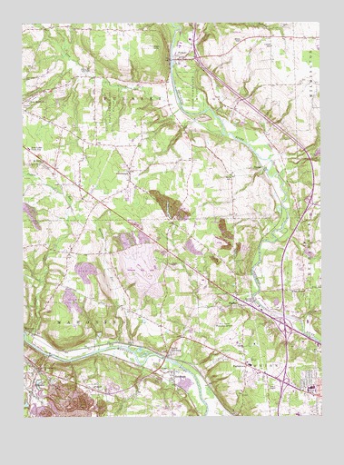
Edinburg, PA USGS Topographic Map
Click on map above to begin viewing in our Map Viewer.

This topographic map contains these locations and features:
Feature Name Type Latitude Longitude GNIS ID View Map
Ashton CemeteryCemeteryN41.0153°W80.4423°1168464View Map
Belmar ParkPopulated PlaceN41.0064°W80.3767°1169198View Map
Bird HillSummitN41.1187°W80.4078°1169657View Map
Books Woods School (historical)SchoolN41.0514°W80.4762°1206187View Map
Brown School (historical)SchoolN41.1092°W80.4592°1206186View Map
Buchanan RunStreamN41.1223°W80.4340°1170500View Map
Coffee RunStreamN41.0262°W80.4990°1039225View Map
Coffee RunStreamN41.0262°W80.4990°1172130View Map
Cotton SchoolSchoolN41.1176°W80.3948°1172490View Map
Deer CreekStreamN41.1033°W80.4353°1173082View Map
Deer Creek CemeteryCemeteryN41.1078°W80.4990°1173085View Map
EdinburgPopulated PlaceN41.0145°W80.4367°1174022View Map
Edinburg Post OfficePost OfficeN41.0143°W80.4366°2772685View Map
Edinburg StationLocaleN41.0145°W80.4367°1207152View Map
FrizzleburgPopulated PlaceN41.0764°W80.4548°1175282View Map
Frizzleburg Census Designated PlaceCensusN41.0744°W80.4491°2633814View Map
HarborPopulated PlaceN41.0353°W80.4092°1176496View Map
Harbor BridgeLocaleN41.0367°W80.4031°1176497View Map
Harbor Church CemeteryCemeteryN41.0489°W80.4106°1176498View Map
High HillSummitN41.1176°W80.4448°1177004View Map
HillsvillePopulated PlaceN41.0078°W80.4967°1177125View Map
Hillsville Post OfficePost OfficeN41.0074°W80.4965°2779965View Map
Hillsville Station (historical)LocaleN41.0195°W80.4892°1206189View Map
Kings ChapelLocaleN41.0403°W80.3817°1178488View Map
Lewisport Airport (historical)AirportN41.1167°W80.4165°1194172View Map
Mahoning Township Police DepartmentBuildingN41.0132°W80.4854°2780261View Map
Mahoning Township Volunteer Fire DepartmentBuildingN41.0142°W80.4351°2644724View Map
Marshall RunStreamN41.0223°W80.4634°1180475View Map
Mathews School (historical)SchoolN41.0512°W80.4456°1206188View Map
Miller School (historical)SchoolN41.0078°W80.4656°1206190View Map
Mohawk Trails Golf CourseLocaleN41.0009°W80.4412°1205587View Map
NashuaPopulated PlaceN41.0787°W80.3990°1182172View Map
New Bedford Census Designated PlaceCensusN41.0956°W80.4952°2633815View Map
New Castle Municipal AirportAirportN41.0247°W80.4131°1194158View Map
New Castle Trade SchoolSchoolN41.0848°W80.4970°1182298View Map
Noga Ambulance Service Station 40BuildingN41.0096°W80.3781°2719566View Map
North EdinburgPopulated PlaceN41.0203°W80.4392°1182572View Map
Number 5 SchoolSchoolN41.0759°W80.4123°1182488View Map
OakwoodPopulated PlaceN41.0106°W80.3795°1867502View Map
Oakwood Census Designated PlaceCensusN41.0111°W80.3793°2389607View Map
ParkstownPopulated PlaceN41.0164°W80.4065°1183336View Map
PeanutPopulated PlaceN41.0087°W80.4703°1183423View Map
PulaskiPopulated PlaceN41.1134°W80.4323°1184485View Map
Pulaski Elementary SchoolSchoolN41.1123°W80.4337°1205560View Map
Pulaski Post OfficePost OfficeN41.1133°W80.4338°2772927View Map
Pulaski Township Police DepartmentBuildingN41.1076°W80.4670°2780280View Map
Pulaski Township Volunteer Fire Department Station 1BuildingN41.1136°W80.4318°2644731View Map
RobinsonPopulated PlaceN41.0281°W80.4948°1185222View Map
Saint James ChurchChurchN41.0809°W80.4915°1186024View Map
Saint Lawrence ChurchChurchN41.0159°W80.4926°1186273View Map
Seymore StationLocaleN41.0189°W80.4598°1207151View Map
Shanango School (historical)SchoolN41.0395°W80.3815°1206296View Map
State Game Lands Number 150ParkN41.1001°W80.4631°1206192View Map
Tanglewood Golf CourseLocaleN41.1084°W80.4909°1205586View Map
Township of MahoningCivilN41.0304°W80.4671°1216656View Map
Township of PulaskiCivilN41.0938°W80.4516°1216661View Map
Township of UnionCivilN41.0111°W80.3952°1216666View Map
Union Township Police DepartmentBuildingN41.0021°W80.3784°2780135View Map
Union Township Volunteer Fire Department Station 1300BuildingN41.0004°W80.3775°2645287View Map
Wallace School (historical)SchoolN41.0078°W80.4073°1206191View Map

Note: Coordinates in the location and feature list above are referenced to NAD83 datum.


Copyright (C) 2008-2025 Ryan Niemi / Sunset Dynamics ... All Rights Reserved