TopoQuest Logo
Do you find TopoQuest useful?
Help keep TopoQuest running and adding new maps/features by donating!
Bitcoin:  19c7KJd3qBynnjoSw5npx9KScwjBe4ifkT
Litecoin:  LXs6TkuXGGXo1vDsWCkWVdjQX94eUKd6ui
Home View Maps Find Maps Find Places Resources & Links


New Sweden, Minnesota Topographic Map

USGS Map Title: New Sweden, MN
USGS Map MRC: 44094D2
DRG (GeoTIFF) Download: o44094d2.tif


Neighboring USGS Topographic Map Quads:


  Winthrop, MN  
44094E3
 

  Gaylord, MN  
44094E2
 

  Arlington, MN  
44094E1
 

  Bernadotte, MN  
44094D3
 

  New Sweden, MN  
44094D2
 

  Norseland, MN  
44094D1
 

  Courtland, MN  
44094C3
 

  Nicollet, MN  
44094C2
 

  North Star, MN  
44094C1


Map MRC Location:

N45°
W95°
N45°
W94°
H8 H7 H6 H5 H4 H3 H2 H1
G8 G7 G6 G5 G4 G3 G2 G1
F8 F7 F6 F5 F4 F3 F2 F1
E8 E7 E6 E5 E4 E3 E2 E1
D8 D7 D6 D5 D4 D3 D2 D1
C8 C7 C6 C5 C4 C3 C2 C1
B8 B7 B6 B5 B4 B3 B2 B1
A8 A7 A6 A5 A4 A3 A2 A1
N44°
W95°
N44°
W94°

New Sweden, MN USGS 1:24K Topographic Map Preview:
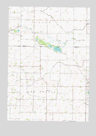
New Sweden, MN USGS Topographic Map
Click on map above to begin viewing in our Map Viewer.

This topographic map contains these locations and features:
Feature Name Type Latitude Longitude GNIS ID View Map
County Ditch Number FiftyfourCanalN44.4755°W94.1664°642185View Map
County Ditch Number Twentyseven ACanalN44.4089°W94.1733°641895View Map
County Ditch Number Twentythree ACanalN44.4036°W94.2169°641846View Map
Goodman CemeteryCemeteryN44.4858°W94.2233°644222View Map
Greenwood CemeteryCemeteryN44.3980°W94.2300°644458View Map
Judicial Ditch Number FifteenCanalN44.4555°W94.2133°645817View Map
Judicial Ditch Number One ACanalN44.4236°W94.1944°645774View Map
Judicial Ditch Number TwelveCanalN44.4266°W94.2191°645798View Map
Judicial Ditch Number TwentyCanalN44.4619°W94.1683°645849View Map
New SwedenPopulated PlaceN44.4075°W94.1900°654845View Map
New Sweden Post Office (historical)Post OfficeN44.4075°W94.1897°2063789View Map
Norwegian Grove ChurchChurchN44.4586°W94.2005°648763View Map
Norwegian Grove Wayside ParkParkN44.4583°W94.2014°2065191View Map
Plaman LakeLakeN44.4568°W94.1860°649537View Map
Rice LakeReservoirN44.4537°W94.1747°650024View Map
Scandian Grove CemeteryCemeteryN44.4166°W94.1258°651268View Map
Township of New SwedenCivilN44.4132°W94.1903°665114View Map
Township of SibleyCivilN44.4999°W94.1902°665608View Map
Trinity Lutheran CemeteryCemeteryN44.4822°W94.1305°2065076View Map
Trinity Lutheran ChurchChurchN44.4825°W94.1300°2065169View Map
Trinity SchoolSchoolN44.4825°W94.1305°653323View Map

Note: Coordinates in the location and feature list above are referenced to NAD83 datum.


Copyright (C) 2008-2024 Ryan Niemi / Sunset Dynamics ... All Rights Reserved