TopoQuest Logo
Do you find TopoQuest useful?
Help keep TopoQuest running and adding new maps/features by donating!
Bitcoin:  19c7KJd3qBynnjoSw5npx9KScwjBe4ifkT
Litecoin:  LXs6TkuXGGXo1vDsWCkWVdjQX94eUKd6ui
Home View Maps Find Maps Find Places Resources & Links


Norseland, Minnesota Topographic Map

USGS Map Title: Norseland, MN
USGS Map MRC: 44094D1
DRG (GeoTIFF) Download: o44094d1.tif


Neighboring USGS Topographic Map Quads:


  Gaylord, MN  
44094E2
 

  Arlington, MN  
44094E1
 

  Henderson, MN  
44093E8
 

  New Sweden, MN  
44094D2
 

  Norseland, MN  
44094D1
 

  Le Sueur, MN  
44093D8
 

  Nicollet, MN  
44094C2
 

  North Star, MN  
44094C1
 

  Saint Peter, MN  
44093C8


Map MRC Location:

N45°
W95°
N45°
W94°
H8 H7 H6 H5 H4 H3 H2 H1
G8 G7 G6 G5 G4 G3 G2 G1
F8 F7 F6 F5 F4 F3 F2 F1
E8 E7 E6 E5 E4 E3 E2 E1
D8 D7 D6 D5 D4 D3 D2 D1
C8 C7 C6 C5 C4 C3 C2 C1
B8 B7 B6 B5 B4 B3 B2 B1
A8 A7 A6 A5 A4 A3 A2 A1
N44°
W95°
N44°
W94°

Norseland, MN USGS 1:24K Topographic Map Preview:
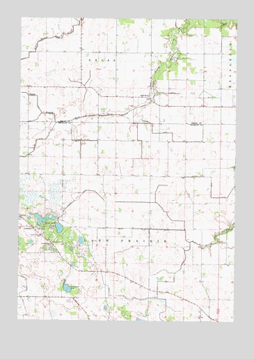
Norseland, MN USGS Topographic Map
Click on map above to begin viewing in our Map Viewer.

This topographic map contains these locations and features:
Feature Name Type Latitude Longitude GNIS ID View Map
Anderson Family CemeteryCemeteryN44.3775°W94.0505°2063904View Map
Annexstad LakeLakeN44.3880°W94.0966°639392View Map
Camp NorselandLocaleN44.4139°W94.1055°640835View Map
County Ditch Number EightCanalN44.4241°W94.0936°642318View Map
County Ditch Number Fortyseven ACanalN44.4130°W94.0575°642130View Map
County Ditch Number SeventyfiveCanalN44.3916°W94.0441°642299View Map
County Ditch Number SeventyfiveCanalN44.4011°W94.0280°642300View Map
County Ditch Number SeventyoneCanalN44.3852°W94.1239°642293View Map
County Ditch Number ThirtyfiveCanalN44.4283°W94.0141°641988View Map
County Ditch Number TwentyoneCanalN44.4691°W94.0208°641811View Map
Judicial Ditch Number FourteenCanalN44.4494°W94.0947°645810View Map
Judicial Ditch Number ThirteenCanalN44.4530°W94.0461°645804View Map
Methodist CemeteryCemeteryN44.4133°W94.1117°2063905View Map
NorselandPopulated PlaceN44.4127°W94.1166°654849View Map
Norseland CemeteryCemeteryN44.4063°W94.1063°648600View Map
Norseland ChurchChurchN44.4175°W94.1250°648601View Map
Norseland Post Office (historical)Post OfficeN44.4128°W94.1164°2063788View Map
Norseland SchoolSchoolN44.4072°W94.1055°648602View Map
Rush RiverPopulated PlaceN44.4672°W94.0508°654919View Map
Rush River Post Office (historical)Post OfficeN44.4672°W94.0506°2065099View Map
Sand LakeLakeN44.4132°W94.1017°651147View Map
Sauer CemeteryCemeteryN44.4430°W94.0708°2063906View Map
Scandian Grove CemeteryCemeteryN44.4097°W94.1122°651267View Map
Township of KelsoCivilN44.5000°W94.0696°664611View Map
Township of Lake PrairieCivilN44.4147°W94.0363°664697View Map
Traver CemeteryCemeteryN44.4691°W94.0461°653268View Map

Note: Coordinates in the location and feature list above are referenced to NAD83 datum.


Copyright (C) 2008-2024 Ryan Niemi / Sunset Dynamics ... All Rights Reserved