TopoQuest Logo
Do you find TopoQuest useful?
Help keep TopoQuest running and adding new maps/features by donating!
Bitcoin:  19c7KJd3qBynnjoSw5npx9KScwjBe4ifkT
Litecoin:  LXs6TkuXGGXo1vDsWCkWVdjQX94eUKd6ui
Home View Maps Find Maps Find Places Resources & Links


New Tripoli, Pennsylvania Topographic Map

USGS Map Title: New Tripoli, PA
USGS Map MRC: 40075F7
DRG (GeoTIFF) Download: o40075f7.tif


Neighboring USGS Topographic Map Quads:


  Tamaqua, PA  
40075G8
 

  Nesquehoning, PA  
40075G7
 

  Lehighton, PA  
40075G6
 

  New Ringgold, PA  
40075F8
 

  New Tripoli, PA  
40075F7
 

  Slatedale, PA  
40075F6
 

  Hamburg, PA  
40075E8
 

  Kutztown, PA  
40075E7
 

  Topton, PA  
40075E6


Map MRC Location:

N41°
W76°
N41°
W75°
H8 H7 H6 H5 H4 H3 H2 H1
G8 G7 G6 G5 G4 G3 G2 G1
F8 F7 F6 F5 F4 F3 F2 F1
E8 E7 E6 E5 E4 E3 E2 E1
D8 D7 D6 D5 D4 D3 D2 D1
C8 C7 C6 C5 C4 C3 C2 C1
B8 B7 B6 B5 B4 B3 B2 B1
A8 A7 A6 A5 A4 A3 A2 A1
N40°
W76°
N40°
W75°

New Tripoli, PA USGS 1:24K Topographic Map Preview:
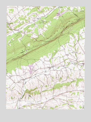
New Tripoli, PA USGS Topographic Map
Click on map above to begin viewing in our Map Viewer.

This topographic map contains these locations and features:
Feature Name Type Latitude Longitude GNIS ID View Map
Andreas Fire Company District 37 Station 2BuildingN40.7447°W75.7905°2652611View Map
Bears RocksSummitN40.7343°W75.7596°1210512View Map
Blue Mountain House of HopeLocaleN40.6858°W75.8526°2487852View Map
Bolich SchoolSchoolN40.7170°W75.8533°1169962View Map
Cuatros Vientos AirportAirportN40.6589°W75.8736°2442945View Map
FetherolfsvillePopulated PlaceN40.6320°W75.8346°1195896View Map
Fetherolfsville BridgeBridgeN40.6320°W75.8346°1174718View Map
Furnace SchoolSchoolN40.7481°W75.7907°1175367View Map
JacksonvillePopulated PlaceN40.6709°W75.8285°1177939View Map
Jerusalem Union Church CemeteryCemeteryN40.6274°W75.8173°2776239View Map
KemptonPopulated PlaceN40.6262°W75.8524°1178350View Map
Kempton Census Designated PlaceCensusN40.6277°W75.8547°2633376View Map
Kistler CreekStreamN40.6262°W75.8549°1178562View Map
Kistler ValleyValleyN40.6265°W75.8530°1178566View Map
Kistler-Longacre SchoolSchoolN40.7345°W75.8235°1178567View Map
Leaser LakeReservoirN40.6686°W75.8347°1217394View Map
Leaser Lake DamDamN40.6668°W75.8363°1194959View Map
LeibeyvillePopulated PlaceN40.7287°W75.8710°1204002View Map
LynnportPopulated PlaceN40.6754°W75.8049°1180128View Map
Lynnport Community Fire Company Station 14BuildingN40.6748°W75.8052°2653089View Map
LynnvillePopulated PlaceN40.6470°W75.7516°1180130View Map
MantzPopulated PlaceN40.7323°W75.8296°1180309View Map
MillersPopulated PlaceN40.7318°W75.8171°1204181View Map
MosservillePopulated PlaceN40.6943°W75.7627°1204214View Map
New Jerusalem ChurchChurchN40.6273°W75.8180°1182339View Map
New TripoliPopulated PlaceN40.6809°W75.7519°1182377View Map
New Tripoli Post OfficePost OfficeN40.6792°W75.7522°2772879View Map
New Tripoli Volunteer Fire Company Station 17BuildingN40.6804°W75.7544°2652832View Map
Ontelaunee CreekStreamN40.6262°W75.8549°1182999View Map
Ontelaunee ParkParkN40.6806°W75.7644°1183001View Map
Orchard View Airport (historical)AirportN40.6306°W75.8205°1194050View Map
Raberts CornerPopulated PlaceN40.6915°W75.7788°1199349View Map
SchneidersvillePopulated PlaceN40.6312°W75.7749°1210795View Map
School CreekStreamN40.6820°W75.7624°1187099View Map
Shochary RidgeRidgeN40.6537°W75.7896°1187572View Map
SlatevillePopulated PlaceN40.6640°W75.8671°1204664View Map
SnydersPopulated PlaceN40.7212°W75.8616°1187963View Map
Spitzberg HillSummitN40.6459°W75.8352°1195895View Map
SteinsvillePopulated PlaceN40.6576°W75.8552°1204729View Map
Township of LynnCivilN40.6700°W75.7908°1216692View Map
TrexlerPopulated PlaceN40.6356°W75.8533°1204827View Map
Ulrichs BridgeBridgeN40.6754°W75.7813°1190070View Map
WanamakersPopulated PlaceN40.6609°W75.8458°1190576View Map

Note: Coordinates in the location and feature list above are referenced to NAD83 datum.


Copyright (C) 2008-2025 Ryan Niemi / Sunset Dynamics ... All Rights Reserved