TopoQuest Logo
Do you find TopoQuest useful?
Help keep TopoQuest running and adding new maps/features by donating!
Bitcoin:  19c7KJd3qBynnjoSw5npx9KScwjBe4ifkT
Litecoin:  LXs6TkuXGGXo1vDsWCkWVdjQX94eUKd6ui
Home View Maps Find Maps Find Places Resources & Links


Slatedale, Pennsylvania Topographic Map

USGS Map Title: Slatedale, PA
USGS Map MRC: 40075F6
DRG (GeoTIFF) Download: o40075f6.tif


Neighboring USGS Topographic Map Quads:


  Nesquehoning, PA  
40075G7
 

  Lehighton, PA  
40075G6
 

  Palmerton, PA  
40075G5
 

  New Tripoli, PA  
40075F7
 

  Slatedale, PA  
40075F6
 

  Cementon, PA  
40075F5
 

  Kutztown, PA  
40075E7
 

  Topton, PA  
40075E6
 

  Allentown West, PA  
40075E5


Map MRC Location:

N41°
W76°
N41°
W75°
H8 H7 H6 H5 H4 H3 H2 H1
G8 G7 G6 G5 G4 G3 G2 G1
F8 F7 F6 F5 F4 F3 F2 F1
E8 E7 E6 E5 E4 E3 E2 E1
D8 D7 D6 D5 D4 D3 D2 D1
C8 C7 C6 C5 C4 C3 C2 C1
B8 B7 B6 B5 B4 B3 B2 B1
A8 A7 A6 A5 A4 A3 A2 A1
N40°
W76°
N40°
W75°

Slatedale, PA USGS 1:24K Topographic Map Preview:
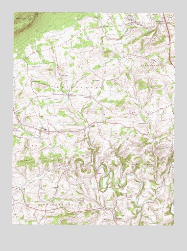
Slatedale, PA USGS Topographic Map
Click on map above to begin viewing in our Map Viewer.

This topographic map contains these locations and features:
Feature Name Type Latitude Longitude GNIS ID View Map
Alvern PondReservoirN40.6461°W75.7427°1168241View Map
Bake Oven KnobSummitN40.7487°W75.7338°1168590View Map
Bausch SchoolSchoolN40.6534°W75.7291°1195908View Map
Best StationPopulated PlaceN40.7251°W75.6560°1169327View Map
Bittners CornerPopulated PlaceN40.6668°W75.6413°1210797View Map
Bull HeadSummitN40.7087°W75.6855°1170638View Map
Bullfly Ultralight FlightparkAirportN40.7089°W75.6864°2442971View Map
Cherith BrookStreamN40.6365°W75.6488°2025264View Map
Citizens Fire Company 1 Station 23BuildingN40.7431°W75.6537°2653090View Map
CusterPopulated PlaceN40.7418°W75.6388°1210799View Map
DiebertsvillePopulated PlaceN40.6848°W75.6463°1203416View Map
EmeraldPopulated PlaceN40.7451°W75.6346°1174214View Map
Flint HillSummitN40.6748°W75.7063°1174904View Map
Flying M AerodromeAirportN40.7369°W75.7074°1194083View Map
Franklin SchoolSchoolN40.6329°W75.6555°1196043View Map
Germans CornersLocaleN40.7093°W75.7360°1175558View Map
GermansvillePopulated PlaceN40.7015°W75.7069°1175559View Map
Germansville Post OfficePost OfficeN40.7012°W75.7085°2772713View Map
Goodwill Fire Company Station 10BuildingN40.7018°W75.7052°2653405View Map
Heidelberg ChurchChurchN40.7101°W75.6705°1176770View Map
Heidelberg School (historical)SchoolN40.7082°W75.6707°1195909View Map
Hoffman SchoolSchoolN40.6957°W75.6269°1195910View Map
Jordan ValleyPopulated PlaceN40.7129°W75.7135°1203900View Map
Kemmener SchoolSchoolN40.7384°W75.6980°1195916View Map
Lehigh FurnacePopulated PlaceN40.7426°W75.6799°1179156View Map
Lehigh Gap SchoolSchoolN40.7334°W75.6466°1195940View Map
LochlandPopulated PlaceN40.6976°W75.7349°1204042View Map
LowhillSummitN40.6543°W75.6832°1180043View Map
Lowhill ChurchChurchN40.6459°W75.6860°1180044View Map
Lowhill SchoolSchoolN40.6459°W75.6860°1195911View Map
Lynnville ChurchChurchN40.6395°W75.7485°1180131View Map
Lyon CreekStreamN40.6390°W75.6532°1180134View Map
Lyon ValleyPopulated PlaceN40.6290°W75.6702°1204081View Map
Lyon Valley SchoolSchoolN40.6409°W75.6669°1195912View Map
Mantz SchoolSchoolN40.7182°W75.7213°1195917View Map
Mill CreekStreamN40.6495°W75.6341°1181125View Map
Mill HillSummitN40.6632°W75.6305°1210798View Map
Millers CemeteryCemeteryN40.6534°W75.7294°1181241View Map
Morganland ChurchChurchN40.6265°W75.6369°1181554View Map
New Tripoli Census Designated PlaceCensusN40.6773°W75.7498°2630031View Map
NewsidePopulated PlaceN40.6907°W75.6444°1204286View Map
Northwestern Elementary SchoolSchoolN40.6812°W75.7266°1210972View Map
Northwestern Lehigh Junior-Senior High SchoolSchoolN40.6809°W75.7241°1210705View Map
Peters Elementary SchoolSchoolN40.7220°W75.6402°1183631View Map
Peters StorePopulated PlaceN40.7207°W75.6432°1211967View Map
Pleasant CornersPopulated PlaceN40.6834°W75.6905°1199318View Map
SaegersvillePopulated PlaceN40.7007°W75.6896°1199433View Map
Sand Spring LakeReservoirN40.7034°W75.6863°1194996View Map
Sand Spring Run DamDamN40.7034°W75.6863°1194995View Map
Scherers SchoolSchoolN40.6659°W75.6477°1195907View Map
Schlicher Covered BridgeBridgeN40.6615°W75.6266°1211966View Map
Schortz SchoolSchoolN40.6709°W75.6941°1195988View Map
SlatedalePopulated PlaceN40.7445°W75.6566°1187788View Map
Slatedale Census Designated PlaceCensusN40.7438°W75.6583°2630040View Map
Snyder SchoolSchoolN40.6765°W75.7366°1195913View Map
Star Hose Company Station 6BuildingN40.7423°W75.6361°2653254View Map
State Game Lands Number 205ParkN40.6584°W75.6585°1188485View Map
SwitzerPopulated PlaceN40.6479°W75.7144°1204786View Map
Switzer CreekStreamN40.6609°W75.6874°1189196View Map
Synder PondReservoirN40.6752°W75.7288°1189226View Map
Township of HeidelbergCivilN40.7095°W75.6995°1216688View Map
Township of LowhillCivilN40.6421°W75.6585°1216691View Map
Township of WashingtonCivilN40.7389°W75.6392°1216699View Map
Trexler Nature PreserveParkN40.6579°W75.6330°1189754View Map
Water Pond SchoolSchoolN40.6682°W75.7007°1195914View Map
WeidasvillePopulated PlaceN40.6384°W75.6455°1204912View Map
Weisenberg ChurchChurchN40.6387°W75.6952°1190790View Map
Werleys CornerPopulated PlaceN40.6332°W75.7235°1204919View Map

Note: Coordinates in the location and feature list above are referenced to NAD83 datum.


Copyright (C) 2008-2025 Ryan Niemi / Sunset Dynamics ... All Rights Reserved