TopoQuest Logo
Do you find TopoQuest useful?
Help keep TopoQuest running and adding new maps/features by donating!
Bitcoin:  19c7KJd3qBynnjoSw5npx9KScwjBe4ifkT
Litecoin:  LXs6TkuXGGXo1vDsWCkWVdjQX94eUKd6ui
Home View Maps Find Maps Find Places Resources & Links


New Vienna, Iowa Topographic Map

USGS Map Title: New Vienna, IA
USGS Map MRC: 42091E1
DRG (GeoTIFF) Download: o42091e1.tif


Neighboring USGS Topographic Map Quads:


  Colesburg, IA  
42091F2
 

  Turkey River, IA  
42091F1
 

  Cassville, WI  
42090F8
 

  Petersburg, IA  
42091E2
 

  New Vienna, IA  
42091E1
 

  Holy Cross, IA  
42090E8
 

  Dyersville West, IA  
42091D2
 

  Dyersville East, IA  
42091D1
 

  Epworth, IA  
42090D8


Map MRC Location:

N43°
W92°
N43°
W91°
H8 H7 H6 H5 H4 H3 H2 H1
G8 G7 G6 G5 G4 G3 G2 G1
F8 F7 F6 F5 F4 F3 F2 F1
E8 E7 E6 E5 E4 E3 E2 E1
D8 D7 D6 D5 D4 D3 D2 D1
C8 C7 C6 C5 C4 C3 C2 C1
B8 B7 B6 B5 B4 B3 B2 B1
A8 A7 A6 A5 A4 A3 A2 A1
N42°
W92°
N42°
W91°

New Vienna, IA USGS 1:24K Topographic Map Preview:
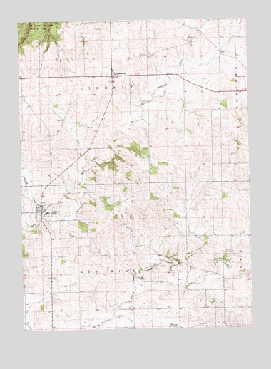
New Vienna, IA USGS Topographic Map
Click on map above to begin viewing in our Map Viewer.

This topographic map contains these locations and features:
Feature Name Type Latitude Longitude GNIS ID View Map
Am Dar FarmLocaleN42.5303°W91.0092°2708594View Map
City of LuxemburgCivilN42.6040°W91.0726°2395788View Map
City of New ViennaCivilN42.5477°W91.1139°2395218View Map
Coffee CreekStreamN42.5450°W91.1162°455511View Map
Fagen Property CemeteryCemeteryN42.5194°W91.0029°2001457View Map
Glassnevin Post Office (historical)Post OfficeN42.6083°W91.0446°2001400View Map
Hennessy Catholic School Saint Boniface CenterSchoolN42.5506°W91.1138°2001319View Map
Heritage House MuseumBuildingN42.5517°W91.1140°2001318View Map
Hickory CreekStreamN42.5053°W91.0760°457430View Map
Holy Trinity CemeteryCemeteryN42.6005°W91.0748°2001480View Map
Holy Trinity Roman Catholic ChurchChurchN42.6022°W91.0746°2001323View Map
La Salle Catholic School - Luxemburg CenterSchoolN42.6023°W91.0751°2001322View Map
LuxemburgPopulated PlaceN42.6028°W91.0740°458690View Map
Luxemburg City HallBuildingN42.6028°W91.0735°2001321View Map
Luxwmburg Post OfficePost OfficeN42.6025°W91.0732°2001328View Map
Millville SidingPopulated PlaceN42.5061°W91.0729°464090View Map
New ViennaPopulated PlaceN42.5481°W91.1143°459494View Map
New Vienna - Luxemburg Fire DepartmentBuildingN42.5484°W91.1146°2001315View Map
New Vienna Community HallBuildingN42.5492°W91.1140°2001316View Map
New Vienna Post OfficePost OfficeN42.5483°W91.1140°2001317View Map
Oakland Post Office (historical)Post OfficeN42.5444°W91.0196°2001401View Map
Saint Boniface CemeteryCemeteryN42.5514°W91.1146°2001479View Map
Saint Bonifaces Catholic ChurchChurchN42.5508°W91.1149°2001320View Map
Township of LibertyCivilN42.6025°W91.0744°468216View Map
Township of New WineCivilN42.5151°W91.0750°468441View Map

Note: Coordinates in the location and feature list above are referenced to NAD83 datum.


Copyright (C) 2008-2024 Ryan Niemi / Sunset Dynamics ... All Rights Reserved