TopoQuest Logo
Do you find TopoQuest useful?
Help keep TopoQuest running and adding new maps/features by donating!
Bitcoin:  19c7KJd3qBynnjoSw5npx9KScwjBe4ifkT
Litecoin:  LXs6TkuXGGXo1vDsWCkWVdjQX94eUKd6ui
Home View Maps Find Maps Find Places Resources & Links


Epworth, Iowa Topographic Map

USGS Map Title: Epworth, IA
USGS Map MRC: 42090D8
DRG (GeoTIFF) Download: o42090d8.tif


Neighboring USGS Topographic Map Quads:


  New Vienna, IA  
42091E1
 

  Holy Cross, IA  
42090E8
 

  Sherrill, IA  
42090E7
 

  Dyersville East, IA  
42091D1
 

  Epworth, IA  
42090D8
 

  Peosta, IA  
42090D7
 

  Cascade, IA  
42091C1
 

  Fillmore, IA  
42090C8
 

  Bernard, IA  
42090C7


Map MRC Location:

N43°
W91°
N43°
W90°
H8 H7 H6 H5 H4 H3 H2 H1
G8 G7 G6 G5 G4 G3 G2 G1
F8 F7 F6 F5 F4 F3 F2 F1
E8 E7 E6 E5 E4 E3 E2 E1
D8 D7 D6 D5 D4 D3 D2 D1
C8 C7 C6 C5 C4 C3 C2 C1
B8 B7 B6 B5 B4 B3 B2 B1
A8 A7 A6 A5 A4 A3 A2 A1
N42°
W91°
N42°
W90°

Epworth, IA USGS 1:24K Topographic Map Preview:
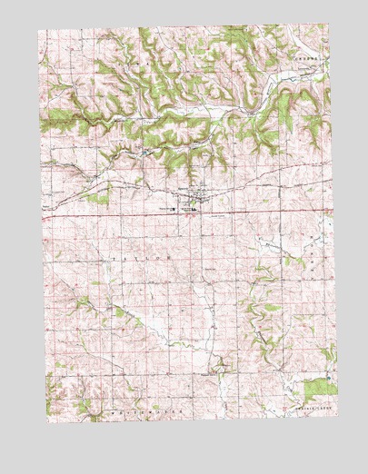
Epworth, IA USGS Topographic Map
Click on map above to begin viewing in our Map Viewer.

This topographic map contains these locations and features:
Feature Name Type Latitude Longitude GNIS ID View Map
Annunciation CemeteryCemeteryN42.4847°W90.8873°2001497View Map
Camp Little CloudLocaleN42.4983°W90.9107°455125View Map
Centennial ParkParkN42.4514°W90.9293°2001337View Map
Channingville Post Office (historical)Post OfficeN42.4847°W90.8835°2001382View Map
City of EpworthCivilN42.4475°W90.9309°2394696View Map
Divine Word CollegeSchoolN42.4417°W90.9350°455899View Map
Dubuque CountyCivilN42.4688°W90.8825°465219View Map
EpworthLocaleN42.4478°W90.9301°2001341View Map
EpworthPopulated PlaceN42.4450°W90.9321°456385View Map
Epworth CemeteryCemeteryN42.4227°W90.9315°456386View Map
Epworth Elementary SchoolSchoolN42.4426°W90.9285°2001345View Map
Epworth Emergency ServiceBuildingN42.4471°W90.9317°2599857View Map
Epworth Fire DepartmentBuildingN42.4470°W90.9317°2577204View Map
Epworth Police DepartmentBuildingN42.4471°W90.9316°2001340View Map
Epworth Post OfficePost OfficeN42.4467°W90.9318°2001339View Map
Epworth United Methodist ChuchChurchN42.4447°W90.9315°2001344View Map
Grace Lutheran ChurchChurchN42.4458°W90.9282°2001342View Map
Highview CemeteryCemeteryN42.4554°W90.9309°457488View Map
Hogan CemeteryCemeteryN42.4500°W90.9862°2001495View Map
Hogans BranchStreamN42.4725°W90.9196°457543View Map
Johnson CemeteryCemeteryN42.4547°W90.8791°457967View Map
KidderPopulated PlaceN42.4642°W90.9279°464162View Map
Kidder (historical)LocaleN42.4642°W90.9279°2001381View Map
Lattner Post Office (historical)Post OfficeN42.4861°W90.8835°2001383View Map
LattnervillePopulated PlaceN42.4856°W90.8829°464612View Map
Matthew Jacoby Memorial LibraryBuildingN42.4408°W90.9312°2001338View Map
Placid Post Office (historical)Post OfficeN42.3894°W90.9279°2001411View Map
Pleasant GrovePopulated PlaceN42.3897°W90.9262°464704View Map
Saint Johns Catholic ChurchChurchN42.3900°W90.9268°2001347View Map
Saint Johns Catholic Placid CemeteryCemeteryN42.3889°W90.9268°2001494View Map
Saint Johns Rectory SchoolSchoolN42.3900°W90.9268°2001348View Map
Saint Josephs CemeteryCemeteryN42.4486°W90.9962°461120View Map
Saint Patrick Catholic ChurchChurchN42.4439°W90.9315°2001343View Map
Saint Patricks CemeteryCemeteryN42.4486°W90.9335°2001496View Map
Seton Catholic SchoolSchoolN42.4439°W90.9310°2001346View Map
Township of TaylorCivilN42.4268°W90.9560°468784View Map
Western Dubuque High SchoolSchoolN42.4420°W90.9434°462933View Map

Note: Coordinates in the location and feature list above are referenced to NAD83 datum.


Copyright (C) 2008-2024 Ryan Niemi / Sunset Dynamics ... All Rights Reserved