TopoQuest Logo
Do you find TopoQuest useful?
Help keep TopoQuest running and adding new maps/features by donating!
Bitcoin:  19c7KJd3qBynnjoSw5npx9KScwjBe4ifkT
Litecoin:  LXs6TkuXGGXo1vDsWCkWVdjQX94eUKd6ui
Home View Maps Find Maps Find Places Resources & Links


Dyersville East, Iowa Topographic Map

USGS Map Title: Dyersville East, IA
USGS Map MRC: 42091D1
DRG (GeoTIFF) Download: o42091d1.tif


Neighboring USGS Topographic Map Quads:


  Petersburg, IA  
42091E2
 

  New Vienna, IA  
42091E1
 

  Holy Cross, IA  
42090E8
 

  Dyersville West, IA  
42091D2
 

  Dyersville East, IA  
42091D1
 

  Epworth, IA  
42090D8
 

  Hopkinton East, IA  
42091C2
 

  Cascade, IA  
42091C1
 

  Fillmore, IA  
42090C8


Map MRC Location:

N43°
W92°
N43°
W91°
H8 H7 H6 H5 H4 H3 H2 H1
G8 G7 G6 G5 G4 G3 G2 G1
F8 F7 F6 F5 F4 F3 F2 F1
E8 E7 E6 E5 E4 E3 E2 E1
D8 D7 D6 D5 D4 D3 D2 D1
C8 C7 C6 C5 C4 C3 C2 C1
B8 B7 B6 B5 B4 B3 B2 B1
A8 A7 A6 A5 A4 A3 A2 A1
N42°
W92°
N42°
W91°

Dyersville East, IA USGS 1:24K Topographic Map Preview:
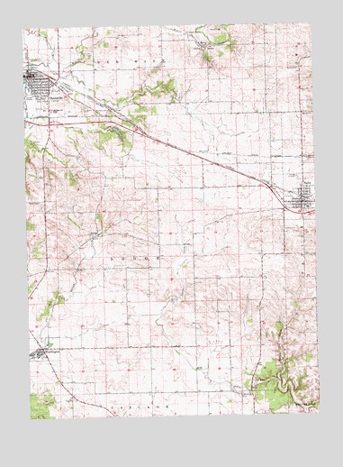
Dyersville East, IA USGS Topographic Map
Click on map above to begin viewing in our Map Viewer.

This topographic map contains these locations and features:
Feature Name Type Latitude Longitude GNIS ID View Map
Arquitt Post Office (historical)Post OfficeN42.4625°W91.0029°2001412View Map
Bakers CreekStreamN42.3853°W91.0174°454326View Map
Beckman Catholic High SchoolSchoolN42.4733°W91.1117°2001375View Map
Bi - County Ambulance IncorporatedBuildingN42.4710°W91.1176°2599681View Map
City of DyersvilleCivilN42.4817°W91.1175°2394584View Map
City of FarleyCivilN42.4438°W91.0091°2394743View Map
City of WorthingtonCivilN42.3981°W91.1208°2397379View Map
Drexler Middle Intermediate SchoolSchoolN42.4443°W91.0015°2001336View Map
Dubuque County LibraryBuildingN42.4431°W91.0057°2001332View Map
Dyer-Botsford Victorian House and Doll MuseumBuildingN42.4847°W91.1210°2001360View Map
DyersvilleLocaleN42.4869°W91.1232°2001365View Map
DyersvillePopulated PlaceN42.4844°W91.1229°456086View Map
Dyersville Fire DepartmentBuildingN42.4711°W91.1176°2001353View Map
Dyersville Golf and Country ClubLocaleN42.4925°W91.0969°2001355View Map
Dyersville Police DepartmentBuildingN42.4848°W91.1207°2001352View Map
Dyersville Post OfficePost OfficeN42.4825°W91.1212°2001359View Map
Evangelical Free ChurchChurchN42.4844°W91.1090°2001369View Map
Fairview CemeteryCemeteryN42.4343°W91.0147°456493View Map
FarleyPopulated PlaceN42.4428°W91.0062°456539View Map
FarleyLocaleN42.4444°W91.0051°2001335View Map
Farley City ParkParkN42.4428°W91.0062°2001330View Map
Farley Post OfficePost OfficeN42.4433°W91.0065°2001334View Map
Farley RacetrackLocaleN42.4428°W91.0062°2001331View Map
Farley Volunteer Fire DepartmentBuildingN42.4439°W91.0072°2577229View Map
Field of DreamsLocaleN42.4978°W91.0540°2001362View Map
Hewitt CreekStreamN42.4878°W91.1143°457413View Map
Inwood Woodcarving ExhibitBuildingN42.4844°W91.1229°2001363View Map
Jehovahs Witnesses CongregationChurchN42.4786°W91.1140°2001371View Map
Johns Creek CemeteryCemeteryN42.3820°W91.0337°457963View Map
M M Hoffman Public LibraryBuildingN42.4847°W91.1207°2001356View Map
McGee CemeteryCemeteryN42.4855°W91.0063°458911View Map
MekeePopulated PlaceN42.4925°W91.0457°464649View Map
Mount Hope CemeteryCemeteryN42.4718°W91.0940°459301View Map
National Farm Toy MuseumBuildingN42.4681°W91.1146°2001357View Map
New Hope Lutheran ChurchChurchN42.4708°W91.1190°2001370View Map
Preston Post Office (historical)Post OfficeN42.3756°W91.0501°2001384View Map
Reiff Ambulance ServiceBuildingN42.4431°W91.0090°2599771View Map
Rolling Knolls Golf CourseLocaleN42.4764°W91.0974°2001361View Map
Saint Boniface Catholic CemeteryCemeteryN42.4792°W91.0835°2001478View Map
Saint Josephs Catholic ChurchChurchN42.4417°W91.0046°2001333View Map
Saint Paul SchoolSchoolN42.3945°W91.1210°2001294View Map
Saint Pauls Catholic ChurchChurchN42.3956°W91.1215°2001293View Map
Seton Catholic School Farley CenterSchoolN42.4411°W91.0036°2719764View Map
Summit Village Dyersville ParkPopulated PlaceN42.4844°W91.1151°2001358View Map
Township of DodgeCivilN42.4270°W91.0722°467717View Map
WorthingtonPopulated PlaceN42.3964°W91.1199°463210View Map
Worthington (historical)LocaleN42.3956°W91.1238°2001287View Map
Worthington Baptist Cemetery (historical)CemeteryN42.3986°W91.1196°2001498View Map
Worthington City HallBuildingN42.3975°W91.1199°2001289View Map
Worthington Community Fire DepartmentBuildingN42.3970°W91.1210°2577408View Map
Worthington Memorial HallBuildingN42.3986°W91.1163°2001288View Map
Worthington Post OfficePost OfficeN42.3964°W91.1182°2001292View Map

Note: Coordinates in the location and feature list above are referenced to NAD83 datum.


Copyright (C) 2008-2024 Ryan Niemi / Sunset Dynamics ... All Rights Reserved