TopoQuest Logo
Do you find TopoQuest useful?
Help keep TopoQuest running and adding new maps/features by donating!
Bitcoin:  19c7KJd3qBynnjoSw5npx9KScwjBe4ifkT
Litecoin:  LXs6TkuXGGXo1vDsWCkWVdjQX94eUKd6ui
Home View Maps Find Maps Find Places Resources & Links


New Washington, Indiana Topographic Map

USGS Map Title: New Washington, IN
USGS Map MRC: 38085E5
DRG (GeoTIFF) Download: o38085e5.tif


Neighboring USGS Topographic Map Quads:


  Blocher, IN  
38085F6
 

  Kent, IN  
38085F5
 

  Madison West, IN  
38085F4
 

  Otisco, IN  
38085E6
 

  New Washington, IN  
38085E5
 

  Bethlehem, IN  
38085E4
 

  Charlestown, IN  
38085D6
 

  Owen, IN  
38085D5
 

  La Grange, KY  
38085D4


Map MRC Location:

N39°
W86°
N39°
W85°
H8 H7 H6 H5 H4 H3 H2 H1
G8 G7 G6 G5 G4 G3 G2 G1
F8 F7 F6 F5 F4 F3 F2 F1
E8 E7 E6 E5 E4 E3 E2 E1
D8 D7 D6 D5 D4 D3 D2 D1
C8 C7 C6 C5 C4 C3 C2 C1
B8 B7 B6 B5 B4 B3 B2 B1
A8 A7 A6 A5 A4 A3 A2 A1
N38°
W86°
N38°
W85°

New Washington, IN USGS 1:24K Topographic Map Preview:
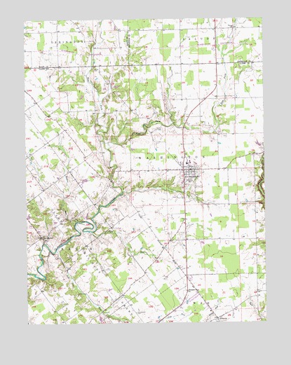
New Washington, IN USGS Topographic Map
Click on map above to begin viewing in our Map Viewer.

This topographic map contains these locations and features:
Feature Name Type Latitude Longitude GNIS ID View Map
Barnes Community CemeteryCemeteryN38.6045°W85.5888°430499View Map
Camp CreekStreamN38.5626°W85.5002°432022View Map
Crown Hill CemeteryCemeteryN38.5594°W85.5390°433210View Map
East Fork Fourteenmile CreekStreamN38.5720°W85.5819°433890View Map
Flag RunStreamN38.5376°W85.5911°434553View Map
HiberniaPopulated PlaceN38.5020°W85.5255°436086View Map
Holloway FieldAirportN38.5902°W85.5063°2676925View Map
New MarketPopulated PlaceN38.5356°W85.6169°440084View Map
New WashingtonPopulated PlaceN38.5631°W85.5397°440123View Map
New Washington Census Designated PlaceCensusN38.5656°W85.5461°2393150View Map
New Washington Fire DepartmentBuildingN38.5639°W85.5376°2701397View Map
New Washington Volunteer Fire DepartmentBuildingN38.5699°W85.5412°2625531View Map
Olive Branch CemeteryCemeteryN38.5044°W85.5678°440636View Map
Pleasant View ChurchChurchN38.5128°W85.5411°441340View Map
Polk RunStreamN38.5298°W85.6097°441409View Map
Polk Run Post Office (historical)Post OfficeN38.5120°W85.5752°453032View Map
Rogers RunStreamN38.5420°W85.5983°442254View Map
Township of WashingtonCivilN38.5672°W85.5504°453987View Map
Tryus ChurchChurchN38.6209°W85.5155°444935View Map
West Fork Fourteenmile CreekStreamN38.5720°W85.5819°445749View Map

Note: Coordinates in the location and feature list above are referenced to NAD83 datum.


Copyright (C) 2008-2025 Ryan Niemi / Sunset Dynamics ... All Rights Reserved