TopoQuest Logo
Do you find TopoQuest useful?
Help keep TopoQuest running and adding new maps/features by donating!
Bitcoin:  19c7KJd3qBynnjoSw5npx9KScwjBe4ifkT
Litecoin:  LXs6TkuXGGXo1vDsWCkWVdjQX94eUKd6ui
Home View Maps Find Maps Find Places Resources & Links


Blocher, Indiana Topographic Map

USGS Map Title: Blocher, IN
USGS Map MRC: 38085F6
DRG (GeoTIFF) Download: o38085f6.tif


Neighboring USGS Topographic Map Quads:


  Crothersville, IN  
38085G7
 

  Deputy, IN  
38085G6
 

  Volga, IN  
38085G5
 

  Scottsburg, IN  
38085F7
 

  Blocher, IN  
38085F6
 

  Kent, IN  
38085F5
 

  Henryville, IN  
38085E7
 

  Otisco, IN  
38085E6
 

  New Washington, IN  
38085E5


Map MRC Location:

N39°
W86°
N39°
W85°
H8 H7 H6 H5 H4 H3 H2 H1
G8 G7 G6 G5 G4 G3 G2 G1
F8 F7 F6 F5 F4 F3 F2 F1
E8 E7 E6 E5 E4 E3 E2 E1
D8 D7 D6 D5 D4 D3 D2 D1
C8 C7 C6 C5 C4 C3 C2 C1
B8 B7 B6 B5 B4 B3 B2 B1
A8 A7 A6 A5 A4 A3 A2 A1
N38°
W86°
N38°
W85°

Blocher, IN USGS 1:24K Topographic Map Preview:
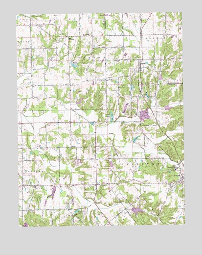
Blocher, IN USGS Topographic Map
Click on map above to begin viewing in our Map Viewer.

This topographic map contains these locations and features:
Feature Name Type Latitude Longitude GNIS ID View Map
AlbionPopulated PlaceN38.7437°W85.7341°430043View Map
Bethel CemeteryCemeteryN38.7011°W85.6544°430888View Map
BlocherPopulated PlaceN38.7181°W85.6566°431188View Map
Bridgewater CemeteryCemeteryN38.6351°W85.7012°440796View Map
Clarks Grant ParkParkN38.6384°W85.6933°432572View Map
Emmanuel ChurchChurchN38.7114°W85.6800°434176View Map
Englishton Park HomeBuildingN38.6576°W85.6314°434208View Map
Estil CemeteryCemeteryN38.6637°W85.7379°434239View Map
GoshenPopulated PlaceN38.6714°W85.7097°435226View Map
Hardy QuarryMineN38.6878°W85.6536°2649431View Map
Hog CreekStreamN38.6867°W85.6964°436285View Map
Hopewell CemeteryCemeteryN38.6491°W85.7378°436447View Map
Howard LakeReservoirN38.7200°W85.7080°436543View Map
Johnson Township Volunteer Fire DepartmentBuildingN38.7223°W85.6576°2701399View Map
Kimberlin CreekStreamN38.6895°W85.7444°437306View Map
Kimberlin Creek ChurchChurchN38.6489°W85.6864°437307View Map
Kinderhook LakeReservoirN38.6335°W85.7062°437316View Map
Lake McCullochReservoirN38.7008°W85.6519°438840View Map
Leroy Smith Lake DamDamN38.6739°W85.6619°447844View Map
LexingtonPopulated PlaceN38.6523°W85.6252°437811View Map
Lexington CemeteryCemeteryN38.6497°W85.6340°437812View Map
Lexington Elementary SchoolSchoolN38.6523°W85.6266°447120View Map
Morgan Trail ParkParkN38.7003°W85.6589°439437View Map
New FrankfortPopulated PlaceN38.7367°W85.7111°440047View Map
Newland CreekStreamN38.6398°W85.6983°440143View Map
Pine LakeReservoirN38.6894°W85.6790°441159View Map
Pine Lake DamDamN38.6867°W85.6783°447843View Map
Pleasant Ridge ChurchChurchN38.6345°W85.6694°441301View Map
Presbyterian National Missions LakeReservoirN38.6562°W85.6357°447248View Map
Presbyterian National Missions Lake DamDamN38.6567°W85.6366°447249View Map
Reeves CemeteryCemeteryN38.6308°W85.7081°441871View Map
Scaffold Lick ChurchChurchN38.7228°W85.6741°443053View Map
Scott CountyCivilN38.6851°W85.7475°450386View Map
Scott County QuarryMineN38.6878°W85.6536°2567523View Map
Smith LakeReservoirN38.6755°W85.6617°443698View Map
Stucker Fork Structure Number 4DamN38.6931°W85.6383°447604View Map
Thomas J Miller LakeReservoirN38.6448°W85.7240°447626View Map
Thomas J Miller Lake DamDamN38.6484°W85.7233°447627View Map
Town CreekStreamN38.6712°W85.6702°444827View Map
Township of LexingtonCivilN38.6522°W85.6466°453549View Map
White Eye BranchStreamN38.6862°W85.6758°445938View Map
Woods ForkStreamN38.6867°W85.6964°446315View Map
WoosterPopulated PlaceN38.7367°W85.6927°446327View Map

Note: Coordinates in the location and feature list above are referenced to NAD83 datum.


Copyright (C) 2008-2024 Ryan Niemi / Sunset Dynamics ... All Rights Reserved