TopoQuest Logo
Do you find TopoQuest useful?
Help keep TopoQuest running and adding new maps/features by donating!
Bitcoin:  19c7KJd3qBynnjoSw5npx9KScwjBe4ifkT
Litecoin:  LXs6TkuXGGXo1vDsWCkWVdjQX94eUKd6ui
Home View Maps Find Maps Find Places Resources & Links


Newman Lake, Washington Topographic Map

USGS Map Title: Newman Lake, WA
USGS Map MRC: 47117G1
DRG (GeoTIFF) Download: o47117g1.tif


Neighboring USGS Topographic Map Quads:


  Mount Kit Carson, WA  
47117H2
 

  Mount Spokane, WA  
47117H1
 

  Spirit Lake West, ID  
47116H8
 

  Foothills, WA  
47117G2
 

  Newman Lake, WA  
47117G1
 

  Rathdrum, ID  
47116G8
 

  Greenacres, WA  
47117F2
 

  Liberty Lake, WA  
47117F1
 

  Post Falls, ID  
47116F8


Map MRC Location:

N48°
W118°
N48°
W117°
H8 H7 H6 H5 H4 H3 H2 H1
G8 G7 G6 G5 G4 G3 G2 G1
F8 F7 F6 F5 F4 F3 F2 F1
E8 E7 E6 E5 E4 E3 E2 E1
D8 D7 D6 D5 D4 D3 D2 D1
C8 C7 C6 C5 C4 C3 C2 C1
B8 B7 B6 B5 B4 B3 B2 B1
A8 A7 A6 A5 A4 A3 A2 A1
N47°
W118°
N47°
W117°

Newman Lake, WA USGS 1:24K Topographic Map Preview:
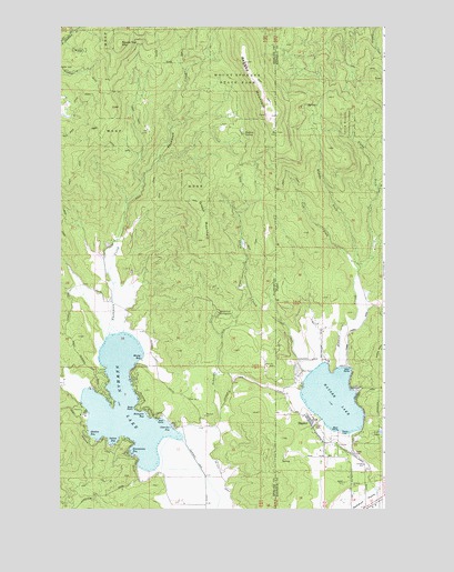
Newman Lake, WA USGS Topographic Map
Click on map above to begin viewing in our Map Viewer.

This topographic map contains these locations and features:
Feature Name Type Latitude Longitude GNIS ID View Map
Bass PointCapeN47.7763°W117.0969°1503195View Map
Cherokee BayBayN47.7710°W117.0845°1503936View Map
City of HauserCivilN47.7644°W117.0103°2410714View Map
Green MountainSummitN47.8296°W117.0733°1512256View Map
Hampton BayBayN47.7747°W117.0926°1505363View Map
HauserPopulated PlaceN47.7730°W117.0280°396624View Map
Hauser CreekStreamN47.7863°W117.0177°373009View Map
Hauser LakeLakeN47.7786°W117.0202°382966View Map
Hauser Lake Access Fish and GameLocaleN47.7702°W117.0185°393938View Map
Hauser Lake Fire DepartmentBuildingN47.7667°W117.0178°2618976View Map
Hauser Lake Recreation SiteLocaleN47.7699°W117.0174°400478View Map
Hauser Lake SchoolSchoolN47.7677°W117.0230°393939View Map
Homestead CampgroundLocaleN47.8010°W117.0638°1513980View Map
Homestead CampgroundLocaleN47.8007°W117.0644°1505582View Map
Honeymoon BayBayN47.7652°W117.0966°1505588View Map
Hysing SpringSpringN47.8473°W117.0541°1505685View Map
Left Fork Hauser CreekStreamN47.8121°W117.0102°384534View Map
Lost LakeLakeN47.7700°W117.0011°386165View Map
Middle Fork Hauser CreekStreamN47.8138°W117.0116°386818View Map
Mount Spokane DivisionCivilN47.8737°W117.1186°1939568View Map
Muzzy BayBayN47.7906°W117.0952°1506912View Map
Newman LakeSwampN47.7776°W117.1006°1513470View Map
Newman LakePopulated PlaceN47.7768°W117.0949°1511452View Map
Newman Lake Flood Control DamDamN47.7682°W117.0777°1532451View Map
Ragged MountainSummitN47.8657°W117.0538°389025View Map
Right Fork Hauser CreekStreamN47.8121°W117.0102°389372View Map
Round Top MountainSummitN47.8705°W117.1024°1512624View Map
Schackle CreekStreamN47.7713°W117.0777°1508142View Map
Shackle CreekStreamN47.7752°W117.0641°1513981View Map
Shadow BayBayN47.7704°W117.1123°1508238View Map
Shaw CreekStreamN47.7846°W117.0302°390164View Map
Smith Ranch AirportAirportN47.7568°W117.0236°400832View Map
Spokane County Fire District 13 Newman Lake Fire and Rescue Station 1BuildingN47.7517°W117.0770°2643780View Map
Spokane County Fire District 13 Newman Lake Fire and Rescue Station 2BuildingN47.8031°W117.1060°2643781View Map
Sutton BayBayN47.7679°W117.1047°1508852View Map
Thompson CreekStreamN47.7955°W117.1063°1508998View Map
Warner DamDamN47.8116°W117.0994°1532934View Map

Note: Coordinates in the location and feature list above are referenced to NAD83 datum.


Copyright (C) 2008-2024 Ryan Niemi / Sunset Dynamics ... All Rights Reserved