TopoQuest Logo
Do you find TopoQuest useful?
Help keep TopoQuest running and adding new maps/features by donating!
Bitcoin:  19c7KJd3qBynnjoSw5npx9KScwjBe4ifkT
Litecoin:  LXs6TkuXGGXo1vDsWCkWVdjQX94eUKd6ui
Home View Maps Find Maps Find Places Resources & Links


Nickel, Louisiana Topographic Map

USGS Map Title: Nickel, LA
USGS Map MRC: 31092G1
DRG (GeoTIFF) Download: o31092g1.tif


Neighboring USGS Topographic Map Quads:


  Olla East, LA  
31092H2
 

  Holum, LA  
31092H1
 

  Enterprise, LA  
31091H8
 

  Summerville, LA  
31092G2
 

  Nickel, LA  
31092G1
 

  Aimwell, LA  
31091G8
 

  Jena West, LA  
31092F2
 

  Jena East, LA  
31092F1
 

  Manifest, LA  
31091F8


Map MRC Location:

N32°
W93°
N32°
W92°
H8 H7 H6 H5 H4 H3 H2 H1
G8 G7 G6 G5 G4 G3 G2 G1
F8 F7 F6 F5 F4 F3 F2 F1
E8 E7 E6 E5 E4 E3 E2 E1
D8 D7 D6 D5 D4 D3 D2 D1
C8 C7 C6 C5 C4 C3 C2 C1
B8 B7 B6 B5 B4 B3 B2 B1
A8 A7 A6 A5 A4 A3 A2 A1
N31°
W93°
N31°
W92°

Nickel, LA USGS 1:24K Topographic Map Preview:
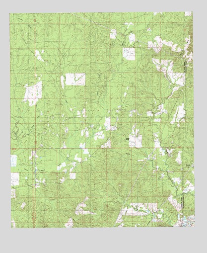
Nickel, LA USGS Topographic Map
Click on map above to begin viewing in our Map Viewer.

This topographic map contains these locations and features:
Feature Name Type Latitude Longitude GNIS ID View Map
Aimoch Baptist ChurchChurchN31.8135°W92.0526°553267View Map
Aimoch School (historical)SchoolN31.8018°W92.0585°545892View Map
Aimwell SpringSpringN31.8009°W92.0466°532094View Map
Antioch CemeteryCemeteryN31.7979°W92.1032°545894View Map
Antioch Free Methodist ChurchChurchN31.7979°W92.1040°553308View Map
Antioch School (historical)SchoolN31.7974°W92.1043°545893View Map
Bald HillSummitN31.7560°W92.0851°532287View Map
Buck CreekStreamN31.8216°W92.0612°533497View Map
Cow CreekStreamN31.7871°W92.1243°534205View Map
Fisher CemeteryCemeteryN31.7579°W92.0029°534966View Map
Hodges BranchStreamN31.7571°W92.0221°535686View Map
Little Brushley Church (historical)ChurchN31.7691°W92.0215°545938View Map
Little Cow CreekStreamN31.8010°W92.1179°536523View Map
Little CreekStreamN31.7993°W92.0232°545940View Map
Mount Zion CemeteryCemeteryN31.7835°W92.0087°555416View Map
Mount Zion Church (historical)ChurchN31.7835°W92.0087°545946View Map
NickelPopulated PlaceN31.8093°W92.0540°541152View Map
Parish Governing Authority District 1CivilN31.8569°W92.1096°1929744View Map
Randall CemeteryCemeteryN31.7996°W92.0151°538490View Map
Rocky CreekStreamN31.7835°W92.0196°538674View Map
Rosefield School (historical)SchoolN31.8629°W92.0349°545967View Map
Salty CreekStreamN31.7924°W92.0851°539112View Map
Summerville - Rosefield Volunteer Fire DepartmentBuildingN31.8063°W92.0552°2672821View Map
Ward OneCivilN31.8443°W92.1199°545104View Map
Wilbanks CemeteryCemeteryN31.7754°W92.1021°540392View Map

Note: Coordinates in the location and feature list above are referenced to NAD83 datum.


Copyright (C) 2008-2025 Ryan Niemi / Sunset Dynamics ... All Rights Reserved