TopoQuest Logo
Do you find TopoQuest useful?
Help keep TopoQuest running and adding new maps/features by donating!
Bitcoin:  19c7KJd3qBynnjoSw5npx9KScwjBe4ifkT
Litecoin:  LXs6TkuXGGXo1vDsWCkWVdjQX94eUKd6ui
Home View Maps Find Maps Find Places Resources & Links


Manifest, Louisiana Topographic Map

USGS Map Title: Manifest, LA
USGS Map MRC: 31091F8
DRG (GeoTIFF) Download: o31091f8.tif


Neighboring USGS Topographic Map Quads:


  Nickel, LA  
31092G1
 

  Aimwell, LA  
31091G8
 

  Harrisonburg, LA  
31091G7
 

  Jena East, LA  
31092F1
 

  Manifest, LA  
31091F8
 

  Jonesville North, LA  
31091F7
 

  Bird Island Point, LA  
31092E1
 

  Walters, LA  
31091E8
 

  Jonesville South, LA  
31091E7


Map MRC Location:

N32°
W92°
N32°
W91°
H8 H7 H6 H5 H4 H3 H2 H1
G8 G7 G6 G5 G4 G3 G2 G1
F8 F7 F6 F5 F4 F3 F2 F1
E8 E7 E6 E5 E4 E3 E2 E1
D8 D7 D6 D5 D4 D3 D2 D1
C8 C7 C6 C5 C4 C3 C2 C1
B8 B7 B6 B5 B4 B3 B2 B1
A8 A7 A6 A5 A4 A3 A2 A1
N31°
W92°
N31°
W91°

Manifest, LA USGS 1:24K Topographic Map Preview:
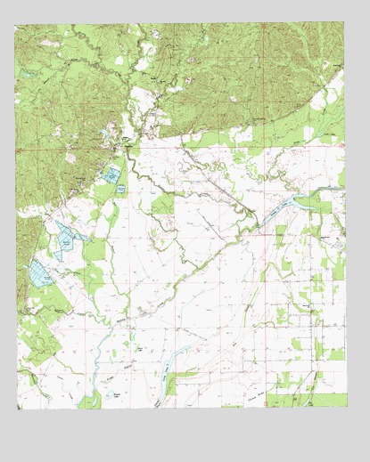
Manifest, LA USGS Topographic Map
Click on map above to begin viewing in our Map Viewer.

This topographic map contains these locations and features:
Feature Name Type Latitude Longitude GNIS ID View Map
Alexander CemeteryCemeteryN31.6571°W91.9968°532101View Map
Aspire Career Center SchoolSchoolN31.7125°W91.9593°2462926View Map
Birds CreekStreamN31.6943°W91.8926°533140View Map
Birds Creek Baptist ChurchChurchN31.7352°W91.8760°558169View Map
Birds Creek Oil FieldOilfieldN31.7052°W91.9010°546000View Map
Black LakeLakeN31.6444°W91.9547°553686View Map
Boggy BayouGutN31.6382°W91.9549°533273View Map
Brushy CreekStreamN31.7363°W91.9679°553805View Map
Clear RunStreamN31.7388°W91.9985°533992View Map
Coons CreekStreamN31.6274°W91.9765°534113View Map
Craig Bayou Oil FieldOilfieldN31.7474°W91.8793°546008View Map
Dysons Lake (historical)LakeN31.6602°W91.9574°557905View Map
Elm LakeLakeN31.6259°W91.8911°554355View Map
Elm SloughGutN31.6524°W91.9135°534810View Map
Fish LakeLakeN31.7132°W91.8842°554411View Map
Flat CreekStreamN31.6538°W91.9671°534989View Map
Ford CreekStreamN31.7302°W91.9571°554452View Map
Girlinghouse CemeteryCemeteryN31.6991°W91.9729°541611View Map
Greens CreekStreamN31.6518°W91.9637°535400View Map
Hawthorne CreekStreamN31.7149°W91.9535°558237View Map
Heard CemeteryCemeteryN31.7202°W91.9487°535588View Map
Huffman CemeteryCemeteryN31.7071°W91.9632°541610View Map
Lacy BranchStreamN31.7354°W91.9854°554964View Map
Long LakeLakeN31.6368°W91.9435°555145View Map
ManifestPopulated PlaceN31.7102°W91.9621°536876View Map
Manifest ChurchChurchN31.7307°W91.9449°536877View Map
Manifest Elementary SchoolSchoolN31.7293°W91.9593°1629833View Map
Manifest Oil FieldOilfieldN31.7463°W91.9460°546034View Map
Manifest Volunteer Fire DepartmentBuildingN31.7097°W91.9611°2673044View Map
Mill BranchStreamN31.6546°W91.9560°537094View Map
Oak Grove ChurchChurchN31.6582°W91.8893°537783View Map
Round LakeLakeN31.6296°W91.9657°555849View Map
Salem CreekStreamN31.7302°W91.9571°539098View Map
Sandy LakeLakeN31.6915°W91.8970°555977View Map
Sandy Lake ChurchChurchN31.6788°W91.8840°558315View Map
Sandy Lake Oil FieldOilfieldN31.6877°W91.8926°546052View Map
Smith CemeteryCemeteryN31.7227°W91.8935°541608View Map
Taunton-Coleman CemeteryCemeteryN31.7177°W91.9104°539794View Map
Thomas BrakeSwampN31.6271°W91.9135°539872View Map
WebbPopulated PlaceN31.7321°W91.9462°541609View Map

Note: Coordinates in the location and feature list above are referenced to NAD83 datum.


Copyright (C) 2008-2024 Ryan Niemi / Sunset Dynamics ... All Rights Reserved