TopoQuest Logo
Do you find TopoQuest useful?
Help keep TopoQuest running and adding new maps/features by donating!
Bitcoin:  19c7KJd3qBynnjoSw5npx9KScwjBe4ifkT
Litecoin:  LXs6TkuXGGXo1vDsWCkWVdjQX94eUKd6ui
Home View Maps Find Maps Find Places Resources & Links


Nickwall, Montana Topographic Map

USGS Map Title: Nickwall, MT
USGS Map MRC: 48105A3
DRG (GeoTIFF) Download: o48105a3.tif


Neighboring USGS Topographic Map Quads:


  Chelsea NW, MT  
48105B4
 

  Chelsea, MT  
48105B3
 

  Badger Creek, MT  
48105B2
 

  Chelsea SW, MT  
48105A4
 

  Nickwall, MT  
48105A3
 

  Poplar, MT  
48105A2
 

  Gady Coulee, MT  
47105H4
 

  Dowse Coulee, MT  
47105H3
 

  Sullivan Coulee, MT  
47105H2


Map MRC Location:

N49°
W106°
N49°
W105°
H8 H7 H6 H5 H4 H3 H2 H1
G8 G7 G6 G5 G4 G3 G2 G1
F8 F7 F6 F5 F4 F3 F2 F1
E8 E7 E6 E5 E4 E3 E2 E1
D8 D7 D6 D5 D4 D3 D2 D1
C8 C7 C6 C5 C4 C3 C2 C1
B8 B7 B6 B5 B4 B3 B2 B1
A8 A7 A6 A5 A4 A3 A2 A1
N48°
W106°
N48°
W105°

Nickwall, MT USGS 1:24K Topographic Map Preview:
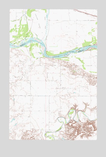
Nickwall, MT USGS Topographic Map
Click on map above to begin viewing in our Map Viewer.

This topographic map contains these locations and features:
Feature Name Type Latitude Longitude GNIS ID View Map
26N49E13ACAB01 WellWellN48.0095°W105.3322°825495View Map
27N49E02BD__01 WellWellN48.1239°W105.3597°826461View Map
27N49E02BD__02 WellWellN48.1239°W105.3597°826462View Map
27N49E02CAAD01 WellWellN48.1200°W105.3558°826428View Map
27N49E02DB__01 WellWellN48.1203°W105.3542°826430View Map
27N49E10AA__01 WellWellN48.1131°W105.3703°826362View Map
27N49E10DA__01 WellWellN48.1059°W105.3703°826273View Map
27N49E11BC__01 WellWellN48.1095°W105.3650°826318View Map
27N49E14BB__01 WellWellN48.0986°W105.3650°826208View Map
27N49E14BB__02 WellWellN48.0986°W105.3650°826209View Map
27N50E05CD__01 WellWellN48.1178°W105.2933°826413View Map
27N50E07BB__01 WellWellN48.1142°W105.3205°826381View Map
27N50E08CC__01 WellWellN48.1031°W105.2989°826259View Map
27N50E08CD__01 WellWellN48.1031°W105.2933°826258View Map
27N50E09BB__01 WellWellN48.1142°W105.2772°826380View Map
27N50E10CD__01 WellWellN48.1031°W105.2503°826257View Map
27N50E20DB__01 WellWellN48.0775°W105.2880°826052View Map
27N50E22BC__01 WellWellN48.0811°W105.2555°826073View Map
27N50E22BCCC01 WellWellN48.0792°W105.2586°826059View Map
27N50E27BA__01 WellWellN48.0703°W105.2503°825992View Map
Chelsea CreekStreamN48.1197°W105.3525°802076View Map
Chelsea IslandIslandN48.1145°W105.3353°769776View Map
NickwallPopulated PlaceN48.0492°W105.3069°774628View Map
Nickwall CreekStreamN48.0786°W105.3369°774629View Map
Nickwall Post Office (historical)Post OfficeN48.0495°W105.3033°1716182View Map
Nickwall School (historical)SchoolN48.0497°W105.3033°1716115View Map
Pleasant View CemeteryCemeteryN48.0497°W105.3014°775290View Map
Rermley CreekStreamN48.0192°W105.3228°1716261View Map
Shefelbine DamDamN48.0017°W105.2989°797793View Map
Tule CreekStreamN48.1178°W105.3578°802220View Map
W Miller DamDamN48.0200°W105.3705°797792View Map
W Miller Number 1 DamDamN48.0150°W105.3655°797587View Map

Note: Coordinates in the location and feature list above are referenced to NAD83 datum.


Copyright (C) 2008-2025 Ryan Niemi / Sunset Dynamics ... All Rights Reserved