TopoQuest Logo
Do you find TopoQuest useful?
Help keep TopoQuest running and adding new maps/features by donating!
Bitcoin:  19c7KJd3qBynnjoSw5npx9KScwjBe4ifkT
Litecoin:  LXs6TkuXGGXo1vDsWCkWVdjQX94eUKd6ui
Home View Maps Find Maps Find Places Resources & Links


Ninetysix Ranch, New Mexico Topographic Map

USGS Map Title: Ninetysix Ranch, NM
USGS Map MRC: 32108C4
DRG (GeoTIFF) Download: o32108c4.tif


Neighboring USGS Topographic Map Quads:


  Gold Hill, NM  
32108D5
 

  C Bar Ranch, NM  
32108D4
 

  Werney Hill, NM  
32108D3
 

  Lisbon, NM  
32108C5
 

  Ninetysix Ranch, NM  
32108C4
 

  Soldiers Farewell Hill, NM  
32108C3
 

  Muir Ranch, NM  
32108B5
 

  Separ, NM  
32108B4
 

  Separ NE, NM  
32108B3


Map MRC Location:

N33°
W109°
N33°
W108°
H8 H7 H6 H5 H4 H3 H2 H1
G8 G7 G6 G5 G4 G3 G2 G1
F8 F7 F6 F5 F4 F3 F2 F1
E8 E7 E6 E5 E4 E3 E2 E1
D8 D7 D6 D5 D4 D3 D2 D1
C8 C7 C6 C5 C4 C3 C2 C1
B8 B7 B6 B5 B4 B3 B2 B1
A8 A7 A6 A5 A4 A3 A2 A1
N32°
W109°
N32°
W108°

Ninetysix Ranch, NM USGS 1:24K Topographic Map Preview:
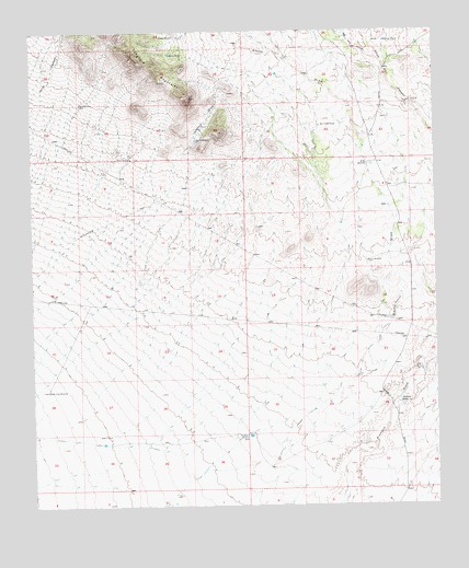
Ninetysix Ranch, NM USGS Topographic Map
Click on map above to begin viewing in our Map Viewer.

This topographic map contains these locations and features:
Feature Name Type Latitude Longitude GNIS ID View Map
10180 Water WellWellN32.2743°W108.3853°919281View Map
10181 Water WellWellN32.2687°W108.4339°919244View Map
10182 Water WellWellN32.2804°W108.4959°919282View Map
Buena Vista WindmillLocaleN32.2806°W108.4962°886854View Map
Bull WindmillLocaleN32.2856°W108.3806°886905View Map
Dons TankReservoirN32.3690°W108.4572°888457View Map
Glaze TankReservoirN32.3737°W108.4561°889422View Map
Glaze WindmillLocaleN32.3562°W108.4853°889424View Map
Hideout WindmillLocaleN32.3462°W108.4492°889950View Map
Langford DrawValleyN32.3448°W108.4514°890929View Map
Langford MountainsRangeN32.3667°W108.4625°920628View Map
Little TankReservoirN32.3579°W108.3762°908052View Map
Lucky WindmillLocaleN32.3143°W108.3964°891482View Map
New Well CanyonValleyN32.3676°W108.3937°909078View Map
Ninetysix RanchLocaleN32.2768°W108.3873°892545View Map
Pendleton WindmillLocaleN32.2687°W108.4337°893166View Map
Rincon TankReservoirN32.3723°W108.3908°893952View Map
Smith DrawValleyN32.2840°W108.4000°911153View Map
Smith WindmillLocaleN32.3398°W108.3964°894953View Map
Snaky WindmillLocaleN32.3415°W108.4698°894971View Map
South WindmillLocaleN32.3559°W108.3837°895184View Map

Note: Coordinates in the location and feature list above are referenced to NAD83 datum.


Copyright (C) 2008-2025 Ryan Niemi / Sunset Dynamics ... All Rights Reserved