TopoQuest Logo
Do you find TopoQuest useful?
Help keep TopoQuest running and adding new maps/features by donating!
Bitcoin:  19c7KJd3qBynnjoSw5npx9KScwjBe4ifkT
Litecoin:  LXs6TkuXGGXo1vDsWCkWVdjQX94eUKd6ui
Home View Maps Find Maps Find Places Resources & Links


Gold Hill, New Mexico Topographic Map

USGS Map Title: Gold Hill, NM
USGS Map MRC: 32108D5
DRG (GeoTIFF) Download: o32108d5.tif


Neighboring USGS Topographic Map Quads:


  Willow Draw, NM  
32108E6
 

  Eagle Eye Peak, NM  
32108E5
 

  Burro Peak, NM  
32108E4
 

  Culberson Ranch, NM  
32108D6
 

  Gold Hill, NM  
32108D5
 

  C Bar Ranch, NM  
32108D4
 

  Lordsburg, NM  
32108C6
 

  Lisbon, NM  
32108C5
 

  Ninetysix Ranch, NM  
32108C4


Map MRC Location:

N33°
W109°
N33°
W108°
H8 H7 H6 H5 H4 H3 H2 H1
G8 G7 G6 G5 G4 G3 G2 G1
F8 F7 F6 F5 F4 F3 F2 F1
E8 E7 E6 E5 E4 E3 E2 E1
D8 D7 D6 D5 D4 D3 D2 D1
C8 C7 C6 C5 C4 C3 C2 C1
B8 B7 B6 B5 B4 B3 B2 B1
A8 A7 A6 A5 A4 A3 A2 A1
N32°
W109°
N32°
W108°

Gold Hill, NM USGS 1:24K Topographic Map Preview:
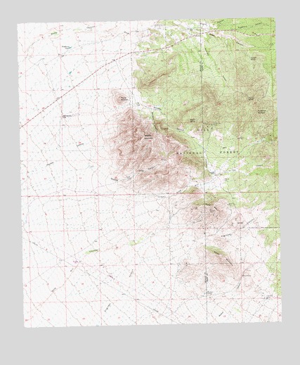
Gold Hill, NM USGS Topographic Map
Click on map above to begin viewing in our Map Viewer.

This topographic map contains these locations and features:
Feature Name Type Latitude Longitude GNIS ID View Map
Apache MountainSummitN32.4526°W108.5656°903229View Map
Apache TankReservoirN32.4449°W108.5546°936639View Map
Apache WellsWellN32.4356°W108.5726°903244View Map
Bradberry TankReservoirN32.4895°W108.6004°904052View Map
Bradberry WindmillLocaleN32.4979°W108.5592°904053View Map
Bruff DepositMineN32.4470°W108.5292°914929View Map
Cline RanchLocaleN32.4273°W108.5564°905214View Map
Contention ClaimMineN32.4362°W108.5326°914933View Map
Coop MineMineN32.4501°W108.5039°905316View Map
Coop WindmillLocaleN32.4484°W108.5106°936640View Map
Crescent DepositMineN32.4265°W108.5323°914942View Map
Cuningham WindmillLocaleN32.3876°W108.5373°905558View Map
Divide WindmillLocaleN32.4892°W108.5020°905785View Map
Engineers WindmillLocaleN32.4204°W108.5067°936641View Map
Gold HillSummitN32.4234°W108.5334°906609View Map
Gold Hill (historical)Populated PlaceN32.4367°W108.5317°919971View Map
Gold Hill CemeteryCemeteryN32.4340°W108.5275°906613View Map
Gold Hill RanchLocaleN32.4367°W108.5317°906615View Map
Golden Cross MineMineN32.4570°W108.5317°906618View Map
Hoodoo SpringSpringN32.4584°W108.5403°907068View Map
Hornbrook MountainSummitN32.4617°W108.5109°907086View Map
HughesMineN32.4001°W108.5589°915386View Map
Juniper SpringSpringN32.4835°W108.5132°907493View Map
McComas Incident Historical MarkerParkN32.4684°W108.5767°932294View Map
Mill MineMineN32.4226°W108.5423°908744View Map
Monarch CanyonValleyN32.4637°W108.5617°908830View Map
Monarch TankReservoirN32.4609°W108.5615°936638View Map
Muscovy MineMineN32.3959°W108.5423°915032View Map
Nancy Lee MineMineN32.4240°W108.5259°909016View Map
Never Fail MineMineN32.3848°W108.5078°909055View Map
Noonday LodeMineN32.4209°W108.5423°915034View Map
North TankReservoirN32.4853°W108.5636°936643View Map
Oak TankReservoirN32.4209°W108.5151°2038594View Map
OrograndeMineN32.4334°W108.5423°915040View Map
Peterson CanyonValleyN32.4962°W108.5434°909590View Map
Peterson SpringSpringN32.4670°W108.5149°909593View Map
Peterson TankReservoirN32.4739°W108.5264°936642View Map
Picnic CanyonValleyN32.4979°W108.5431°909614View Map
Powerline CanyonValleyN32.4937°W108.5228°902917View Map
Reservation MineMineN32.4567°W108.5337°910133View Map
Round MountainSummitN32.4684°W108.5767°910441View Map
Round Mountain RanchLocaleN32.4615°W108.6048°910448View Map
Ruby MineMineN32.4512°W108.5195°910468View Map
Standard MineMineN32.4215°W108.5348°911385View Map
Walker MountainSummitN32.4023°W108.5289°912139View Map
Walker WindmillLocaleN32.3945°W108.5201°912142View Map
Weatherfords Uranium DepositMineN32.4751°W108.5756°915510View Map
Werney MineMineN32.4556°W108.5564°915512View Map
White Rock DepositMineN32.4751°W108.5423°915513View Map
Wing Feather LadyMineN32.4548°W108.5426°915517View Map
WO RanchLocaleN32.4370°W108.5320°2038766View Map
Z X CanyonValleyN32.4345°W108.5312°912540View Map

Note: Coordinates in the location and feature list above are referenced to NAD83 datum.


Copyright (C) 2008-2025 Ryan Niemi / Sunset Dynamics ... All Rights Reserved