TopoQuest Logo
Do you find TopoQuest useful?
Help keep TopoQuest running and adding new maps/features by donating!
Bitcoin:  19c7KJd3qBynnjoSw5npx9KScwjBe4ifkT
Litecoin:  LXs6TkuXGGXo1vDsWCkWVdjQX94eUKd6ui
Home View Maps Find Maps Find Places Resources & Links


Nonpareil, Oregon Topographic Map

USGS Map Title: Nonpareil, OR
USGS Map MRC: 43123D2
DRG (GeoTIFF) Download: o43123d2.tif


Neighboring USGS Topographic Map Quads:


  Yoncalla, OR  
43123E3
 

  Scotts Valley, OR  
43123E2
 

  Harness Mountain, OR  
43123E1
 

  Sutherlin, OR  
43123D3
 

  Nonpareil, OR  
43123D2
 

  Hinkle Creek, OR  
43123D1
 

  Winchester, OR  
43123C3
 

  Oak Creek Valley, OR  
43123C2
 

  Glide, OR  
43123C1


Map MRC Location:

N44°
W124°
N44°
W123°
H8 H7 H6 H5 H4 H3 H2 H1
G8 G7 G6 G5 G4 G3 G2 G1
F8 F7 F6 F5 F4 F3 F2 F1
E8 E7 E6 E5 E4 E3 E2 E1
D8 D7 D6 D5 D4 D3 D2 D1
C8 C7 C6 C5 C4 C3 C2 C1
B8 B7 B6 B5 B4 B3 B2 B1
A8 A7 A6 A5 A4 A3 A2 A1
N43°
W124°
N43°
W123°

Nonpareil, OR USGS 1:24K Topographic Map Preview:
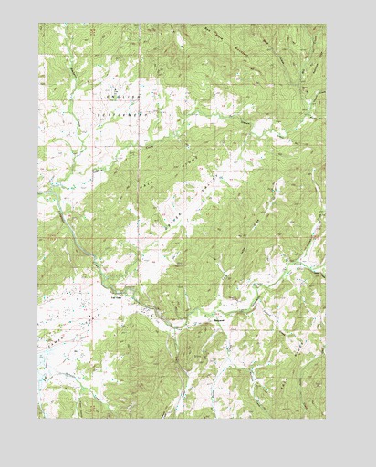
Nonpareil, OR USGS Topographic Map
Click on map above to begin viewing in our Map Viewer.

This topographic map contains these locations and features:
Feature Name Type Latitude Longitude GNIS ID View Map
Bachelor CreekStreamN43.4493°W123.2417°1117123View Map
Banks CreekStreamN43.4007°W123.1701°1117222View Map
Bonanza MineMineN43.3940°W123.1845°1117920View Map
Boyd CreekStreamN43.4804°W123.1412°1118023View Map
Cantell CreekStreamN43.4237°W123.1426°1118569View Map
Denley Brothers DamDamN43.3765°W123.2476°1133503View Map
Driver ValleyValleyN43.4210°W123.2131°1120097View Map
English SettlementLocaleN43.4740°W123.2173°1135134View Map
Fair OaksPopulated PlaceN43.4173°W123.2134°1136275View Map
Fair Oaks CemeteryCemeteryN43.4151°W123.2206°1132906View Map
Fair Oaks Census Designated PlaceCensusN43.4109°W123.2195°2611729View Map
Fair Oaks County ParkParkN43.4082°W123.1998°1132907View Map
Fair Oaks Post Office (historical)Post OfficeN43.4173°W123.2134°1165234View Map
Fair Oaks Rural Fire Protection DistrictBuildingN43.4094°W123.2008°2576938View Map
Flying D Ranch AirportAirportN43.3823°W123.2256°2646002View Map
Foster CreekStreamN43.4035°W123.1920°1120907View Map
Fraser CanyonValleyN43.3835°W123.2320°1120958View Map
Gassy CreekStreamN43.4221°W123.1342°1121072View Map
Gossett CreekStreamN43.4707°W123.1370°1121267View Map
Hall RidgeRidgeN43.3915°W123.1412°1158274View Map
Hall RidgeRidgeN43.4504°W123.2045°1158275View Map
Haney CreekStreamN43.4707°W123.1373°1121555View Map
Harvey CemeteryCemeteryN43.4540°W123.2220°1132905View Map
Long Valley CreekStreamN43.4090°W123.1751°1123453View Map
Markham CreekStreamN43.3937°W123.1687°1123765View Map
Mill CreekStreamN43.4710°W123.1370°1124158View Map
Nonpareil (historical)LocaleN43.4076°W123.1681°1136576View Map
Nonpareil MineMineN43.4126°W123.1648°1135133View Map
Nonpareil Post Office (historical)Post OfficeN43.4076°W123.1681°1165710View Map
Norris CreekStreamN43.3951°W123.1295°1124713View Map
Pelland CreekStreamN43.4132°W123.1573°1125279View Map
Platt 1 ReservoirReservoirN43.3924°W123.2497°1133238View Map
Robinson RidgeRidgeN43.4848°W123.1328°1126127View Map
Salt Lick CreekStreamN43.4207°W123.1456°1132096View Map
Smith CanyonValleyN43.3804°W123.2248°1132909View Map
Sutherlin CemeteryCemeteryN43.3998°W123.2456°1132908View Map
Sutherlin Nonpareil Water Treatment PlantLocaleN43.4091°W123.1631°2660766View Map

Note: Coordinates in the location and feature list above are referenced to NAD83 datum.


Copyright (C) 2008-2025 Ryan Niemi / Sunset Dynamics ... All Rights Reserved