TopoQuest Logo
Do you find TopoQuest useful?
Help keep TopoQuest running and adding new maps/features by donating!
Bitcoin:  19c7KJd3qBynnjoSw5npx9KScwjBe4ifkT
Litecoin:  LXs6TkuXGGXo1vDsWCkWVdjQX94eUKd6ui
Home View Maps Find Maps Find Places Resources & Links


Winchester, Oregon Topographic Map

USGS Map Title: Winchester, OR
USGS Map MRC: 43123C3
DRG (GeoTIFF) Download: o43123c3.tif


Neighboring USGS Topographic Map Quads:


  Tyee Mountain, OR  
43123D4
 

  Sutherlin, OR  
43123D3
 

  Nonpareil, OR  
43123D2
 

  Garden Valley, OR  
43123C4
 

  Winchester, OR  
43123C3
 

  Oak Creek Valley, OR  
43123C2
 

  Roseburg West, OR  
43123B4
 

  Roseburg East, OR  
43123B3
 

  Dixonville, OR  
43123B2


Map MRC Location:

N44°
W124°
N44°
W123°
H8 H7 H6 H5 H4 H3 H2 H1
G8 G7 G6 G5 G4 G3 G2 G1
F8 F7 F6 F5 F4 F3 F2 F1
E8 E7 E6 E5 E4 E3 E2 E1
D8 D7 D6 D5 D4 D3 D2 D1
C8 C7 C6 C5 C4 C3 C2 C1
B8 B7 B6 B5 B4 B3 B2 B1
A8 A7 A6 A5 A4 A3 A2 A1
N43°
W124°
N43°
W123°

Winchester, OR USGS 1:24K Topographic Map Preview:
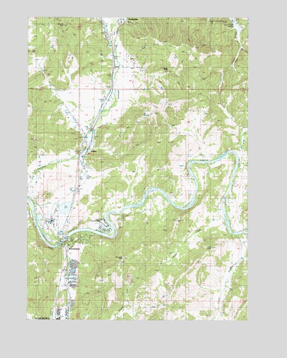
Winchester, OR USGS Topographic Map
Click on map above to begin viewing in our Map Viewer.

This topographic map contains these locations and features:
Feature Name Type Latitude Longitude GNIS ID View Map
Akin (historical)LocaleN43.2904°W123.3626°1166606View Map
Amacher County ParkParkN43.2804°W123.3581°1133000View Map
Amacher County Park Boat RampLocaleN43.2817°W123.3564°2668596View Map
Clover CreekStreamN43.2854°W123.2576°1119032View Map
Cooper CreekStreamN43.3748°W123.3240°1119250View Map
Davis CreekStreamN43.2818°W123.3554°1133002View Map
Davis HillSummitN43.3607°W123.3742°1136203View Map
Deady (historical)LocaleN43.3543°W123.3259°1119770View Map
Dixon CreekStreamN43.2940°W123.2648°1119974View Map
Douglas County Fire District 2 Station 4BuildingN43.2915°W123.3524°2576931View Map
Douglas County Forest Products Biomass ProductionLocaleN43.2912°W123.3608°2697258View Map
Echo ButteSummitN43.2799°W123.2714°1133001View Map
Mar-Linn Log PondReservoirN43.2967°W123.3544°1132999View Map
Mar-Linn Timber Corporation Log Pond DikeDamN43.2965°W123.3562°1133605View Map
Omro Post Office (historical)Post OfficeN43.3212°W123.3220°1164562View Map
Otey CemeteryCemeteryN43.3393°W123.3595°1135782View Map
RedbellLocaleN43.3390°W123.3304°1166700View Map
Richards ButteSummitN43.3717°W123.3553°1125980View Map
Roseburg North Census Designated PlaceCensusN43.2650°W123.3030°2409210View Map
Roseburg Winchester Water Treatment PlantLocaleN43.2827°W123.3537°2660815View Map
Short CreekStreamN43.3304°W123.3415°1132998View Map
Umpqua Community CollegeSchoolN43.2895°W123.3333°1135783View Map
Umpqua Community College AmphitheatreLocaleN43.2906°W123.3329°2661467View Map
Umpqua Community College Jacoby AuditoriumBuildingN43.2903°W123.3350°2661059View Map
WilburPopulated PlaceN43.3210°W123.3406°1166724View Map
Wilbur CemeteryCemeteryN43.3252°W123.3379°1132997View Map
Wilbur Post OfficePost OfficeN43.3215°W123.3410°1166173View Map
WinchesterPopulated PlaceN43.2801°W123.3537°1129211View Map
Winchester BaldySummitN43.2756°W123.3215°1129212View Map
Winchester DamDamN43.2832°W123.3529°1159144View Map
Winchester Elementary SchoolSchoolN43.2827°W123.3505°2417833View Map
Winchester Post OfficePost OfficeN43.2786°W123.3538°1166197View Map
Winchester ReservoirReservoirN43.2828°W123.3531°1133726View Map

Note: Coordinates in the location and feature list above are referenced to NAD83 datum.


Copyright (C) 2008-2024 Ryan Niemi / Sunset Dynamics ... All Rights Reserved