TopoQuest Logo
Do you find TopoQuest useful?
Help keep TopoQuest running and adding new maps/features by donating!
Bitcoin:  19c7KJd3qBynnjoSw5npx9KScwjBe4ifkT
Litecoin:  LXs6TkuXGGXo1vDsWCkWVdjQX94eUKd6ui
Home View Maps Find Maps Find Places Resources & Links


Yoncalla, Oregon Topographic Map

USGS Map Title: Yoncalla, OR
USGS Map MRC: 43123E3
DRG (GeoTIFF) Download: o43123e3.tif


Neighboring USGS Topographic Map Quads:


  Putnam Valley, OR  
43123F4
 

  Drain, OR  
43123F3
 

  Curtin, OR  
43123F2
 

  Yellow Butte, OR  
43123E4
 

  Yoncalla, OR  
43123E3
 

  Scotts Valley, OR  
43123E2
 

  Tyee Mountain, OR  
43123D4
 

  Sutherlin, OR  
43123D3
 

  Nonpareil, OR  
43123D2


Map MRC Location:

N44°
W124°
N44°
W123°
H8 H7 H6 H5 H4 H3 H2 H1
G8 G7 G6 G5 G4 G3 G2 G1
F8 F7 F6 F5 F4 F3 F2 F1
E8 E7 E6 E5 E4 E3 E2 E1
D8 D7 D6 D5 D4 D3 D2 D1
C8 C7 C6 C5 C4 C3 C2 C1
B8 B7 B6 B5 B4 B3 B2 B1
A8 A7 A6 A5 A4 A3 A2 A1
N43°
W124°
N43°
W123°

Yoncalla, OR USGS 1:24K Topographic Map Preview:
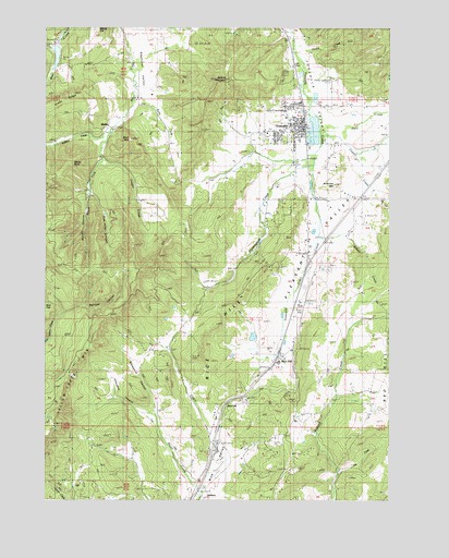
Yoncalla, OR USGS Topographic Map
Click on map above to begin viewing in our Map Viewer.

This topographic map contains these locations and features:
Feature Name Type Latitude Longitude GNIS ID View Map
Ambrose HillSummitN43.5835°W123.2711°1136002View Map
Andrews CreekStreamN43.5968°W123.3543°1116944View Map
Bear Creek DamDamN43.6198°W123.3712°1133454View Map
Bear Creek ReservoirReservoirN43.6173°W123.3724°1133455View Map
Blackberry CanyonValleyN43.5246°W123.3362°1117787View Map
Charles Applegate HouseLocaleN43.6115°W123.2731°1135339View Map
Churchill CanyonValleyN43.5221°W123.3384°1118939View Map
City of YoncallaCivilN43.6004°W123.2876°2412320View Map
Cold CreekStreamN43.6165°W123.3456°1133007View Map
Cougar PassGapN43.5971°W123.3720°1133059View Map
Cowan CreekStreamN43.5965°W123.2754°1119435View Map
Devore (historical)LocaleN43.6248°W123.2901°1133006View Map
DeVore MountainSummitN43.6109°W123.3104°1119730View Map
East Fork Billy CreekStreamN43.6062°W123.3445°1120297View Map
Five Point CanyonValleyN43.5807°W123.3598°1120804View Map
Flagler CreekStreamN43.5965°W123.3543°1120815View Map
Halo CreekStreamN43.5976°W123.2773°1121526View Map
Halo ValleyValleyN43.6026°W123.2504°1121527View Map
Hanlon CreekStreamN43.6218°W123.2868°1121560View Map
Hayhurst ValleyValleyN43.6165°W123.3420°1121703View Map
Huntington CreekStreamN43.5885°W123.2795°1122161View Map
Isadore (historical)LocaleN43.5029°W123.3176°1166665View Map
Kopp CreekStreamN43.5110°W123.3137°1133003View Map
Locust Grove Post Office (historical)Post OfficeN43.5193°W123.3137°1165552View Map
Lost Cabin CreekStreamN43.6196°W123.3729°1123483View Map
Marsh CreekStreamN43.5015°W123.3184°1123783View Map
McDaniel CreekStreamN43.5914°W123.2786°2370283View Map
Middle CanyonValleyN43.5801°W123.3618°1124088View Map
North Douglas County Fire and Emergency Medical Services Station 2BuildingN43.5996°W123.2831°2576909View Map
North Douglas County Fire and Emergency Medical Services Station 3BuildingN43.5355°W123.2926°2576652View Map
North Douglas County Fire and Emergency Medical Services Station 6BuildingN43.5026°W123.2927°2576906View Map
North Fork Wilson CreekStreamN43.5637°W123.2581°1133017View Map
Panther CanyonValleyN43.5498°W123.3687°1125156View Map
Poodle CreekStreamN43.5915°W123.2623°1133016View Map
Red Hill SchoolLocaleN43.5351°W123.2531°1125884View Map
Rice HillPopulated PlaceN43.5387°W123.2901°1158447View Map
Rice HillSummitN43.5379°W123.3205°1158448View Map
Rice Hill Owners Association Sewage Treatment FacilityLocaleN43.5488°W123.2903°2660686View Map
Rice Hill Post Office (historical)Post OfficeN43.5262°W123.3048°1165851View Map
Salt CreekStreamN43.5057°W123.2687°1126526View Map
SkelleyLocaleN43.5987°W123.3606°1127023View Map
Skelley Post Office (historical)Post OfficeN43.5987°W123.3606°1165958View Map
Skull MountainSummitN43.5954°W123.3456°1127041View Map
South Fork Billy CreekStreamN43.5965°W123.3531°1132112View Map
South Fork Flagler CreekStreamN43.5804°W123.3623°1127282View Map
Sweet PointSummitN43.5887°W123.3675°1127831View Map
Thurman Weaver ReservoirReservoirN43.5431°W123.3007°1160707View Map
Thurman Weaver ReservoirReservoirN43.5382°W123.3080°1133709View Map
Weaver DamDamN43.5415°W123.2979°1133708View Map
Wilson CreekStreamN43.5687°W123.2748°1129196View Map
YoncallaPopulated PlaceN43.5985°W123.2834°1136932View Map
Yoncalla Branch LibraryBuildingN43.6001°W123.2842°2661132View Map
Yoncalla CemeteryCemeteryN43.5950°W123.2877°1133005View Map
Yoncalla City HallBuildingN43.5991°W123.2825°2661335View Map
Yoncalla Elementary SchoolSchoolN43.6012°W123.2860°2417834View Map
Yoncalla High SchoolSchoolN43.5952°W123.2840°2417835View Map
Yoncalla Log PondReservoirN43.5978°W123.2783°1133731View Map
Yoncalla Lumber Company Log Pond DamDamN43.6015°W123.2795°1133732View Map
Yoncalla Post OfficePost OfficeN43.6002°W123.2838°1166225View Map
Yoncalla Public WorksBuildingN43.5972°W123.2900°2661555View Map
Yoncalla RodeoLocaleN43.5906°W123.2840°2661196View Map
Yoncalla Sewage Treatment PlantLocaleN43.6062°W123.2782°2660734View Map
Yoncalla ValleyBasinN43.6082°W123.2762°1160709View Map
Yoncalla Water Treatment PlantLocaleN43.5772°W123.2767°2660813View Map

Note: Coordinates in the location and feature list above are referenced to NAD83 datum.


Copyright (C) 2008-2025 Ryan Niemi / Sunset Dynamics ... All Rights Reserved