TopoQuest Logo
Do you find TopoQuest useful?
Help keep TopoQuest running and adding new maps/features by donating!
Bitcoin:  19c7KJd3qBynnjoSw5npx9KScwjBe4ifkT
Litecoin:  LXs6TkuXGGXo1vDsWCkWVdjQX94eUKd6ui
Home View Maps Find Maps Find Places Resources & Links


Norman Park, Georgia Topographic Map

USGS Map Title: Norman Park, GA
USGS Map MRC: 31083C6
DRG (GeoTIFF) Download: o31083c6.tif


Neighboring USGS Topographic Map Quads:


  Tempy, GA  
31083D7
 

  Ty Ty, GA  
31083D6
 

  Tifton West, GA  
31083D5
 

  Sigsbee, GA  
31083C7
 

  Norman Park, GA  
31083C6
 

  Omega, GA  
31083C5
 

  Moultrie, GA  
31083B7
 

  Pineboro, GA  
31083B6
 

  Ellenton, GA  
31083B5


Map MRC Location:

N32°
W84°
N32°
W83°
H8 H7 H6 H5 H4 H3 H2 H1
G8 G7 G6 G5 G4 G3 G2 G1
F8 F7 F6 F5 F4 F3 F2 F1
E8 E7 E6 E5 E4 E3 E2 E1
D8 D7 D6 D5 D4 D3 D2 D1
C8 C7 C6 C5 C4 C3 C2 C1
B8 B7 B6 B5 B4 B3 B2 B1
A8 A7 A6 A5 A4 A3 A2 A1
N31°
W84°
N31°
W83°

Norman Park, GA USGS 1:24K Topographic Map Preview:
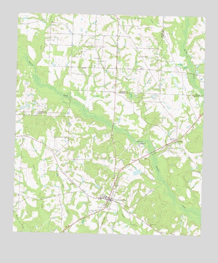
Norman Park, GA USGS Topographic Map
Click on map above to begin viewing in our Map Viewer.

This topographic map contains these locations and features:
Feature Name Type Latitude Longitude GNIS ID View Map
Bethel ChurchChurchN31.3446°W83.6674°311163View Map
City of Norman ParkCivilN31.2692°W83.6843°2404386View Map
Colquitt County Volunteer Firefighters Association Fire Station 21 Norman ParkBuildingN31.2695°W83.6848°2603747View Map
CroslandPopulated PlaceN31.3044°W83.6429°331479View Map
Deep Bottom CemeteryCemeteryN31.2557°W83.6599°313404View Map
Galson CemeteryCemeteryN31.3699°W83.6827°343287View Map
Gray LakeReservoirN31.3292°W83.6581°341770View Map
Gray Lake DamDamN31.3285°W83.6599°341769View Map
Hall LakeReservoirN31.2902°W83.6666°341768View Map
Hall Lake DamDamN31.2902°W83.6666°341767View Map
Little BranchStreamN31.3744°W83.6371°344089View Map
Little CreekStreamN31.3463°W83.6366°317021View Map
Lolly CreekStreamN31.3446°W83.7382°317294View Map
Mount Zion ChurchChurchN31.2999°W83.6471°318944View Map
New Hope ChurchChurchN31.3444°W83.7063°319371View Map
Norman College (historical)SchoolN31.2713°W83.6888°343998View Map
Norman ParkPopulated PlaceN31.2691°W83.6871°332509View Map
Norman Park DivisionCivilN31.2812°W83.6579°1936437View Map
Norman Park Elementary SchoolSchoolN31.2701°W83.6921°343999View Map
Norman Park Police DepartmentBuildingN31.2694°W83.6850°2734135View Map
Paulks CemeteryCemeteryN31.3574°W83.6991°320291View Map
Paulks ChapelChurchN31.3577°W83.6988°343318View Map
Paulks Chapel Consolidated School (historical)SchoolN31.3577°W83.6988°343319View Map
Perry School (historical)SchoolN31.3446°W83.6679°343320View Map
Pine Level ChurchChurchN31.3502°W83.6949°320625View Map
Rocky CreekStreamN31.3052°W83.6607°321802View Map
Rocky Creek CemeteryCemeteryN31.3516°W83.6679°349414View Map
Rocky Creek ChurchChurchN31.3516°W83.6671°321828View Map
Saint Lukes ChurchChurchN31.2780°W83.6829°322153View Map
Sandy Ridge CemeteryCemeteryN31.2985°W83.6479°344014View Map
Seizmo School (historical)SchoolN31.3066°W83.6860°344016View Map
Southside ChurchChurchN31.2594°W83.7010°344018View Map
Tompkins CemeteryCemeteryN31.3599°W83.7285°343355View Map
Tucker BranchStreamN31.3705°W83.6599°324345View Map
Willis LakeLakeN31.3028°W83.6658°325396View Map
Willis Lake MissionChurchN31.3021°W83.6657°325399View Map
Yates CemeteryCemeteryN31.2909°W83.7451°344032View Map
Zion Church (historical)ChurchN31.2566°W83.6638°344034View Map

Note: Coordinates in the location and feature list above are referenced to NAD83 datum.


Copyright (C) 2008-2025 Ryan Niemi / Sunset Dynamics ... All Rights Reserved