TopoQuest Logo
Do you find TopoQuest useful?
Help keep TopoQuest running and adding new maps/features by donating!
Bitcoin:  19c7KJd3qBynnjoSw5npx9KScwjBe4ifkT
Litecoin:  LXs6TkuXGGXo1vDsWCkWVdjQX94eUKd6ui
Home View Maps Find Maps Find Places Resources & Links


Ty Ty, Georgia Topographic Map

USGS Map Title: Ty Ty, GA
USGS Map MRC: 31083D6
DRG (GeoTIFF) Download: o31083d6.tif


Neighboring USGS Topographic Map Quads:


  Sylvester, GA  
31083E7
 

  Sumner, GA  
31083E6
 

  Chula, GA  
31083E5
 

  Tempy, GA  
31083D7
 

  Ty Ty, GA  
31083D6
 

  Tifton West, GA  
31083D5
 

  Sigsbee, GA  
31083C7
 

  Norman Park, GA  
31083C6
 

  Omega, GA  
31083C5


Map MRC Location:

N32°
W84°
N32°
W83°
H8 H7 H6 H5 H4 H3 H2 H1
G8 G7 G6 G5 G4 G3 G2 G1
F8 F7 F6 F5 F4 F3 F2 F1
E8 E7 E6 E5 E4 E3 E2 E1
D8 D7 D6 D5 D4 D3 D2 D1
C8 C7 C6 C5 C4 C3 C2 C1
B8 B7 B6 B5 B4 B3 B2 B1
A8 A7 A6 A5 A4 A3 A2 A1
N31°
W84°
N31°
W83°

Ty Ty, GA USGS 1:24K Topographic Map Preview:
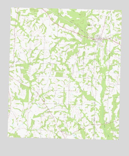
Ty Ty, GA USGS Topographic Map
Click on map above to begin viewing in our Map Viewer.

This topographic map contains these locations and features:
Feature Name Type Latitude Longitude GNIS ID View Map
City of Ty TyCivilN31.4720°W83.6509°2405619View Map
Harold LakeReservoirN31.4893°W83.7131°338334View Map
Harold Lake DamDamN31.4902°W83.7132°338333View Map
Harold Lake EastReservoirN31.4878°W83.7079°338338View Map
Harold Lake East DamDamN31.4885°W83.7082°338337View Map
Johns CreekStreamN31.4091°W83.6446°316141View Map
Kelley LakeReservoirN31.4948°W83.6551°340917View Map
Kelley Lake DamDamN31.4952°W83.6582°340916View Map
Lake LollyReservoirN31.4202°W83.7179°343303View Map
Little CreekStreamN31.4802°W83.6641°317024View Map
New Hope ChurchChurchN31.4002°W83.7030°319372View Map
New Prospect CemeteryCemeteryN31.3999°W83.7029°349395View Map
New Prospect School (historical)SchoolN31.4007°W83.7032°343316View Map
Patterson LakeReservoirN31.4065°W83.7156°341914View Map
Patterson Lake DamDamN31.4068°W83.7166°341913View Map
Pine Forest CemeteryCemeteryN31.4471°W83.7421°349400View Map
Pine Forest ChurchChurchN31.4477°W83.7416°320554View Map
Pine HillPopulated PlaceN31.4471°W83.7038°343323View Map
Pine Hill CemeteryCemeteryN31.4480°W83.7041°349401View Map
Pine Hill CemeteryCemeteryN31.4274°W83.6613°320590View Map
Pine Hill ChurchChurchN31.4477°W83.7035°320594View Map
Pine Hill School (historical)SchoolN31.4474°W83.7035°343324View Map
Poulan DivisionCivilN31.4759°W83.7347°1936477View Map
Powell ChapelChurchN31.4032°W83.7477°321113View Map
Saint Johns ChurchChurchN31.4096°W83.6529°322113View Map
Salem Baptist ChurchChurchN31.3916°W83.6388°322343View Map
Salem CemeteryCemeteryN31.3918°W83.6402°349375View Map
ScootervillePopulated PlaceN31.3821°W83.6899°326507View Map
Scooterville Volunteer Fire Department Station 9BuildingN31.4082°W83.7084°2604715View Map
Ty TyPopulated PlaceN31.4718°W83.6468°333293View Map
Ty Ty Baptist ChurchChurchN31.4757°W83.6499°342622View Map
Ty Ty CemeteryCemeteryN31.4760°W83.6504°349376View Map
Ty Ty Volunteer Fire Department Station 4BuildingN31.4753°W83.6475°2603945View Map
Walker LakeReservoirN31.3783°W83.6747°341916View Map
Walker Lake DamDamN31.3769°W83.6749°341915View Map
Willis CemeteryCemeteryN31.4577°W83.6727°325390View Map

Note: Coordinates in the location and feature list above are referenced to NAD83 datum.


Copyright (C) 2008-2024 Ryan Niemi / Sunset Dynamics ... All Rights Reserved