TopoQuest Logo
Do you find TopoQuest useful?
Help keep TopoQuest running and adding new maps/features by donating!
Bitcoin:  19c7KJd3qBynnjoSw5npx9KScwjBe4ifkT
Litecoin:  LXs6TkuXGGXo1vDsWCkWVdjQX94eUKd6ui
Home View Maps Find Maps Find Places Resources & Links


Sigsbee, Georgia Topographic Map

USGS Map Title: Sigsbee, GA
USGS Map MRC: 31083C7
DRG (GeoTIFF) Download: o31083c7.tif


Neighboring USGS Topographic Map Quads:


  Bridgeboro, GA  
31083D8
 

  Tempy, GA  
31083D7
 

  Ty Ty, GA  
31083D6
 

  Doerun, GA  
31083C8
 

  Sigsbee, GA  
31083C7
 

  Norman Park, GA  
31083C6
 

  Hartsfield, GA  
31083B8
 

  Moultrie, GA  
31083B7
 

  Pineboro, GA  
31083B6


Map MRC Location:

N32°
W84°
N32°
W83°
H8 H7 H6 H5 H4 H3 H2 H1
G8 G7 G6 G5 G4 G3 G2 G1
F8 F7 F6 F5 F4 F3 F2 F1
E8 E7 E6 E5 E4 E3 E2 E1
D8 D7 D6 D5 D4 D3 D2 D1
C8 C7 C6 C5 C4 C3 C2 C1
B8 B7 B6 B5 B4 B3 B2 B1
A8 A7 A6 A5 A4 A3 A2 A1
N31°
W84°
N31°
W83°

Sigsbee, GA USGS 1:24K Topographic Map Preview:
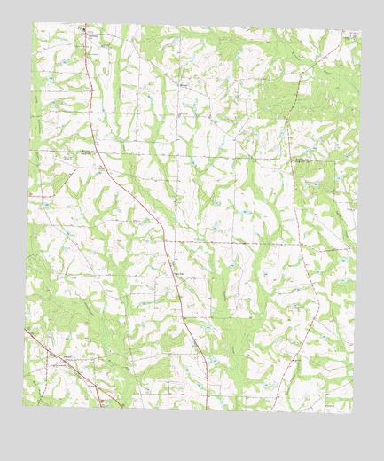
Sigsbee, GA USGS Topographic Map
Click on map above to begin viewing in our Map Viewer.

This topographic map contains these locations and features:
Feature Name Type Latitude Longitude GNIS ID View Map
Anderson CityPopulated PlaceN31.3716°W83.8546°310522View Map
Beadles LakeReservoirN31.3268°W83.7574°341892View Map
Beadles Lake DamDamN31.3269°W83.7566°341891View Map
Colquitt County Volunteer Firefighters Association Fire Station 32 New ElmBuildingN31.2929°W83.8195°2604069View Map
Elm School (historical)SchoolN31.2885°W83.8446°343955View Map
Hancock CemeteryCemeteryN31.2884°W83.8440°343969View Map
Harkan School (historical)SchoolN31.3052°W83.7713°343970View Map
Hour of Deliverance ChurchChurchN31.2966°W83.8663°343974View Map
Kimball CemeteryCemeteryN31.3680°W83.8491°349387View Map
Kimball ChurchChurchN31.3677°W83.8482°316416View Map
Live Oak CemeteryCemeteryN31.2621°W83.8349°343981View Map
Live Oak ChurchChurchN31.2630°W83.8349°317250View Map
MintonPopulated PlaceN31.3552°W83.8188°332403View Map
Minton SchoolSchoolN31.3732°W83.8552°318325View Map
New ElmPopulated PlaceN31.2938°W83.8191°332481View Map
New Elm ChurchChurchN31.2969°W83.8202°343997View Map
Oak Dale ChurchChurchN31.2669°W83.7730°319739View Map
Oak Ridge ChurchChurchN31.3732°W83.7543°319849View Map
Oak Ridge Plantation AirportAirportN31.3666°W83.7549°351923View Map
Okapilco School (historical)SchoolN31.3113°W83.8349°334646View Map
Old Minton School (historical)SchoolN31.3677°W83.8463°334761View Map
Providence ChurchChurchN31.3674°W83.8546°321188View Map
Rochelle ChurchChurchN31.2527°W83.7602°321705View Map
Rochelle School (historical)SchoolN31.2524°W83.7602°334647View Map
Rose of Sharon ChurchChurchN31.2632°W83.8632°321926View Map
Saint Pauls ChurchChurchN31.3163°W83.7516°322248View Map
SigsbeePopulated PlaceN31.2652°W83.8593°333049View Map
South Minton ChurchChurchN31.3460°W83.8185°323261View Map
South Minton School (historical)SchoolN31.3460°W83.8188°343339View Map
WALB-TV (Albany)TowerN31.3313°W83.8621°352831View Map
WFXL-TV (Albany)TowerN31.3313°W83.8618°352829View Map
Worth County Fire and Rescue Station 10BuildingN31.3715°W83.8551°2604751View Map
Wrights ChapelChurchN31.3724°W83.7541°325578View Map
Wrights Chapel CemeteryCemeteryN31.3718°W83.7538°349413View Map
Wrights Chapel Consolidated School (historical)SchoolN31.3724°W83.7543°343372View Map

Note: Coordinates in the location and feature list above are referenced to NAD83 datum.


Copyright (C) 2008-2025 Ryan Niemi / Sunset Dynamics ... All Rights Reserved