TopoQuest Logo
Do you find TopoQuest useful?
Help keep TopoQuest running and adding new maps/features by donating!
Bitcoin:  19c7KJd3qBynnjoSw5npx9KScwjBe4ifkT
Litecoin:  LXs6TkuXGGXo1vDsWCkWVdjQX94eUKd6ui
Home View Maps Find Maps Find Places Resources & Links


Norris NE, Montana Topographic Map

USGS Map Title: Norris NE, MT
USGS Map MRC: 45111F5
DRG (GeoTIFF) Download: o45111f5.tif


Neighboring USGS Topographic Map Quads:


  Willow Creek, MT  
45111G6
 

  Three Forks SE, MT  
45111G5
 

  Manhattan SW, MT  
45111G4
 

  Willow Creek Reservoir, MT  
45111F6
 

  Norris NE, MT  
45111F5
 

  Madison Plateau, MT  
45111F4
 

  Norris, MT  
45111E6
 

  Bear Trap Creek, MT  
45111E5
 

  Cherry Creek Canyon, MT  
45111E4


Map MRC Location:

N46°
W112°
N46°
W111°
H8 H7 H6 H5 H4 H3 H2 H1
G8 G7 G6 G5 G4 G3 G2 G1
F8 F7 F6 F5 F4 F3 F2 F1
E8 E7 E6 E5 E4 E3 E2 E1
D8 D7 D6 D5 D4 D3 D2 D1
C8 C7 C6 C5 C4 C3 C2 C1
B8 B7 B6 B5 B4 B3 B2 B1
A8 A7 A6 A5 A4 A3 A2 A1
N45°
W112°
N45°
W111°

Norris NE, MT USGS 1:24K Topographic Map Preview:
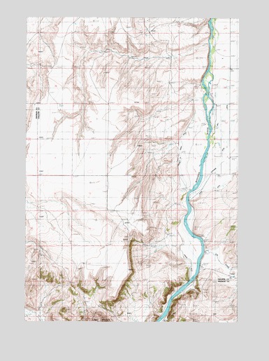
Norris NE, MT USGS Topographic Map
Click on map above to begin viewing in our Map Viewer.

This topographic map contains these locations and features:
Feature Name Type Latitude Longitude GNIS ID View Map
01S01E21BBBB01 WellWellN45.7433°W111.6183°811594View Map
01S01E22DBAA01 WellWellN45.7360°W111.5827°811540View Map
01S02E17DCAB01 SpringSpringN45.7472°W111.5022°811628View Map
01S02E20CACC01 WellWellN45.7333°W111.5105°811511View Map
01S02E20CBBA01 WellWellN45.7363°W111.5147°811544View Map
02S01E01AACB01 WellWellN45.6980°W111.5414°811217View Map
02S01E02BCCB01 WellWellN45.6938°W111.5769°811193View Map
02S02E05BAA_01 WellWellN45.6988°W111.5072°811237View Map
02S02E05BDBB01 WellWellN45.6960°W111.5102°811209View Map
02S02E05CAAD01 WellWellN45.6913°W111.5069°811177View Map
02S02E05CC__01 WellWellN45.6872°W111.5127°811127View Map
02S02E05CCC_01 WellWellN45.6872°W111.5136°811128View Map
02S02E05CDA_01 WellWellN45.6885°W111.5075°811153View Map
02S02E06BCCC01 WellWellN45.6933°W111.5358°811187View Map
02S02E18CDCD01 WellWellN45.6566°W111.5297°810869View Map
02S02E19BA__01 WellWellN45.6549°W111.5286°810858View Map
Black CemeteryCemeteryN45.6454°W111.5207°2674718View Map
Blacks FordCrossingN45.6876°W111.5203°2674719View Map
Blacks Ford Fishing Access SiteLocaleN45.6533°W111.5205°1744273View Map
Blacks Ranch (historical)LocaleN45.6472°W111.5230°1743901View Map
Blue Moon MineMineN45.6327°W111.5155°804548View Map
Dell DitchCanalN45.7097°W111.5097°770596View Map
Denike RanchLocaleN45.6930°W111.5364°770602View Map
Elk CreekStreamN45.6541°W111.5200°783062View Map
Elk Creek School (historical)SchoolN45.6485°W111.5869°1738060View Map
Greene Ranch DitchCanalN45.6735°W111.5319°771974View Map
Greycliff CampgroundLocaleN45.7052°W111.5147°1737968View Map
Greycliff Fishing Access SiteLocaleN45.7019°W111.5141°1744490View Map
HR and HM MineMineN45.6408°W111.5425°804148View Map
Hutchison DitchCanalN45.6966°W111.5083°772650View Map
Noble RanchLocaleN45.6649°W111.5366°774655View Map
Nobles DitchCanalN45.6549°W111.5352°774658View Map
NW NW Section 30 MineMineN45.6416°W111.5319°804494View Map
Red Mountain CampgroundLocaleN45.6277°W111.5452°1797674View Map

Note: Coordinates in the location and feature list above are referenced to NAD83 datum.


Copyright (C) 2008-2024 Ryan Niemi / Sunset Dynamics ... All Rights Reserved