TopoQuest Logo
Do you find TopoQuest useful?
Help keep TopoQuest running and adding new maps/features by donating!
Bitcoin:  19c7KJd3qBynnjoSw5npx9KScwjBe4ifkT
Litecoin:  LXs6TkuXGGXo1vDsWCkWVdjQX94eUKd6ui
Home View Maps Find Maps Find Places Resources & Links


Cedaredge, Colorado Topographic Map

USGS Map Title: Cedaredge, CO
USGS Map MRC: 38107H8
DRG (GeoTIFF) Download: o38107h8.tif


Neighboring USGS Topographic Map Quads:


  Mesa Lakes, CO  
39108A1
 

  Grand Mesa, CO  
39107A8
 

  Leon Peak, CO  
39107A7
 

  Hells Kitchen, CO  
38108H1
 

  Cedaredge, CO  
38107H8
 

  Dry Creek, CO  
38107H7
 

  North Delta, CO  
38108G1
 

  Orchard City, CO  
38107G8
 

  Lazear, CO  
38107G7


Map MRC Location:

N39°
W108°
N39°
W107°
H8 H7 H6 H5 H4 H3 H2 H1
G8 G7 G6 G5 G4 G3 G2 G1
F8 F7 F6 F5 F4 F3 F2 F1
E8 E7 E6 E5 E4 E3 E2 E1
D8 D7 D6 D5 D4 D3 D2 D1
C8 C7 C6 C5 C4 C3 C2 C1
B8 B7 B6 B5 B4 B3 B2 B1
A8 A7 A6 A5 A4 A3 A2 A1
N38°
W108°
N38°
W107°

Cedaredge, CO USGS 1:24K Topographic Map Preview:
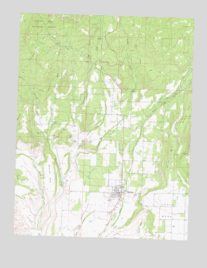
Cedaredge, CO USGS Topographic Map
Click on map above to begin viewing in our Map Viewer.

This topographic map contains these locations and features:
Feature Name Type Latitude Longitude GNIS ID View Map
Big DitchCanalN38.9591°W107.9373°186262View Map
Black Diamond MineMineN38.9328°W107.9817°186252View Map
Bluenose MesaSummitN38.9211°W107.9795°186247View Map
Brimstone CornerPopulated PlaceN38.9380°W107.9753°186256View Map
Cedar MesaSummitN38.9011°W107.8870°186250View Map
Cedar Mesa DitchCanalN38.9344°W107.8859°203207View Map
Cedar Run DitchCanalN38.8766°W107.9323°186249View Map
CedaredgePopulated PlaceN38.9016°W107.9265°186245View Map
Cedaredge CemeteryCemeteryN38.8905°W107.9277°2045050View Map
Cedaredge DivisionCivilN38.9384°W107.9621°1935419View Map
Cedaredge Police DepartmentBuildingN38.9015°W107.9252°2757261View Map
Cedaredge Post OfficePost OfficeN38.9001°W107.9251°2759182View Map
Childs DitchCanalN38.9089°W107.9481°186246View Map
Coalby Mine Number TwoMineN38.9222°W107.9756°1745524View Map
ColbyPopulated PlaceN38.9316°W107.9753°186253View Map
Colby MineMineN38.9325°W107.9840°186251View Map
Cottonwood CreekStreamN38.9291°W107.9540°175229View Map
Delta County Fire Protection District 3 Cedaredge Fire DepartmentBuildingN38.8991°W107.9251°2667111View Map
Dirty George CreekStreamN38.8764°W107.9828°185291View Map
Green Valley MineMineN38.9344°W107.9540°186261View Map
Horse CreekStreamN38.9600°W107.9162°175231View Map
Ideal Number One MineMineN38.9283°W107.9634°1745525View Map
Ideal Number Three MineMineN38.9333°W107.9623°1745527View Map
Ideal Number Two MineMineN38.9314°W107.9631°1745526View Map
Independence MineMineN38.9314°W107.9634°186254View Map
Kiser CreekStreamN38.9039°W107.9662°175230View Map
Lambert PitMineN38.9839°W107.9790°1745548View Map
Lone Pine DitchCanalN38.9214°W107.8901°186244View Map
McGruder MineMineN38.9239°W107.8809°186263View Map
Mesa DitchCanalN38.9019°W107.8828°186243View Map
Mesawood AirparkAirportN38.9614°W107.9585°2443903View Map
Milk CreekStreamN38.9447°W107.9056°175360View Map
Morning Star MineMineN38.9289°W107.9576°186258View Map
Red Canyon MineMineN38.9350°W107.9678°186255View Map
States MineMineN38.9289°W107.9517°186259View Map
Top MineMineN38.9286°W107.9478°186260View Map
Town of CedaredgeCivilN38.8941°W107.9255°2413184View Map
Ward CreekStreamN38.8764°W107.9828°175232View Map
Williams CreekStreamN38.9325°W107.9790°186257View Map
Youngs CreekStreamN38.9228°W107.9548°175233View Map

Note: Coordinates in the location and feature list above are referenced to NAD83 datum.


Copyright (C) 2008-2024 Ryan Niemi / Sunset Dynamics ... All Rights Reserved