TopoQuest Logo
Do you find TopoQuest useful?
Help keep TopoQuest running and adding new maps/features by donating!
Bitcoin:  19c7KJd3qBynnjoSw5npx9KScwjBe4ifkT
Litecoin:  LXs6TkuXGGXo1vDsWCkWVdjQX94eUKd6ui
Home View Maps Find Maps Find Places Resources & Links


Northwest Pontotoc, Mississippi Topographic Map

USGS Map Title: Northwest Pontotoc, MS
USGS Map MRC: 34089C1
DRG (GeoTIFF) Download: o34089c1.tif


Neighboring USGS Topographic Map Quads:


  Etta, MS  
34089D2
 

  New Albany West, MS  
34089D1
 

  New Albany East, MS  
34088D8
 

  Thaxton, MS  
34089C2
 

  Northwest Pontotoc, MS  
34089C1
 

  Northeast Pontotoc, MS  
34088C8
 

  Randolph, MS  
34089B2
 

  Southwest Pontotoc, MS  
34089B1
 

  Southeast Pontotoc, MS  
34088B8


Map MRC Location:

N35°
W90°
N35°
W89°
H8 H7 H6 H5 H4 H3 H2 H1
G8 G7 G6 G5 G4 G3 G2 G1
F8 F7 F6 F5 F4 F3 F2 F1
E8 E7 E6 E5 E4 E3 E2 E1
D8 D7 D6 D5 D4 D3 D2 D1
C8 C7 C6 C5 C4 C3 C2 C1
B8 B7 B6 B5 B4 B3 B2 B1
A8 A7 A6 A5 A4 A3 A2 A1
N34°
W90°
N34°
W89°

Northwest Pontotoc, MS USGS 1:24K Topographic Map Preview:
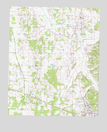
Northwest Pontotoc, MS USGS Topographic Map
Click on map above to begin viewing in our Map Viewer.

This topographic map contains these locations and features:
Feature Name Type Latitude Longitude GNIS ID View Map
Allen BranchStreamN34.3409°W89.0003°666199View Map
Babb CemeteryCemeteryN34.3362°W89.0376°684695View Map
Baptist Female College (historical)SchoolN34.2520°W89.0009°706848View Map
Bethany ChurchChurchN34.3651°W89.1098°666873View Map
Bethlehem ChurchChurchN34.2995°W89.0870°684696View Map
Beulah Grove ChurchChurchN34.3034°W89.0537°684697View Map
Beulah Grove SchoolSchoolN34.2920°W89.0517°667056View Map
Boyce Monohan Pond DamDamN34.3268°W89.1051°682582View Map
BuchannanPopulated PlaceN34.3390°W89.0995°691734View Map
Buchannan Missionary Baptist ChurchChurchN34.3398°W89.1026°706851View Map
Byrds CreekStreamN34.3579°W89.0720°667892View Map
Cherry CreekStreamN34.3387°W89.0267°668367View Map
City of PontotocCivilN34.2531°W89.0091°2404549View Map
EcruPopulated PlaceN34.3532°W89.0231°669661View Map
Ecru Baptist ChurchChurchN34.3504°W89.0242°706872View Map
Ecru Male and Female Institute (historical)SchoolN34.3562°W89.0242°706873View Map
Ecru Police DepartmentBuildingN34.3503°W89.0307°2754228View Map
Ecru Post OfficePost OfficeN34.3512°W89.0296°2768566View Map
Ecru Second Missionary Baptist ChurchChurchN34.3559°W89.0242°706874View Map
Ecru United Methodist ChurchChurchN34.3529°W89.0237°706875View Map
Ecru Volunteer Fire DepartmentBuildingN34.3506°W89.0310°2665691View Map
FriendshipPopulated PlaceN34.3240°W89.0376°670207View Map
Friendship Missionary Baptist ChurchChurchN34.3215°W89.0403°706878View Map
Gates SchoolSchoolN34.3662°W89.0395°670334View Map
Horton Memorial ChurchChurchN34.3495°W89.0728°684708View Map
HortontownPopulated PlaceN34.3520°W89.0790°671510View Map
Johns CreekStreamN34.3387°W89.0562°671910View Map
Judon Line SchoolSchoolN34.3659°W89.0126°672047View Map
Lyon CreekStreamN34.3051°W89.0223°672973View Map
McDonald United Methodist ChurchChurchN34.2557°W89.0056°684714View Map
McGregor ChapelChurchN34.2729°W89.0934°673365View Map
Merle Palmer Lake DamDamN34.2901°W89.0917°682557View Map
North JunctionPopulated PlaceN34.2570°W89.0153°674950View Map
North Pontotoc Attendance CenterSchoolN34.3640°W89.0270°684721View Map
Piny Grove ChurchChurchN34.2604°W89.0792°684723View Map
Pontotoc County AirportAirportN34.2734°W89.0341°680425View Map
Pontotoc Post OfficePost OfficeN34.2641°W89.0202°2768704View Map
Pontotoc Ridge Vocational Technical SchoolSchoolN34.2554°W89.0231°706913View Map
Pontotoc Second Baptist ChurchChurchN34.2559°W89.0048°706914View Map
Possum TrotPopulated PlaceN34.3023°W89.0845°676271View Map
Rocky FordPopulated PlaceN34.3709°W89.1134°706921View Map
Saint Paul ChurchChurchN34.3659°W89.0381°677204View Map
Shady GrovePopulated PlaceN34.3745°W89.1056°706923View Map
Shady Grove CemeteryCemeteryN34.3743°W89.1056°684726View Map
Shady Grove ChurchChurchN34.3748°W89.1051°684727View Map
Shady Grove School (historical)SchoolN34.3745°W89.1045°706924View Map
Town of EcruCivilN34.3550°W89.0222°2406421View Map
TurnpikePopulated PlaceN34.2898°W89.1234°706942View Map
Turnpike ChurchChurchN34.2896°W89.1228°678981View Map
Turnpike SchoolSchoolN34.2823°W89.0903°678983View Map
Victoria (historical)LocaleN34.2640°W89.0181°706944View Map
Wardlow CemeteryCemeteryN34.2643°W89.0884°684729View Map
Wardlow SchoolSchoolN34.2629°W89.0873°679338View Map
Weatherall CemeteryCemeteryN34.2837°W89.0356°684730View Map
West Heights ChurchChurchN34.2507°W89.0198°684731View Map

Note: Coordinates in the location and feature list above are referenced to NAD83 datum.


Copyright (C) 2008-2025 Ryan Niemi / Sunset Dynamics ... All Rights Reserved