TopoQuest Logo
Do you find TopoQuest useful?
Help keep TopoQuest running and adding new maps/features by donating!
Bitcoin:  19c7KJd3qBynnjoSw5npx9KScwjBe4ifkT
Litecoin:  LXs6TkuXGGXo1vDsWCkWVdjQX94eUKd6ui
Home View Maps Find Maps Find Places Resources & Links


Norwich, Ohio Topographic Map

USGS Map Title: Norwich, OH
USGS Map MRC: 39081H7
DRG (GeoTIFF) Download: o39081h7.tif


Neighboring USGS Topographic Map Quads:


  Adamsville, OH  
40081A8
 

  Otsego, OH  
40081A7
 

  Bloomfield, OH  
40081A6
 

  Zanesville East, OH  
39081H8
 

  Norwich, OH  
39081H7
 

  New Concord, OH  
39081H6
 

  Philo, OH  
39081G8
 

  Ruraldale, OH  
39081G7
 

  Cumberland, OH  
39081G6


Map MRC Location:

N40°
W82°
N40°
W81°
H8 H7 H6 H5 H4 H3 H2 H1
G8 G7 G6 G5 G4 G3 G2 G1
F8 F7 F6 F5 F4 F3 F2 F1
E8 E7 E6 E5 E4 E3 E2 E1
D8 D7 D6 D5 D4 D3 D2 D1
C8 C7 C6 C5 C4 C3 C2 C1
B8 B7 B6 B5 B4 B3 B2 B1
A8 A7 A6 A5 A4 A3 A2 A1
N39°
W82°
N39°
W81°

Norwich, OH USGS 1:24K Topographic Map Preview:
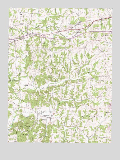
Norwich, OH USGS Topographic Map
Click on map above to begin viewing in our Map Viewer.

This topographic map contains these locations and features:
Feature Name Type Latitude Longitude GNIS ID View Map
Bakers PondReservoirN39.9742°W81.8199°1077708View Map
Bakers Pond DamDamN39.9751°W81.8182°1077707View Map
BridgevillePopulated PlaceN39.9695°W81.8676°1056228View Map
Bridgeville Post Office (historical)Post OfficeN39.9695°W81.8679°2041189View Map
Buck RunStreamN39.9923°W81.7518°1054547View Map
Buffalo ForkStreamN39.8970°W81.8671°1038494View Map
Chandersville Post OfficePost OfficeN39.8987°W81.8276°2039689View Map
ChandlersvillePopulated PlaceN39.8984°W81.8274°1056788View Map
Chandlersville CemeteryCemeteryN39.8962°W81.8285°1038981View Map
Chandlersville Presbyterian ChurchChurchN39.8976°W81.8232°1069045View Map
Chandlersville School (historical)SchoolN39.8992°W81.8293°1069046View Map
Chandlersville United Methodist ChurchChurchN39.8978°W81.8243°1069044View Map
Coon RidgeRidgeN39.8820°W81.8649°1039347View Map
Derry Landing Strip Airport (historical)AirportN39.9947°W81.8641°1083020View Map
Forestdale School (historical)SchoolN39.9576°W81.7737°1054600View Map
Franklin School (historical)SchoolN39.9265°W81.8332°1054588View Map
FreelandPopulated PlaceN39.8812°W81.7754°1064685View Map
Freeland Post Office (historical)Post OfficeN39.8806°W81.7749°2039672View Map
Frog RunStreamN39.9740°W81.8471°1040705View Map
Georges RunStreamN39.9828°W81.8399°1066724View Map
Green Valley School (historical)SchoolN39.9148°W81.7860°1054597View Map
Interchange 164CrossingN39.9740°W81.8337°1054592View Map
Lawton (historical)Populated PlaceN39.8920°W81.8712°1054587View Map
Lawton Post Office (historical)Post OfficeN39.8917°W81.8707°2039684View Map
Lepage RunStreamN39.8998°W81.8249°1042494View Map
Little Salt CreekStreamN39.9301°W81.8715°1042636View Map
National Road MuseumBuildingN39.9770°W81.8232°1054596View Map
NorwichPopulated PlaceN39.9851°W81.7915°1056459View Map
Norwich Methodist CemeteryCemeteryN39.9862°W81.7926°1964178View Map
Norwich Post OfficePost OfficeN39.9848°W81.7915°2039686View Map
Norwich School (historical)SchoolN39.9870°W81.7907°1069065View Map
Norwich United Presbyterian CemeteryCemeteryN39.9826°W81.7962°1964179View Map
Perry Elementary SchoolSchoolN39.9717°W81.8593°1081764View Map
Pike School (historical)SchoolN39.9740°W81.8387°1054591View Map
Pleasant RunStreamN39.9253°W81.8407°1044578View Map
Pleasant Valley School (historical)SchoolN39.9392°W81.8415°1054589View Map
Rich Hill (historical)Populated PlaceN39.9092°W81.7518°1067306View Map
Rich Hill CemeteryCemeteryN39.9037°W81.7568°1044972View Map
Rich Hill Church (historical)ChurchN39.9098°W81.7518°1054599View Map
Rich Hill Post Office (historical)Post OfficeN39.9098°W81.7512°2039715View Map
Rock Spring CemeteryCemeteryN39.9273°W81.8071°1964190View Map
Salt Creek Baptist ChurchChurchN39.9328°W81.8707°1070932View Map
Salt Creek BridgeBridgeN39.9992°W81.8401°1054594View Map
Salt Creek CemeteryCemeteryN39.9056°W81.7671°1045911View Map
Salt Creek CemeteryCemeteryN39.9317°W81.8735°1045912View Map
Salt Creek Church (historical)ChurchN39.9059°W81.7668°1054598View Map
Seawright (historical)Populated PlaceN39.8987°W81.8521°1068258View Map
Shuck School (historical)SchoolN39.9948°W81.8468°1054593View Map
Smith (historical)Populated PlaceN39.8892°W81.8032°1068259View Map
Smith MillPopulated PlaceN39.9276°W81.8551°1063022View Map
Spry School (historical)SchoolN39.9592°W81.8660°1054590View Map
Sun Dale Post Office (historical)Post OfficeN39.9778°W81.7915°2041203View Map
SundalePopulated PlaceN39.9773°W81.7915°1061664View Map
Township of PerryCivilN39.9740°W81.8676°1086730View Map
Township of Salt CreekCivilN39.8948°W81.8508°1086733View Map
Township of UnionCivilN39.9705°W81.7735°1086735View Map
Village of NorwichCivilN39.9843°W81.7924°2399529View Map
West Union School (historical)SchoolN39.9490°W81.7996°1054595View Map
White Eyes CreekStreamN39.9178°W81.8643°1067053View Map
Williams ForkStreamN39.9040°W81.8279°1067058View Map

Note: Coordinates in the location and feature list above are referenced to NAD83 datum.


Copyright (C) 2008-2025 Ryan Niemi / Sunset Dynamics ... All Rights Reserved