TopoQuest Logo
Do you find TopoQuest useful?
Help keep TopoQuest running and adding new maps/features by donating!
Bitcoin:  19c7KJd3qBynnjoSw5npx9KScwjBe4ifkT
Litecoin:  LXs6TkuXGGXo1vDsWCkWVdjQX94eUKd6ui
Home View Maps Find Maps Find Places Resources & Links


Otsego, Ohio Topographic Map

USGS Map Title: Otsego, OH
USGS Map MRC: 40081A7
DRG (GeoTIFF) Download: o40081a7.tif


Neighboring USGS Topographic Map Quads:


  Conesville, OH  
40081B8
 

  Wills Creek, OH  
40081B7
 

  Plainfield, OH  
40081B6
 

  Adamsville, OH  
40081A8
 

  Otsego, OH  
40081A7
 

  Bloomfield, OH  
40081A6
 

  Zanesville East, OH  
39081H8
 

  Norwich, OH  
39081H7
 

  New Concord, OH  
39081H6


Map MRC Location:

N41°
W82°
N41°
W81°
H8 H7 H6 H5 H4 H3 H2 H1
G8 G7 G6 G5 G4 G3 G2 G1
F8 F7 F6 F5 F4 F3 F2 F1
E8 E7 E6 E5 E4 E3 E2 E1
D8 D7 D6 D5 D4 D3 D2 D1
C8 C7 C6 C5 C4 C3 C2 C1
B8 B7 B6 B5 B4 B3 B2 B1
A8 A7 A6 A5 A4 A3 A2 A1
N40°
W82°
N40°
W81°

Otsego, OH USGS 1:24K Topographic Map Preview:
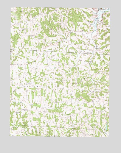
Otsego, OH USGS Topographic Map
Click on map above to begin viewing in our Map Viewer.

This topographic map contains these locations and features:
Feature Name Type Latitude Longitude GNIS ID View Map
Anderson School (historical)SchoolN40.0459°W81.7951°1054545View Map
Barnett School (historical)SchoolN40.0737°W81.7885°1054544View Map
Bethel Methodist CemeteryCemeteryN40.0370°W81.7985°1964156View Map
Bethel Methodist ChurchChurchN40.0367°W81.7962°1070677View Map
Brush RunStreamN40.0992°W81.7726°1038420View Map
Buker School (historical)SchoolN40.1015°W81.7885°1054543View Map
Burnt Mill School (historical)SchoolN40.0637°W81.8426°1054540View Map
Carr CemeteryCemeteryN40.0015°W81.8276°1964161View Map
Drummond KnobSummitN40.0231°W81.8682°1066683View Map
Fairview CemeteryCemeteryN40.0976°W81.8476°1054541View Map
Fairview Methodist ChurchChurchN40.0976°W81.8465°1070744View Map
Ferncliff (historical)Populated PlaceN40.1192°W81.8324°1054542View Map
Ferncliff Post Office (historical)Post OfficeN40.1195°W81.8318°2039701View Map
Highland OrchardLocaleN40.0436°W81.7519°2544524View Map
Jamison School (historical)SchoolN40.0220°W81.7946°1054546View Map
Milligan School (historical)SchoolN40.0245°W81.8424°1054539View Map
Monroe Rural High and Grade School (historical)SchoolN40.1178°W81.7660°1069061View Map
New Concord Village ReservoirReservoirN40.0096°W81.7533°1077712View Map
New Concord Village Reservoir DamDamN40.0067°W81.7532°1077711View Map
New Hope Lutheran CemeteryCemeteryN40.0698°W81.8518°1964177View Map
New Hope Lutheran ChurchChurchN40.0706°W81.8518°1070867View Map
OtsegoPopulated PlaceN40.1215°W81.7649°1049044View Map
Otsego Baptist ChurchChurchN40.1234°W81.7612°1069066View Map
Otsego Methodist CemeteryCemeteryN40.1242°W81.7635°1964184View Map
Otsego Methodist ChurchChurchN40.1242°W81.7632°1069067View Map
Otsego Post Office (historical)Post OfficeN40.1223°W81.7651°2041212View Map
Prairie ForkStreamN40.0317°W81.8649°1066910View Map
Richardson CemeteryCemeteryN40.1123°W81.7632°1964189View Map
Salem CemeteryCemeteryN40.0253°W81.8548°1054538View Map
Salem Methodist ChurchChurchN40.0259°W81.8557°1070930View Map
Township of AdamsCivilN40.1203°W81.8592°1086713View Map
Township of HighlandCivilN40.0440°W81.7691°1086720View Map
Township of MonroeCivilN40.1173°W81.7648°1086727View Map
Township of SalemCivilN40.0475°W81.8631°1086732View Map
Yearys OrchardLocaleN40.1172°W81.8717°2544543View Map
Young American School (historical)SchoolN40.1017°W81.8374°1071028View Map

Note: Coordinates in the location and feature list above are referenced to NAD83 datum.


Copyright (C) 2008-2024 Ryan Niemi / Sunset Dynamics ... All Rights Reserved