TopoQuest Logo
Do you find TopoQuest useful?
Help keep TopoQuest running and adding new maps/features by donating!
Bitcoin:  19c7KJd3qBynnjoSw5npx9KScwjBe4ifkT
Litecoin:  LXs6TkuXGGXo1vDsWCkWVdjQX94eUKd6ui
Home View Maps Find Maps Find Places Resources & Links


Noti, Oregon Topographic Map

USGS Map Title: Noti, OR
USGS Map MRC: 44123A4
DRG (GeoTIFF) Download: o44123a4.tif


Neighboring USGS Topographic Map Quads:


  Triangle Lake, OR  
44123B5
 

  Horton, OR  
44123B4
 

  Cheshire, OR  
44123B3
 

  Walton, OR  
44123A5
 

  Noti, OR  
44123A4
 

  Veneta, OR  
44123A3
 

  Clay Creek, OR  
43123H5
 

  High Point, OR  
43123H4
 

  Crow, OR  
43123H3


Map MRC Location:

N45°
W124°
N45°
W123°
H8 H7 H6 H5 H4 H3 H2 H1
G8 G7 G6 G5 G4 G3 G2 G1
F8 F7 F6 F5 F4 F3 F2 F1
E8 E7 E6 E5 E4 E3 E2 E1
D8 D7 D6 D5 D4 D3 D2 D1
C8 C7 C6 C5 C4 C3 C2 C1
B8 B7 B6 B5 B4 B3 B2 B1
A8 A7 A6 A5 A4 A3 A2 A1
N44°
W124°
N44°
W123°

Noti, OR USGS 1:24K Topographic Map Preview:
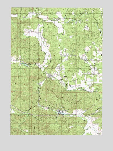
Noti, OR USGS Topographic Map
Click on map above to begin viewing in our Map Viewer.

This topographic map contains these locations and features:
Feature Name Type Latitude Longitude GNIS ID View Map
Badger Mountain DivisionCivilN44.0593°W123.4303°1937959View Map
Berkley Post Office (historical)Post OfficeN44.0665°W123.4345°1164909View Map
Camp WilaniLocaleN44.0362°W123.3809°1135136View Map
Capps (historical)LocaleN44.0512°W123.4618°1166296View Map
Cedar CreekStreamN44.0090°W123.3926°1118738View Map
Clay HillSummitN44.0988°W123.3905°1135138View Map
Cram CreekStreamN44.0226°W123.4387°1130717View Map
Crow-Mag AirportAirportN44.0632°W123.3921°1131410View Map
Determination CreekStreamN44.1037°W123.3784°1135135View Map
Elk CreekStreamN44.0668°W123.4568°1120447View Map
ElrusLocaleN44.0523°W123.4215°1136260View Map
Evans CreekStreamN44.0921°W123.4609°1130706View Map
Flagg (historical)LocaleN44.0251°W123.4995°1136291View Map
Forcia and Larsen DamDamN44.0682°W123.4779°1131305View Map
Forcia and Larsen ReservoirReservoirN44.0682°W123.4799°1131306View Map
Gold Run CreekStreamN44.0773°W123.4318°1130710View Map
Green CreekStreamN44.0957°W123.4318°1130704View Map
Green MountainRidgeN44.0340°W123.4229°1135142View Map
Hale (historical)LocaleN44.0712°W123.4865°1130708View Map
Hale Post Office (historical)Post OfficeN44.0712°W123.4865°1165358View Map
Hardy CreekStreamN44.0218°W123.4376°1121598View Map
Hayes CreekStreamN44.1171°W123.4632°1121699View Map
Hendricks BranchStreamN44.1076°W123.4290°1130657View Map
Hoselton CreekStreamN44.0207°W123.4248°1133155View Map
Ivison (historical)LocaleN44.0212°W123.4804°1166302View Map
Ivison Post Office (historical)Post OfficeN44.0165°W123.4845°1164436View Map
January CreekStreamN44.0973°W123.4890°1122386View Map
Jones CreekStreamN44.0971°W123.4618°1130705View Map
Lane County Fire District 1 Station 103BuildingN44.1169°W123.4065°2577001View Map
Lane County Fire District 1 Station 104BuildingN44.0595°W123.4465°2576763View Map
Langworthy CreekStreamN44.0235°W123.4429°1130716View Map
Little Hahnee ReservoirReservoirN44.0451°W123.3818°1130712View Map
Long TomLocaleN44.0496°W123.3895°1136498View Map
Long Tom Post Office (historical)Post OfficeN44.0496°W123.3895°1165560View Map
Mill Valley CreekStreamN44.0676°W123.4665°1130709View Map
Noel CreekStreamN44.0087°W123.3926°1124704View Map
NotiPopulated PlaceN44.0590°W123.4487°1136585View Map
Noti CreekStreamN44.0540°W123.4401°1124861View Map
Noti Creek ReservoirReservoirN44.0213°W123.4313°1131041View Map
Noti Post OfficePost OfficeN44.0579°W123.4481°1165719View Map
Oregon Country FairgroundsLocaleN44.0605°W123.3761°2661507View Map
Orth (historical)LocaleN44.0262°W123.4623°1166307View Map
Parsley CreekStreamN44.0246°W123.4509°1130715View Map
Poodle CreekStreamN44.0554°W123.4501°1125554View Map
Sailor (historical)LocaleN44.0510°W123.4320°1136721View Map
Sailor Pioneer - Noti CemeteryCemeteryN44.0569°W123.4298°1130897View Map
Spring CreekStreamN44.0212°W123.4273°1130718View Map
Star CampLocaleN44.0693°W123.4776°1135140View Map
Stephens S S Heirs CemeteryCemeteryN44.0016°W123.3782°1130719View Map
Stoney PointSummitN44.1090°W123.4888°1135139View Map
Sweet CreekStreamN44.1082°W123.4329°1130668View Map
Varien Post Office (historical)Post OfficeN44.1012°W123.4582°1166097View Map
VaughnPopulated PlaceN44.0237°W123.4370°1136864View Map
Vaughn Log DamDamN44.0215°W123.4362°1133699View Map
Vaughn StationLocaleN44.0276°W123.4540°1130714View Map
Warden CreekStreamN44.0187°W123.4782°1135143View Map
Wilson CreekStreamN44.0454°W123.3970°1130711View Map

Note: Coordinates in the location and feature list above are referenced to NAD83 datum.


Copyright (C) 2008-2024 Ryan Niemi / Sunset Dynamics ... All Rights Reserved