TopoQuest Logo
Do you find TopoQuest useful?
Help keep TopoQuest running and adding new maps/features by donating!
Bitcoin:  19c7KJd3qBynnjoSw5npx9KScwjBe4ifkT
Litecoin:  LXs6TkuXGGXo1vDsWCkWVdjQX94eUKd6ui
Home View Maps Find Maps Find Places Resources & Links


O'Brien, Oregon Topographic Map

USGS Map Title: O'Brien, OR
USGS Map MRC: 42123A6
DRG (GeoTIFF) Download: o42123a6.tif


Neighboring USGS Topographic Map Quads:


  Josephine Mountain, OR  
42123B7
 

  Cave Junction, OR  
42123B6
 

  Holland, OR  
42123B5
 

  Buckskin Peak, OR  
42123A7
 

  O'Brien, OR  
42123A6
 

  Takilma, OR  
42123A5
 

  Shelly Creek Ridge, CA  
41123H7
 

  Broken Rib Mountain, CA  
41123H6
 

  Polar Bear Mountain, CA  
41123H5


Map MRC Location:

N43°
W124°
N43°
W123°
H8 H7 H6 H5 H4 H3 H2 H1
G8 G7 G6 G5 G4 G3 G2 G1
F8 F7 F6 F5 F4 F3 F2 F1
E8 E7 E6 E5 E4 E3 E2 E1
D8 D7 D6 D5 D4 D3 D2 D1
C8 C7 C6 C5 C4 C3 C2 C1
B8 B7 B6 B5 B4 B3 B2 B1
A8 A7 A6 A5 A4 A3 A2 A1
N42°
W124°
N42°
W123°

O'Brien, OR USGS 1:24K Topographic Map Preview:
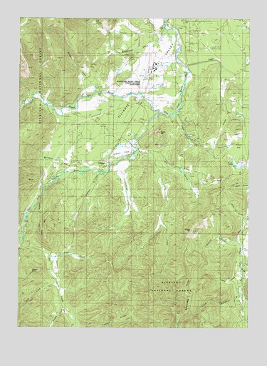
O'Brien, OR USGS Topographic Map
Click on map above to begin viewing in our Map Viewer.

This topographic map contains these locations and features:
Feature Name Type Latitude Longitude GNIS ID View Map
Allen GulchValleyN42.0451°W123.6295°1137148View Map
Allentown (historical)Populated PlaceN42.0443°W123.6262°1154574View Map
Bearcamp RidgeRidgeN42.0190°W123.6590°1137781View Map
Blue CreekStreamN42.0171°W123.7295°254632View Map
Brown City (historical)Populated PlaceN42.0137°W123.6276°1154575View Map
Butcher GulchValleyN42.0665°W123.6651°1154585View Map
Cedar GulchValleyN42.0209°W123.6331°1139520View Map
Deering Post Office (historical)Post OfficeN42.0157°W123.7259°1164307View Map
Dwight CreekStreamN42.0090°W123.7256°1141451View Map
Elk CreekStreamN42.0340°W123.7498°266685View Map
Elk ValleyValleyN42.0001°W123.7184°266687View Map
Esterly LakesLakeN42.0659°W123.6323°1141898View Map
Esterly MineMineN42.0784°W123.6348°1141899View Map
French FlatFlatN42.0743°W123.6337°1142466View Map
Fry GulchValleyN42.0701°W123.6767°1142514View Map
Gateway State Wayside (historical)ParkN42.0054°W123.7234°1890966View Map
Gilligan ButteSummitN42.0226°W123.7448°1142735View Map
Gilligan CreekStreamN42.0287°W123.7340°1142736View Map
Grannys RunStreamN42.0632°W123.7092°1142936View Map
Hope SpringSpringN42.0651°W123.6817°1154586View Map
Illinois Valley AirportAirportN42.1041°W123.6811°1162602View Map
Illinois Valley Fire District Old Station 3BuildingN42.0675°W123.7035°2576684View Map
Illinois Valley Fire District Station 3BuildingN42.0675°W123.7041°2576683View Map
Indian HillSummitN42.0786°W123.6751°1144061View Map
Leuizenger CreekStreamN42.0682°W123.6920°1144958View Map
Little Rock CreekStreamN42.0565°W123.7367°1145236View Map
Logan CutStreamN42.1057°W123.6612°1145338View Map
Lone MountainSummitN42.0369°W123.7370°1145351View Map
Long GulchValleyN42.0109°W123.6326°1145404View Map
Mendenhall CreekStreamN42.1212°W123.6728°1146096View Map
O'BrienPopulated PlaceN42.0673°W123.7031°1147100View Map
O'Brien Census Designated PlaceCensusN42.0701°W123.7077°2611772View Map
O'Brien CreekStreamN42.0701°W123.6889°1154587View Map
O'Brien Post OfficePost OfficeN42.0670°W123.7037°1165723View Map
Page CreekStreamN42.0321°W123.6298°1147350View Map
Parker CreekStreamN42.0948°W123.7070°1147444View Map
Rock CreekStreamN42.0362°W123.7487°1148587View Map
Rough and Ready CreekStreamN42.0873°W123.6748°1148744View Map
Rough and Ready Log PondReservoirN42.1048°W123.6762°1155652View Map
Rough and Ready Lumber Biomass ProductionLocaleN42.1043°W123.6771°2697280View Map
Rough and Ready Mill Pond DamLakeN42.1045°W123.6760°1155651View Map
Rough and Ready State ParkParkN42.0968°W123.6828°1148745View Map
Scotch GulchValleyN42.0346°W123.6348°1149165View Map
Seats DamDamN42.0945°W123.7064°1149199View Map
Siskiyou Aerial Project ComplexLocaleN42.1051°W123.6778°1638101View Map
Skag CreekStreamN42.0254°W123.6303°1149576View Map
Studhorse CreekStreamN42.0359°W123.6553°1154582View Map
Trapper GulchValleyN42.0007°W123.7173°1151395View Map
WaldoLocaleN42.0609°W123.6481°1151815View Map
Waldo HillSummitN42.0382°W123.6580°1151817View Map
Waldo Post Office (historical)Post OfficeN42.0609°W123.6481°1166114View Map
Wood CreekStreamN42.0718°W123.6873°1152619View Map

Note: Coordinates in the location and feature list above are referenced to NAD83 datum.


Copyright (C) 2008-2024 Ryan Niemi / Sunset Dynamics ... All Rights Reserved