TopoQuest Logo
Do you find TopoQuest useful?
Help keep TopoQuest running and adding new maps/features by donating!
Bitcoin:  19c7KJd3qBynnjoSw5npx9KScwjBe4ifkT
Litecoin:  LXs6TkuXGGXo1vDsWCkWVdjQX94eUKd6ui
Home View Maps Find Maps Find Places Resources & Links


Holland, Oregon Topographic Map

USGS Map Title: Holland, OR
USGS Map MRC: 42123B5
DRG (GeoTIFF) Download: o42123b5.tif


Neighboring USGS Topographic Map Quads:


  Eight Dollar Mountain, OR  
42123C6
 

  Selma, OR  
42123C5
 

  Murphy Mountain, OR  
42123C4
 

  Cave Junction, OR  
42123B6
 

  Holland, OR  
42123B5
 

  Kerby Peak, OR  
42123B4
 

  O'Brien, OR  
42123A6
 

  Takilma, OR  
42123A5
 

  Oregon Caves, OR  
42123A4


Map MRC Location:

N43°
W124°
N43°
W123°
H8 H7 H6 H5 H4 H3 H2 H1
G8 G7 G6 G5 G4 G3 G2 G1
F8 F7 F6 F5 F4 F3 F2 F1
E8 E7 E6 E5 E4 E3 E2 E1
D8 D7 D6 D5 D4 D3 D2 D1
C8 C7 C6 C5 C4 C3 C2 C1
B8 B7 B6 B5 B4 B3 B2 B1
A8 A7 A6 A5 A4 A3 A2 A1
N42°
W124°
N42°
W123°

Holland, OR USGS 1:24K Topographic Map Preview:
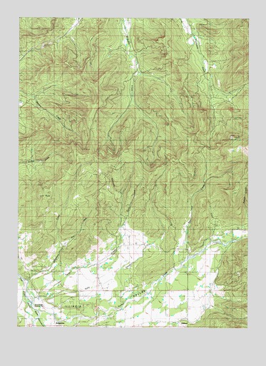
Holland, OR USGS Topographic Map
Click on map above to begin viewing in our Map Viewer.

This topographic map contains these locations and features:
Feature Name Type Latitude Longitude GNIS ID View Map
Aloysius Post Office (historical)Post OfficeN42.1359°W123.5526°1164826View Map
Althouse (historical)Populated PlaceN42.1262°W123.5776°1154569View Map
Althouse CreekStreamN42.1290°W123.6159°1137178View Map
Althouse Post Office (historical)Post OfficeN42.1262°W123.5776°1164832View Map
B Bar Ranch AirportAirportN42.2472°W123.5688°2646008View Map
Bear CreekStreamN42.1540°W123.5323°1137648View Map
BridgeviewPopulated PlaceN42.1259°W123.6059°1138625View Map
Brown SloughStreamN42.1457°W123.5790°1154536View Map
Chapman CreekStreamN42.1437°W123.6215°1139567View Map
Cove CreekStreamN42.1604°W123.5165°1140261View Map
East Fork Chapman CreekStreamN42.1568°W123.6042°1141543View Map
Fort Briggs (historical)LocaleN42.1332°W123.6148°1160665View Map
Green GulchValleyN42.1665°W123.5345°1154568View Map
Haven CreekStreamN42.2248°W123.5234°1155076View Map
HollandPopulated PlaceN42.1276°W123.5390°1143665View Map
Holland Post Office (historical)Post OfficeN42.1276°W123.5390°1165402View Map
Horse SpringSpringN42.1415°W123.6151°1154603View Map
Kelly CreekStreamN42.1382°W123.6212°1144522View Map
Lime RockPillarN42.1771°W123.6118°1145024View Map
Little Bear CreekStreamN42.1776°W123.5317°1154567View Map
Mulvaney GulchValleyN42.1359°W123.5290°1155078View Map
Payne SloughStreamN42.1401°W123.5915°1154605View Map
Perdin CreekStreamN42.1679°W123.5717°1147591View Map
Peterson GulchValleyN42.1401°W123.5220°1155079View Map
Rattlesnake CreekStreamN42.1787°W123.5709°1148233View Map
Ryan CreekStreamN42.2496°W123.5359°1154352View Map
Sawyer SloughStreamN42.1415°W123.5928°1154535View Map
Sucker CreekStreamN42.1301°W123.6151°1150519View Map
Tycer CreekStreamN42.1371°W123.6134°1151622View Map
Villair RanchLocaleN42.1540°W123.5773°1155926View Map

Note: Coordinates in the location and feature list above are referenced to NAD83 datum.


Copyright (C) 2008-2025 Ryan Niemi / Sunset Dynamics ... All Rights Reserved