TopoQuest Logo
Do you find TopoQuest useful?
Help keep TopoQuest running and adding new maps/features by donating!
Bitcoin:  19c7KJd3qBynnjoSw5npx9KScwjBe4ifkT
Litecoin:  LXs6TkuXGGXo1vDsWCkWVdjQX94eUKd6ui
Home View Maps Find Maps Find Places Resources & Links


Cave Junction, Oregon Topographic Map

USGS Map Title: Cave Junction, OR
USGS Map MRC: 42123B6
DRG (GeoTIFF) Download: o42123b6.tif


Neighboring USGS Topographic Map Quads:


  Pearsoll Peak, OR  
42123C7
 

  Eight Dollar Mountain, OR  
42123C6
 

  Selma, OR  
42123C5
 

  Josephine Mountain, OR  
42123B7
 

  Cave Junction, OR  
42123B6
 

  Holland, OR  
42123B5
 

  Buckskin Peak, OR  
42123A7
 

  O'Brien, OR  
42123A6
 

  Takilma, OR  
42123A5


Map MRC Location:

N43°
W124°
N43°
W123°
H8 H7 H6 H5 H4 H3 H2 H1
G8 G7 G6 G5 G4 G3 G2 G1
F8 F7 F6 F5 F4 F3 F2 F1
E8 E7 E6 E5 E4 E3 E2 E1
D8 D7 D6 D5 D4 D3 D2 D1
C8 C7 C6 C5 C4 C3 C2 C1
B8 B7 B6 B5 B4 B3 B2 B1
A8 A7 A6 A5 A4 A3 A2 A1
N42°
W124°
N42°
W123°

Cave Junction, OR USGS 1:24K Topographic Map Preview:
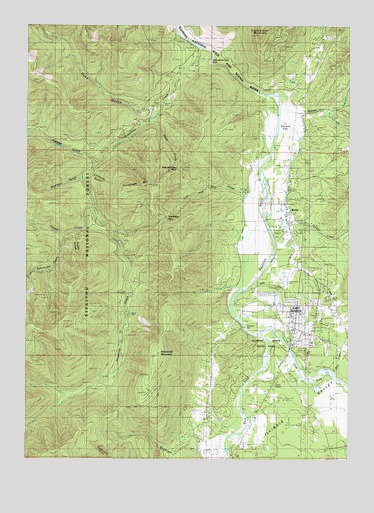
Cave Junction, OR USGS Topographic Map
Click on map above to begin viewing in our Map Viewer.

This topographic map contains these locations and features:
Feature Name Type Latitude Longitude GNIS ID View Map
Bacus CreekStreamN42.1332°W123.6609°1154592View Map
Calvert SloughStreamN42.1443°W123.6317°1132282View Map
Camp CreekStreamN42.2443°W123.6984°1154604View Map
Canyon CreekStreamN42.1973°W123.7259°1139327View Map
Canyon GulchValleyN42.2346°W123.6901°1154596View Map
Cave JunctionPopulated PlaceN42.1629°W123.6481°1139474View Map
Cave Junction City HallBuildingN42.1672°W123.6467°2661036View Map
Cave Junction Municipal CourtBuildingN42.1672°W123.6467°2661037View Map
Cave Junction Post OfficePost OfficeN42.1672°W123.6475°1165022View Map
Cave Junction Public WorksBuildingN42.1672°W123.6467°2661484View Map
Cave Junction Wastewater Sewage TreatmentLocaleN42.1746°W123.6504°2660714View Map
Cave Junction Water Treatment PlantLocaleN42.1607°W123.6461°2660740View Map
Chandler CreekStreamN42.2082°W123.6609°1154599View Map
Choke Cherry CreekStreamN42.1332°W123.6706°1154590View Map
City of Cave JunctionCivilN42.1673°W123.6475°2409414View Map
Days GulchValleyN42.2229°W123.7087°1140678View Map
Department of Motor Vehicles Cave JunctionBuildingN42.1672°W123.6482°2697234View Map
East Fork Illinois RiverStreamN42.1611°W123.6629°259737View Map
Evergreen Elementary SchoolSchoolN42.1698°W123.6523°2440332View Map
Fiddler GulchValleyN42.2115°W123.7265°1142080View Map
Free and Easy CreekStreamN42.2012°W123.6637°1142436View Map
Free and Easy PassGapN42.2076°W123.6931°1142437View Map
Frost GulchValleyN42.1304°W123.6720°1154589View Map
George CreekStreamN42.1843°W123.6556°1142612View Map
Gold SpringSpringN42.2453°W123.6429°1154622View Map
Holton CreekStreamN42.1896°W123.6567°1143682View Map
Illinois River Forks State ParkParkN42.1568°W123.6581°1851894View Map
Illinois Valley Fire District Station 1BuildingN42.1592°W123.6357°2576631View Map
Illinois Valley High SchoolSchoolN42.1671°W123.6316°2440338View Map
Jacobson SpringsSpringN42.1887°W123.6512°1154602View Map
Jimmy CreekStreamN42.1748°W123.6678°1154594View Map
Josephine CreekStreamN42.2434°W123.6856°1144409View Map
KerbyPopulated PlaceN42.1943°W123.6517°1144563View Map
Kerby Census Designated PlaceCensusN42.2047°W123.6489°2611738View Map
Kerby DitchCanalN42.1759°W123.6587°1144565View Map
Kerby Post OfficePost OfficeN42.1943°W123.6517°1165478View Map
Kerby SloughStreamN42.2012°W123.6540°1154601View Map
Kerbyville MuseumBuildingN42.1971°W123.6503°2661570View Map
KIVR-AMTowerN42.1768°W123.6495°1153940View Map
Laurel CemeteryCemeteryN42.1714°W123.6340°1144863View Map
Little Illinois River FallsFallsN42.2392°W123.6800°1155694View Map
Lorna Byrne Middle SchoolSchoolN42.1670°W123.6433°2440340View Map
Lynholm GulchValleyN42.2076°W123.7267°1145695View Map
Madison GulchValleyN42.2057°W123.7306°1145723View Map
Meadow Creek CampgroundLocaleN42.2401°W123.7484°1132276View Map
Mill CreekStreamN42.1512°W123.6317°1154593View Map
Montgomery CreekStreamN42.2290°W123.6498°1154597View Map
Nogle CreekStreamN42.2232°W123.7028°1146864View Map
Peterson CreekStreamN42.2026°W123.6540°1154600View Map
Pomeroy DamDamN42.1630°W123.6665°1147868View Map
Reeves CreekStreamN42.2304°W123.6567°1148365View Map
Rogue River Siskiyou National Forest Law Enforcement Wild Rivers Ranger District Cave JunctionBuildingN42.1615°W123.6477°2737866View Map
Rosenberg ReservoirReservoirN42.1281°W123.6570°1154591View Map
Sauers CreekStreamN42.2234°W123.6526°1154598View Map
Sauers FlatFlatN42.2223°W123.6517°1149078View Map
Sebastopol CreekStreamN42.1896°W123.7370°1149200View Map
South Fork Fiddler GulchValleyN42.2207°W123.7470°1155080View Map
Sugar GulchValleyN42.1896°W123.7312°1150533View Map
Tennessee GulchValleyN42.1887°W123.7178°1154595View Map
Tennessee MountainSummitN42.2037°W123.7048°1150980View Map
Tennessee PassGapN42.1948°W123.6978°1150981View Map
West Fork Illinois RiverStreamN42.1598°W123.6592°1152083View Map
Woodcock CreekStreamN42.1296°W123.6742°1152623View Map
Woodcock MountainSummitN42.1552°W123.7003°1152624View Map

Note: Coordinates in the location and feature list above are referenced to NAD83 datum.


Copyright (C) 2008-2025 Ryan Niemi / Sunset Dynamics ... All Rights Reserved