TopoQuest Logo
Do you find TopoQuest useful?
Help keep TopoQuest running and adding new maps/features by donating!
Bitcoin:  19c7KJd3qBynnjoSw5npx9KScwjBe4ifkT
Litecoin:  LXs6TkuXGGXo1vDsWCkWVdjQX94eUKd6ui
Home View Maps Find Maps Find Places Resources & Links


Oak Grove, Michigan Topographic Map

USGS Map Title: Oak Grove, MI
USGS Map MRC: 42083F8
DRG (GeoTIFF) Download: o42083f8.tif


Neighboring USGS Topographic Map Quads:


  Corunna SE, MI  
42084G1
 

  Byron, MI  
42083G8
 

  Linden, MI  
42083G7
 

  Fowlerville, MI  
42084F1
 

  Oak Grove, MI  
42083F8
 

  Hartland, MI  
42083F7
 

  Parkers Corners, MI  
42084E1
 

  Howell, MI  
42083E8
 

  Brighton, MI  
42083E7


Map MRC Location:

N43°
W84°
N43°
W83°
H8 H7 H6 H5 H4 H3 H2 H1
G8 G7 G6 G5 G4 G3 G2 G1
F8 F7 F6 F5 F4 F3 F2 F1
E8 E7 E6 E5 E4 E3 E2 E1
D8 D7 D6 D5 D4 D3 D2 D1
C8 C7 C6 C5 C4 C3 C2 C1
B8 B7 B6 B5 B4 B3 B2 B1
A8 A7 A6 A5 A4 A3 A2 A1
N42°
W84°
N42°
W83°

Oak Grove, MI USGS 1:24K Topographic Map Preview:
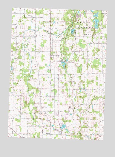
Oak Grove, MI USGS Topographic Map
Click on map above to begin viewing in our Map Viewer.

This topographic map contains these locations and features:
Feature Name Type Latitude Longitude GNIS ID View Map
Bogue CreekStreamN42.7295°W83.9302°621687View Map
Boutell CemeteryCemeteryN42.7220°W83.9304°621781View Map
Cohoctah ChurchChurchN42.7448°W83.9947°623546View Map
Dama Farms Golf CourseLocaleN42.6597°W83.9292°2630287View Map
Frank J Hecox House Historical MarkerParkN42.6286°W83.9874°2630862View Map
Hidden LakeLakeN42.7292°W83.9199°628205View Map
Hidden Springs ChurchChurchN42.6864°W83.8758°2630283View Map
Howell Area Fire Department Station 24BuildingN42.7085°W83.9470°2620036View Map
Hunters Ridge Golf CourseLocaleN42.7194°W83.9750°2630289View Map
Hutchings Elementary SchoolSchoolN42.6323°W83.8834°2630298View Map
Immanuel Lutheran ChurchChurchN42.6431°W83.9347°2630282View Map
Indian LakeLakeN42.7376°W83.8894°628984View Map
Livingston County Emergency Medical ServicesBuildingN42.6283°W83.9756°2661905View Map
Livingston County Spencer J Hardy AirportAirportN42.6259°W83.9809°1623968View Map
Marr ChurchChurchN42.6650°W83.9947°631607View Map
Oak GrovePopulated PlaceN42.7003°W83.9319°633813View Map
Oak Grove Post Office (historical)Post OfficeN42.7003°W83.9319°2631002View Map
Oak Grove State Game AreaParkN42.7414°W83.9072°633836View Map
Oak Grove StationLocaleN42.6986°W83.9422°2630916View Map
Oak Grove United Methodist ChurchChurchN42.7000°W83.9297°2630284View Map
Pioneer CemeteryCemeteryN42.6688°W83.9953°635026View Map
Saint Augustine Church and Cemetery Historical MarkerParkN42.6991°W83.9269°2630875View Map
Sanford CemeteryCemeteryN42.7080°W83.9645°637237View Map
Sprague CreekStreamN42.7311°W83.9638°638524View Map
Taylor's Beach CampgroundLocaleN42.6931°W83.9986°2630288View Map
Township of CohoctahCivilN42.7329°W83.9788°1623162View Map
Township of HowellCivilN42.6469°W83.9787°1626496View Map
Van Keuren CemeteryCemeteryN42.6586°W83.8969°1615477View Map
WHMI-FM (Howell)TowerN42.6631°W83.9400°1625420View Map

Note: Coordinates in the location and feature list above are referenced to NAD83 datum.


Copyright (C) 2008-2024 Ryan Niemi / Sunset Dynamics ... All Rights Reserved