TopoQuest Logo
Do you find TopoQuest useful?
Help keep TopoQuest running and adding new maps/features by donating!
Bitcoin:  19c7KJd3qBynnjoSw5npx9KScwjBe4ifkT
Litecoin:  LXs6TkuXGGXo1vDsWCkWVdjQX94eUKd6ui
Home View Maps Find Maps Find Places Resources & Links


Oak Hill, Illinois Topographic Map

USGS Map Title: Oak Hill, IL
USGS Map MRC: 40089G7
DRG (GeoTIFF) Download: o40089g7.tif


Neighboring USGS Topographic Map Quads:


  Laura, IL  
40089H8
 

  Princeville, IL  
40089H7
 

  Edelstein, IL  
40089H6
 

  Elmwood, IL  
40089G8
 

  Oak Hill, IL  
40089G7
 

  Dunlap, IL  
40089G6
 

  Farmington East, IL  
40089F8
 

  Hanna City, IL  
40089F7
 

  Peoria West, IL  
40089F6


Map MRC Location:

N41°
W90°
N41°
W89°
H8 H7 H6 H5 H4 H3 H2 H1
G8 G7 G6 G5 G4 G3 G2 G1
F8 F7 F6 F5 F4 F3 F2 F1
E8 E7 E6 E5 E4 E3 E2 E1
D8 D7 D6 D5 D4 D3 D2 D1
C8 C7 C6 C5 C4 C3 C2 C1
B8 B7 B6 B5 B4 B3 B2 B1
A8 A7 A6 A5 A4 A3 A2 A1
N40°
W90°
N40°
W89°

Oak Hill, IL USGS 1:24K Topographic Map Preview:
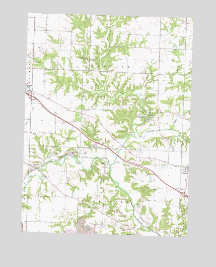
Oak Hill, IL USGS Topographic Map
Click on map above to begin viewing in our Map Viewer.

This topographic map contains these locations and features:
Feature Name Type Latitude Longitude GNIS ID View Map
Bow Wood Glen Picnic AreaLocaleN40.8223°W89.7945°1820846View Map
Bramble School (historical)SchoolN40.8092°W89.8132°1720258View Map
Brimfield Community Fire Protection District Station 2BuildingN40.7908°W89.7527°2640588View Map
Brown CemeteryCemeteryN40.7767°W89.7750°1959209View Map
Brown School (historical)SchoolN40.7773°W89.7757°1720259View Map
Cahill School (historical)SchoolN40.8281°W89.8615°1720260View Map
Calvary CemeteryCemeteryN40.8473°W89.8696°405397View Map
Center School (historical)SchoolN40.7559°W89.8146°1720264View Map
Combs CemeteryCemeteryN40.7669°W89.7884°406423View Map
Edwards Post OfficePost OfficeN40.7729°W89.7548°2788300View Map
Fargo RunStreamN40.8111°W89.7629°408268View Map
Golden Knoll School (historical)SchoolN40.7939°W89.7762°1720276View Map
Gray Horse FarmLocaleN40.8631°W89.8300°2556445View Map
Greenbush School (historical)SchoolN40.8642°W89.7751°1720277View Map
Interchange 75CrossingN40.8278°W89.8704°1820860View Map
Interchange 82CrossingN40.7742°W89.7529°1820861View Map
Jubilee CemeteryCemeteryN40.8161°W89.7831°411266View Map
Jubilee College (historical)SchoolN40.8167°W89.7807°1820868View Map
Jubilee College Forest Nature PreserveParkN40.8297°W89.7814°2085550View Map
Jubilee College State ParkParkN40.8170°W89.7812°411267View Map
Jubilee CreekStreamN40.8078°W89.7920°411268View Map
Jubilee Lodge Home for GirlsBuildingN40.8498°W89.8293°411269View Map
Jubilee Town HallBuildingN40.8434°W89.8126°1720287View Map
KickapooPopulated PlaceN40.7900°W89.7512°411445View Map
KrammLocaleN40.7581°W89.7820°422887View Map
Lutheran CemeteryCemeteryN40.8210°W89.8303°1720295View Map
Moore School (historical)SchoolN40.7564°W89.8707°1720298View Map
Nixon RunStreamN40.7645°W89.7907°414536View Map
Nixon School (historical)SchoolN40.7720°W89.8429°1720301View Map
Oak HillPopulated PlaceN40.7875°W89.8665°414816View Map
Oak Hill CemeteryCemeteryN40.7949°W89.8516°414821View Map
OlinPopulated PlaceN40.7528°W89.7684°423042View Map
Peoria CountyCivilN40.7881°W89.7600°1784920View Map
Prairie Lane Picnic AreaLocaleN40.8214°W89.7973°1820876View Map
Quail MeadowFlatN40.8250°W89.7959°1820877View Map
Red Fox Run Picnic AreaLocaleN40.8223°W89.8023°1820878View Map
Rupp RunStreamN40.7531°W89.7776°417045View Map
Saint Marys SchoolSchoolN40.7881°W89.7504°2041090View Map
Saint Patrick's CemeteryCemeteryN40.7903°W89.7565°1959228View Map
Shane School (historical)SchoolN40.8636°W89.8612°1720319View Map
South PondReservoirN40.7982°W89.7873°1691316View Map
South Pond DamDamN40.7984°W89.7868°1691315View Map
Township of JubileeCivilN40.8429°W89.8129°429192View Map
Township of RosefieldCivilN40.7550°W89.8139°429673View Map
Turkey Hollow Picnic AreaLocaleN40.8264°W89.7884°1820884View Map
Valley View Picnic AreaLocaleN40.8273°W89.8029°1820885View Map
Walker CemeteryCemeteryN40.8066°W89.8657°420404View Map
West Fork Kickapoo CreekStreamN40.7892°W89.8093°420832View Map

Note: Coordinates in the location and feature list above are referenced to NAD83 datum.


Copyright (C) 2008-2025 Ryan Niemi / Sunset Dynamics ... All Rights Reserved