TopoQuest Logo
Do you find TopoQuest useful?
Help keep TopoQuest running and adding new maps/features by donating!
Bitcoin:  19c7KJd3qBynnjoSw5npx9KScwjBe4ifkT
Litecoin:  LXs6TkuXGGXo1vDsWCkWVdjQX94eUKd6ui
Home View Maps Find Maps Find Places Resources & Links


Princeville, Illinois Topographic Map

USGS Map Title: Princeville, IL
USGS Map MRC: 40089H7
DRG (GeoTIFF) Download: o40089h7.tif


Neighboring USGS Topographic Map Quads:


  Lafayette, IL  
41089A8
 

  Wyoming, IL  
41089A7
 

  Castleton, IL  
41089A6
 

  Laura, IL  
40089H8
 

  Princeville, IL  
40089H7
 

  Edelstein, IL  
40089H6
 

  Elmwood, IL  
40089G8
 

  Oak Hill, IL  
40089G7
 

  Dunlap, IL  
40089G6


Map MRC Location:

N41°
W90°
N41°
W89°
H8 H7 H6 H5 H4 H3 H2 H1
G8 G7 G6 G5 G4 G3 G2 G1
F8 F7 F6 F5 F4 F3 F2 F1
E8 E7 E6 E5 E4 E3 E2 E1
D8 D7 D6 D5 D4 D3 D2 D1
C8 C7 C6 C5 C4 C3 C2 C1
B8 B7 B6 B5 B4 B3 B2 B1
A8 A7 A6 A5 A4 A3 A2 A1
N40°
W90°
N40°
W89°

Princeville, IL USGS 1:24K Topographic Map Preview:
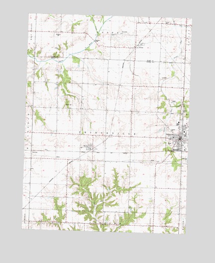
Princeville, IL USGS Topographic Map
Click on map above to begin viewing in our Map Viewer.

This topographic map contains these locations and features:
Feature Name Type Latitude Longitude GNIS ID View Map
Adams School (historical)SchoolN40.9598°W89.7807°403354View Map
Akron - Princeville AmbulanceBuildingN40.9298°W89.7550°2673997View Map
Akron - Princeville Fire DepartmentBuildingN40.9306°W89.7552°2041080View Map
Byrnes School (historical)SchoolN40.9234°W89.7943°405321View Map
Carroll School (historical)SchoolN40.8800°W89.8279°405640View Map
Chippewa Estates DamDamN40.9034°W89.7968°1692422View Map
Chippewa Estates LakeReservoirN40.9034°W89.7968°1692423View Map
DuncanPopulated PlaceN40.9836°W89.7893°407481View Map
First Presbyterian ChurchChurchN40.9273°W89.7576°2041079View Map
Good Hope School (historical)SchoolN40.8975°W89.7751°409140View Map
Henry School (historical)SchoolN40.9442°W89.7937°410075View Map
Indian CreekStreamN40.9889°W89.8220°410850View Map
MonicaPopulated PlaceN40.9236°W89.8232°413724View Map
Moody School (historical)SchoolN40.9595°W89.8223°413762View Map
Nelson School (historical)SchoolN40.9125°W89.8426°414356View Map
Phils Airstrip (historical)AirportN40.9906°W89.8018°1720246View Map
Prince RunStreamN40.9948°W89.7612°416225View Map
PrincevillePopulated PlaceN40.9298°W89.7576°416227View Map
Princeville Baptist ChurchChurchN40.9256°W89.7609°1840124View Map
Princeville Elementary SchoolSchoolN40.9342°W89.7534°1840125View Map
Princeville High SchoolSchoolN40.9323°W89.7523°1840126View Map
Princeville Post OfficePost OfficeN40.9308°W89.7566°2788835View Map
Princeville Township CemeteryCemeteryN40.9353°W89.7654°1720327View Map
Princeville United Methodist ChurchChurchN40.9378°W89.7529°1840127View Map
Saint Mary of the Wood ChurchChurchN40.9267°W89.7551°1840154View Map
Saint Marys CemeteryCemeteryN40.9484°W89.7543°417567View Map
Schiebel CemeteryCemeteryN40.9964°W89.7707°1720247View Map
Schiebel School (historical)SchoolN40.9964°W89.7715°418080View Map
Slackwater (historical)Populated PlaceN40.9825°W89.8209°1829245View Map
Slackwater BridgeBridgeN40.9850°W89.8243°1720248View Map
Stringtown CemeteryCemeteryN40.9890°W89.8518°1720249View Map
Stringtown School (historical)SchoolN40.9892°W89.8512°419226View Map
Township of PrincevilleCivilN40.9307°W89.8123°429606View Map
Underwood PondReservoirN40.8867°W89.7901°1691328View Map
Underwood Pond DamDamN40.8867°W89.7901°1691327View Map
Village of PrincevilleCivilN40.9350°W89.7547°2399025View Map
Walliker CemeteryCemeteryN40.9477°W89.8446°1720331View Map
Whites Grove School (historical)SchoolN40.9459°W89.8521°421100View Map

Note: Coordinates in the location and feature list above are referenced to NAD83 datum.


Copyright (C) 2008-2025 Ryan Niemi / Sunset Dynamics ... All Rights Reserved