TopoQuest Logo
Do you find TopoQuest useful?
Help keep TopoQuest running and adding new maps/features by donating!
Bitcoin:  19c7KJd3qBynnjoSw5npx9KScwjBe4ifkT
Litecoin:  LXs6TkuXGGXo1vDsWCkWVdjQX94eUKd6ui
Home View Maps Find Maps Find Places Resources & Links


Elmwood, Illinois Topographic Map

USGS Map Title: Elmwood, IL
USGS Map MRC: 40089G8
DRG (GeoTIFF) Download: o40089g8.tif


Neighboring USGS Topographic Map Quads:


  Williamsfield, IL  
40090H1
 

  Laura, IL  
40089H8
 

  Princeville, IL  
40089H7
 

  Yates City, IL  
40090G1
 

  Elmwood, IL  
40089G8
 

  Oak Hill, IL  
40089G7
 

  Farmington West, IL  
40090F1
 

  Farmington East, IL  
40089F8
 

  Hanna City, IL  
40089F7


Map MRC Location:

N41°
W90°
N41°
W89°
H8 H7 H6 H5 H4 H3 H2 H1
G8 G7 G6 G5 G4 G3 G2 G1
F8 F7 F6 F5 F4 F3 F2 F1
E8 E7 E6 E5 E4 E3 E2 E1
D8 D7 D6 D5 D4 D3 D2 D1
C8 C7 C6 C5 C4 C3 C2 C1
B8 B7 B6 B5 B4 B3 B2 B1
A8 A7 A6 A5 A4 A3 A2 A1
N40°
W90°
N40°
W89°

Elmwood, IL USGS 1:24K Topographic Map Preview:
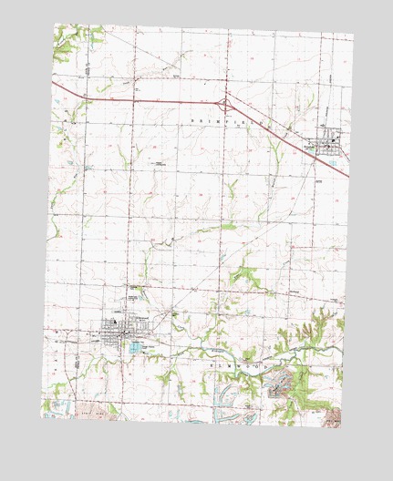
Elmwood, IL USGS Topographic Map
Click on map above to begin viewing in our Map Viewer.

This topographic map contains these locations and features:
Feature Name Type Latitude Longitude GNIS ID View Map
Bell School (historical)SchoolN40.8145°W89.9282°404131View Map
BrimfieldPopulated PlaceN40.8389°W89.8865°404871View Map
Brimfield - Yates City - Elmwood Ambulance ServiceBuildingN40.7771°W89.9652°2674006View Map
Brimfield CemeteryCemeteryN40.8431°W89.8974°1959174View Map
Brimfield Community Fire Protection District Station 1BuildingN40.8387°W89.8827°2041078View Map
Brimfield Grade SchoolSchoolN40.8420°W89.8804°1839910View Map
Brimfield High SchoolSchoolN40.8409°W89.8823°1839911View Map
Brimfield Post OfficePost OfficeN40.8396°W89.8849°2041076View Map
Brimfield Public LibraryBuildingN40.8384°W89.8848°2041077View Map
Brimfield United Methodist ChurchChurchN40.8378°W89.8851°1839912View Map
Burt School (historical)SchoolN40.8434°W89.9659°405274View Map
City of ElmwoodCivilN40.7804°W89.9656°2394676View Map
Clark BranchStreamN40.7725°W89.8957°406147View Map
Crossroads Assembly of God ChurchChurchN40.7820°W89.9554°2041071View Map
ElmwoodPopulated PlaceN40.7778°W89.9665°407949View Map
Elmwood Baptist ChurchChurchN40.7795°W89.9748°1839958View Map
Elmwood City CemeteryCemeteryN40.7848°W89.9688°1959229View Map
Elmwood City HallBuildingN40.7781°W89.9676°2041073View Map
Elmwood Elementary SchoolSchoolN40.7814°W89.9704°1839959View Map
Elmwood Fire DepartmentBuildingN40.7789°W89.9665°2041075View Map
Elmwood High SchoolSchoolN40.7811°W89.9701°1839961View Map
Elmwood Police DepartmentBuildingN40.7782°W89.9677°2756732View Map
Elmwood Post OfficePost OfficeN40.7784°W89.9664°2041074View Map
First Presbyterian ChurchChurchN40.7792°W89.9679°2043752View Map
Gibbs School (historical)SchoolN40.7845°W89.9140°408985View Map
Interchange 71CrossingN40.8509°W89.9276°1820859View Map
Lehigh CemeteryCemeteryN40.7560°W89.9122°1720291View Map
Lehigh School (historical)SchoolN40.7559°W89.9196°411931View Map
Maple Grove School (historical)SchoolN40.8739°W89.8893°412945View Map
Maple Lane Country ClubLocaleN40.7881°W89.9634°1720296View Map
Paradise Chapel School (historical)SchoolN40.8142°W89.9659°415371View Map
Phelps School (historical)SchoolN40.7539°W89.9676°415599View Map
Radley School (historical)SchoolN40.8145°W89.8907°416346View Map
Reed School (historical)SchoolN40.8736°W89.9654°416489View Map
Saint Josephs Catholic ChurchChurchN40.8398°W89.8890°1840150View Map
Saint Marys CemeteryCemeteryN40.7849°W89.9476°1720314View Map
Saint Patricks Catholic ChurchChurchN40.7773°W89.9768°1840157View Map
Saint Pauls Lutheran ChurchChurchN40.8398°W89.8868°1840161View Map
Shissler Farm Airport (historical)AirportN40.7964°W89.9859°427259View Map
Shissler Landing Strip (historical)AirportN40.8317°W89.9590°1720320View Map
SouthportPopulated PlaceN40.7925°W89.8987°423193View Map
Southport CemeteryCemeteryN40.7900°W89.8777°418857View Map
Sweetwater ParkParkN40.7759°W89.9598°1720323View Map
Tiber CreekStreamN40.7764°W89.9343°419711View Map
Township of BrimfieldCivilN40.8436°W89.9278°428710View Map
Township of ElmwoodCivilN40.7558°W89.9284°428962View Map
Union ChurchChurchN40.8403°W89.8851°1840187View Map
Village of BrimfieldCivilN40.8381°W89.8836°2397455View Map
Walnut CreekStreamN40.7739°W89.9340°420441View Map
Whitten School (historical)SchoolN40.8736°W89.9262°421116View Map
Wiley LibraryBuildingN40.7775°W89.9684°2041072View Map

Note: Coordinates in the location and feature list above are referenced to NAD83 datum.


Copyright (C) 2008-2024 Ryan Niemi / Sunset Dynamics ... All Rights Reserved