TopoQuest Logo
Do you find TopoQuest useful?
Help keep TopoQuest running and adding new maps/features by donating!
Bitcoin:  19c7KJd3qBynnjoSw5npx9KScwjBe4ifkT
Litecoin:  LXs6TkuXGGXo1vDsWCkWVdjQX94eUKd6ui
Home View Maps Find Maps Find Places Resources & Links


Laura, Illinois Topographic Map

USGS Map Title: Laura, IL
USGS Map MRC: 40089H8
DRG (GeoTIFF) Download: o40089h8.tif


Neighboring USGS Topographic Map Quads:


  Victoria, IL  
41090A1
 

  Lafayette, IL  
41089A8
 

  Wyoming, IL  
41089A7
 

  Williamsfield, IL  
40090H1
 

  Laura, IL  
40089H8
 

  Princeville, IL  
40089H7
 

  Yates City, IL  
40090G1
 

  Elmwood, IL  
40089G8
 

  Oak Hill, IL  
40089G7


Map MRC Location:

N41°
W90°
N41°
W89°
H8 H7 H6 H5 H4 H3 H2 H1
G8 G7 G6 G5 G4 G3 G2 G1
F8 F7 F6 F5 F4 F3 F2 F1
E8 E7 E6 E5 E4 E3 E2 E1
D8 D7 D6 D5 D4 D3 D2 D1
C8 C7 C6 C5 C4 C3 C2 C1
B8 B7 B6 B5 B4 B3 B2 B1
A8 A7 A6 A5 A4 A3 A2 A1
N40°
W90°
N40°
W89°

Laura, IL USGS 1:24K Topographic Map Preview:
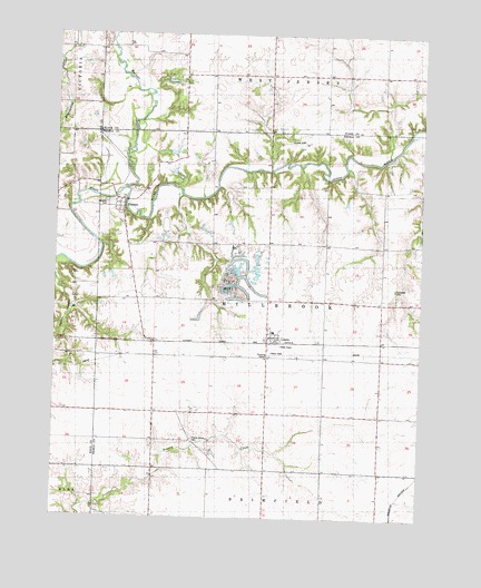
Laura, IL USGS Topographic Map
Click on map above to begin viewing in our Map Viewer.

This topographic map contains these locations and features:
Feature Name Type Latitude Longitude GNIS ID View Map
Campbell CemeteryCemeteryN40.9345°W89.8837°1720261View Map
Cowen PondReservoirN40.9628°W89.9577°1692421View Map
Cowen Pond DamDamN40.9634°W89.9584°1692420View Map
Dixie School (historical)SchoolN40.9573°W89.9996°407248View Map
ElmorePopulated PlaceN40.9567°W89.9771°407948View Map
Elmore Stock Farm PondReservoirN40.9695°W89.9598°1692471View Map
Elmore Stock Farm Pond DamDamN40.9750°W89.9634°1692470View Map
French Grove CemeteryCemeteryN40.8950°W89.9526°1720273View Map
Glendale CemeteryCemeteryN40.9561°W89.9826°409070View Map
Kepler LakeReservoirN40.9878°W89.9614°1692571View Map
Kepler Lake DamDamN40.9867°W89.9634°1692570View Map
LauraPopulated PlaceN40.9214°W89.9265°411849View Map
Laura Post OfficePost OfficeN40.9216°W89.9265°2788869View Map
Nightingale School (historical)SchoolN40.9311°W89.9718°414522View Map
Pleasant Hill School (historical)SchoolN40.9817°W89.9854°415857View Map
Scotland School (historical)SchoolN40.9009°W89.8893°418137View Map
Township of MillbrookCivilN40.9311°W89.9274°429365View Map
Walnut CreekStreamN40.9598°W89.9765°420442View Map

Note: Coordinates in the location and feature list above are referenced to NAD83 datum.


Copyright (C) 2008-2025 Ryan Niemi / Sunset Dynamics ... All Rights Reserved