TopoQuest Logo
Do you find TopoQuest useful?
Help keep TopoQuest running and adding new maps/features by donating!
Bitcoin:  19c7KJd3qBynnjoSw5npx9KScwjBe4ifkT
Litecoin:  LXs6TkuXGGXo1vDsWCkWVdjQX94eUKd6ui
Home View Maps Find Maps Find Places Resources & Links


Oak Level, Kentucky Topographic Map

USGS Map Title: Oak Level, KY
USGS Map MRC: 36088G4
DRG (GeoTIFF) Download: o36088g4.tif


Neighboring USGS Topographic Map Quads:


  Symsonia, KY  
36088H5
 

  Elva, KY  
36088H4
 

  Briensburg, KY  
36088H3
 

  Westplains, KY  
36088G5
 

  Oak Level, KY  
36088G4
 

  Hardin, KY  
36088G3
 

  Farmington, KY  
36088F5
 

  Kirksey, KY  
36088F4
 

  Dexter, KY  
36088F3


Map MRC Location:

N37°
W89°
N37°
W88°
H8 H7 H6 H5 H4 H3 H2 H1
G8 G7 G6 G5 G4 G3 G2 G1
F8 F7 F6 F5 F4 F3 F2 F1
E8 E7 E6 E5 E4 E3 E2 E1
D8 D7 D6 D5 D4 D3 D2 D1
C8 C7 C6 C5 C4 C3 C2 C1
B8 B7 B6 B5 B4 B3 B2 B1
A8 A7 A6 A5 A4 A3 A2 A1
N36°
W89°
N36°
W88°

Oak Level, KY USGS 1:24K Topographic Map Preview:
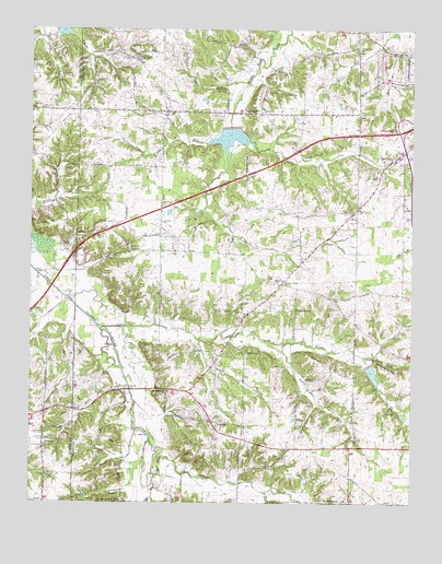
Oak Level, KY USGS Topographic Map
Click on map above to begin viewing in our Map Viewer.

This topographic map contains these locations and features:
Feature Name Type Latitude Longitude GNIS ID View Map
Benton DivisionCivilN36.8275°W88.3993°1936872View Map
Bowie BranchStreamN36.7928°W88.4450°487732View Map
BrewersPopulated PlaceN36.7714°W88.4389°487866View Map
Brewers CemeteryCemeteryN36.7716°W88.4372°2775703View Map
Caney BranchStreamN36.7514°W88.4600°488820View Map
Cole CemeteryCemeteryN36.8198°W88.4122°489809View Map
Cross SpringSpringN36.8011°W88.4131°490397View Map
Danner HillSummitN36.7856°W88.4028°490582View Map
Dry BranchStreamN36.7889°W88.3870°491158View Map
Duncan CreekStreamN36.7637°W88.4562°491300View Map
Free BranchStreamN36.7556°W88.4314°492491View Map
Gibson CemeteryCemeteryN36.8453°W88.4129°2775725View Map
Gibson CreekStreamN36.8439°W88.4273°492808View Map
Gore CemeteryCemeteryN36.7745°W88.3819°493033View Map
Graves County LinePopulated PlaceN36.7748°W88.4853°2743714View Map
Hale SpringSpringN36.7797°W88.4566°493558View Map
HarveyPopulated PlaceN36.8084°W88.4178°508200View Map
Harvey Brewers Fire StationBuildingN36.8069°W88.4185°2636615View Map
J & C Antique AirfieldAirportN36.7622°W88.3754°2444072View Map
Jackson (historical)Populated PlaceN36.7658°W88.3929°2743718View Map
Little Bee CreekStreamN36.8742°W88.3806°496616View Map
Middle Fork (historical)Populated PlaceN36.8705°W88.3929°2743728View Map
Middle Fork CemeteryCemeteryN36.8697°W88.3929°2775730View Map
Middle Fork ChurchChurchN36.8700°W88.3926°2632582View Map
Moss BranchStreamN36.7809°W88.4678°498664View Map
New Bethel Baptist ChurchChurchN36.8184°W88.4048°499283View Map
New Home ChurchChurchN36.7653°W88.4948°499334View Map
New Sand Hill CemeteryCemeteryN36.8544°W88.4971°2775726View Map
New Zion CemeteryCemeteryN36.7864°W88.3753°2775705View Map
North Fork Duncan CreekStreamN36.7531°W88.4228°499549View Map
North Fork Soldier CreekStreamN36.7889°W88.3914°499566View Map
Oak LevelPopulated PlaceN36.8670°W88.4656°499714View Map
Oak Level BranchStreamN36.8673°W88.4798°499715View Map
Oak Level CemeteryCemeteryN36.8677°W88.4659°2775729View Map
Patty CreekStreamN36.7920°W88.4173°500271View Map
Pleasant Grove CemeteryCemeteryN36.8072°W88.4176°2775744View Map
Pleasant Grove ChurchChurchN36.8076°W88.4175°500811View Map
Pleasant Valley (historical)Populated PlaceN36.8531°W88.4108°2743730View Map
Potato HillSummitN36.8242°W88.4887°501178View Map
Reeves BranchStreamN36.8726°W88.4848°501706View Map
Riley BranchStreamN36.7578°W88.4590°501950View Map
Sand Hill ChurchChurchN36.8542°W88.4962°502911View Map
Smith CreekStreamN36.8273°W88.4437°503777View Map
Soldier CreekStreamN36.7967°W88.4770°503868View Map
Soldier Creek CemeteryCemeteryN36.7902°W88.4283°2775704View Map
Soldier Creek Primitive Baptist ChurchChurchN36.7899°W88.4291°503869View Map
South Fork Duncan CreekStreamN36.7528°W88.4228°503922View Map
South Fork Soldier CreekStreamN36.7887°W88.3914°503947View Map
Stillhouse BranchStreamN36.8603°W88.4298°504404View Map
Stillhouse HillSummitN36.7867°W88.3856°504413View Map
Stillhouse SpringSpringN36.8599°W88.4383°504424View Map
Vanzora (historical)Populated PlaceN36.8244°W88.4577°2743739View Map
Vanzora ChurchChurchN36.8239°W88.4573°505982View Map
Waller HillSummitN36.8531°W88.4256°506151View Map
Woodall (historical)Populated PlaceN36.8446°W88.4567°2743740View Map
Woodall BranchStreamN36.8451°W88.4434°507084View Map

Note: Coordinates in the location and feature list above are referenced to NAD83 datum.


Copyright (C) 2008-2024 Ryan Niemi / Sunset Dynamics ... All Rights Reserved