TopoQuest Logo
Do you find TopoQuest useful?
Help keep TopoQuest running and adding new maps/features by donating!
Bitcoin:  19c7KJd3qBynnjoSw5npx9KScwjBe4ifkT
Litecoin:  LXs6TkuXGGXo1vDsWCkWVdjQX94eUKd6ui
Home View Maps Find Maps Find Places Resources & Links


Dexter, Kentucky Topographic Map

USGS Map Title: Dexter, KY
USGS Map MRC: 36088F3
DRG (GeoTIFF) Download: o36088f3.tif


Neighboring USGS Topographic Map Quads:


  Oak Level, KY  
36088G4
 

  Hardin, KY  
36088G3
 

  Fairdealing, KY  
36088G2
 

  Kirksey, KY  
36088F4
 

  Dexter, KY  
36088F3
 

  Hico, KY  
36088F2
 

  Lynn Grove, KY  
36088E4
 

  Murray, KY  
36088E3
 

  New Concord, KY  
36088E2


Map MRC Location:

N37°
W89°
N37°
W88°
H8 H7 H6 H5 H4 H3 H2 H1
G8 G7 G6 G5 G4 G3 G2 G1
F8 F7 F6 F5 F4 F3 F2 F1
E8 E7 E6 E5 E4 E3 E2 E1
D8 D7 D6 D5 D4 D3 D2 D1
C8 C7 C6 C5 C4 C3 C2 C1
B8 B7 B6 B5 B4 B3 B2 B1
A8 A7 A6 A5 A4 A3 A2 A1
N36°
W89°
N36°
W88°

Dexter, KY USGS 1:24K Topographic Map Preview:
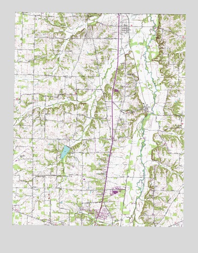
Dexter, KY USGS Topographic Map
Click on map above to begin viewing in our Map Viewer.

This topographic map contains these locations and features:
Feature Name Type Latitude Longitude GNIS ID View Map
AlmoPopulated PlaceN36.6948°W88.2784°485892View Map
Almo CemeteryCemeteryN36.6953°W88.2815°2775689View Map
Almo ChurchChurchN36.6917°W88.2889°485893View Map
Almo Fire StationBuildingN36.6940°W88.2773°2637186View Map
Almo HeightsPopulated PlaceN36.6928°W88.2959°485894View Map
Bee CreekStreamN36.6339°W88.2859°486666View Map
Bethel (historical)Populated PlaceN36.6429°W88.2717°2743610View Map
Bethel CemeteryCemeteryN36.6484°W88.2715°486948View Map
Bethel ChurchChurchN36.6431°W88.2723°486956View Map
Blakely (historical)Populated PlaceN36.7343°W88.3173°2743611View Map
Brooks ChapelChurchN36.7359°W88.2675°487961View Map
Brooks Chapel - Gordon CemeteryCemeteryN36.7351°W88.2675°2775688View Map
Coles Campground CemeteryCemeteryN36.6681°W88.3326°2775685View Map
Coles Campground ChurchChurchN36.6684°W88.3311°489829View Map
DexterPopulated PlaceN36.7428°W88.2964°490852View Map
Dexter Census Designated PlaceCensusN36.7396°W88.2955°2629603View Map
Dexter Hardin ChurchChurchN36.7498°W88.2975°490853View Map
East Fork Rockhouse CreekStreamN36.7045°W88.3153°491477View Map
Flint (historical)Populated PlaceN36.6958°W88.3074°2743626View Map
Flint ChurchChurchN36.6953°W88.3061°492247View Map
Hickory Grove ChurchChurchN36.7126°W88.3331°494127View Map
Kyle-Oakley FieldAirportN36.6646°W88.3728°517448View Map
Muck BranchStreamN36.7412°W88.3292°498971View Map
Murray Memorial GardensCemeteryN36.6564°W88.3078°499123View Map
North Pleasant Grove CemeteryCemeteryN36.6540°W88.3512°2775684View Map
North Pleasant Grove ChurchChurchN36.6537°W88.3520°499582View Map
Northside ChurchChurchN36.6881°W88.2973°499607View Map
Oak Grove ChurchChurchN36.7492°W88.3700°499668View Map
Owen BranchStreamN36.7384°W88.3325°500052View Map
Owen ChapelChurchN36.7239°W88.3600°500055View Map
PennyPopulated PlaceN36.6470°W88.3606°508801View Map
Peterson BranchStreamN36.7259°W88.3409°500482View Map
Pleasant HillPopulated PlaceN36.7139°W88.2934°508833View Map
Rockhouse CreekStreamN36.7489°W88.2761°502188View Map
Scotts Grove CemeteryCemeteryN36.6439°W88.3095°2775686View Map
Scotts Grove ChurchChurchN36.6434°W88.3089°503114View Map
Spring CreekStreamN36.6953°W88.3556°504122View Map
Spring Creek CemeteryCemeteryN36.6896°W88.3523°2775687View Map
Spring Creek ChurchChurchN36.6903°W88.3528°504132View Map
Stewart CemeteryCemeteryN36.7173°W88.2974°504378View Map
Temple Hill (historical)Populated PlaceN36.6831°W88.2513°2743648View Map
Temple Hill CemeteryCemeteryN36.6838°W88.2534°2775690View Map
Temple Hill ChurchChurchN36.6842°W88.2523°505060View Map
Turner FieldAirportN36.7293°W88.2515°2444078View Map
Union Grove ChurchChurchN36.6462°W88.3562°505795View Map
Utterback (historical)Populated PlaceN36.6390°W88.3157°2743649View Map
WadesboroPopulated PlaceN36.7481°W88.3214°509298View Map
West Fork Rockhouse CreekStreamN36.7045°W88.3153°506446View Map
WNBS-AM (Murray)TowerN36.6284°W88.3011°517647View Map
WSJP-AM (Murray)TowerN36.6359°W88.3200°517645View Map
WSPH-TV (Murray)TowerN36.6359°W88.3200°517752View Map

Note: Coordinates in the location and feature list above are referenced to NAD83 datum.


Copyright (C) 2008-2024 Ryan Niemi / Sunset Dynamics ... All Rights Reserved