TopoQuest Logo
Do you find TopoQuest useful?
Help keep TopoQuest running and adding new maps/features by donating!
Bitcoin:  19c7KJd3qBynnjoSw5npx9KScwjBe4ifkT
Litecoin:  LXs6TkuXGGXo1vDsWCkWVdjQX94eUKd6ui
Home View Maps Find Maps Find Places Resources & Links


Cascade Gorge, Oregon Topographic Map

USGS Map Title: Cascade Gorge, OR
USGS Map MRC: 42122F5
DRG (GeoTIFF) Download: o42122f5.tif


Neighboring USGS Topographic Map Quads:


  Sugarpine Creek, OR  
42122G6
 

  Whetstone Point, OR  
42122G5
 

  Prospect North, OR  
42122G4
 

  McLeod, OR  
42122F6
 

  Cascade Gorge, OR  
42122F5
 

  Prospect South, OR  
42122F4
 

  Obenchain Mountain, OR  
42122E6
 

  Butte Falls, OR  
42122E5
 

  Big Butte Springs, OR  
42122E4


Map MRC Location:

N43°
W123°
N43°
W122°
H8 H7 H6 H5 H4 H3 H2 H1
G8 G7 G6 G5 G4 G3 G2 G1
F8 F7 F6 F5 F4 F3 F2 F1
E8 E7 E6 E5 E4 E3 E2 E1
D8 D7 D6 D5 D4 D3 D2 D1
C8 C7 C6 C5 C4 C3 C2 C1
B8 B7 B6 B5 B4 B3 B2 B1
A8 A7 A6 A5 A4 A3 A2 A1
N42°
W123°
N42°
W122°

Cascade Gorge, OR USGS 1:24K Topographic Map Preview:
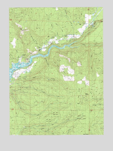
Cascade Gorge, OR USGS Topographic Map
Click on map above to begin viewing in our Map Viewer.

This topographic map contains these locations and features:
Feature Name Type Latitude Longitude GNIS ID View Map
Cascade GorgePopulated PlaceN42.7157°W122.5686°1139419View Map
Cascade GorgeValleyN42.7057°W122.5861°1139420View Map
Cold Spring CreekStreamN42.7012°W122.5801°1155049View Map
Diamond CreekStreamN42.6821°W122.6236°1140991View Map
Dudley (historical)Populated PlaceN42.6290°W122.5400°1155046View Map
Dudley MountainSummitN42.6261°W122.5252°1141375View Map
Dudley Post Office (historical)Post OfficeN42.6290°W122.5400°1165183View Map
Evergreen SpringSpringN42.7034°W122.6089°1155406View Map
Flounce RockPillarN42.7272°W122.6093°1142263View Map
Hole in the Ground CreekStreamN42.7035°W122.5856°1159076View Map
Hurd CreekStreamN42.7426°W122.5764°1159074View Map
Joseph H Stewart State ParkParkN42.6843°W122.6186°1155815View Map
Katydid RanchLocaleN42.7340°W122.5348°1144494View Map
Knighten CreekStreamN42.6929°W122.6125°1159077View Map
Leeds Post Office (historical)Post OfficeN42.6832°W122.6178°1164467View Map
Middle CreekStreamN42.7160°W122.5836°1159075View Map
Needle RockArchN42.6990°W122.6023°1146753View Map
North Fork Clark CreekStreamN42.6323°W122.5970°1116684View Map
Nye CemeteryCemeteryN42.7209°W122.5688°1116717View Map
Nye DitchCanalN42.7235°W122.5442°1116718View Map
Nye SpringSpringN42.7214°W122.5719°1159073View Map
Olson MountainSummitN42.6622°W122.5355°1147220View Map
Payton (historical)LocaleN42.6818°W122.6081°1116721View Map
Peyton BridgeBridgeN42.6946°W122.6005°1638090View Map
Peyton ReservoirReservoirN42.6877°W122.5993°1116720View Map
Prospect Guard StationLocaleN42.7354°W122.5134°1158431View Map
Prospect Power PlantBuildingN42.7315°W122.5136°1116719View Map
Red Rock CanyonValleyN42.7018°W122.5742°1148331View Map
Round MountainSummitN42.6647°W122.5265°1148782View Map
Skookum CreekStreamN42.7140°W122.5439°1149608View Map
Skookum GorgeValleyN42.7123°W122.5450°1154320View Map
Smith CreekStreamN42.7121°W122.5161°1149746View Map
South Fork Clark CreekStreamN42.6298°W122.5878°1149952View Map
South Fork Rogue RiverStreamN42.7115°W122.5467°1150004View Map
Summit PrairieFlatN42.6549°W122.5345°1150632View Map
Taggarts CreekStreamN42.6926°W122.6084°1150836View Map
Tie CreekStreamN42.6915°W122.6011°1155048View Map
Whelpley Post Office (historical)Post OfficeN42.7165°W122.6178°1164779View Map

Note: Coordinates in the location and feature list above are referenced to NAD83 datum.


Copyright (C) 2008-2025 Ryan Niemi / Sunset Dynamics ... All Rights Reserved