TopoQuest Logo
Do you find TopoQuest useful?
Help keep TopoQuest running and adding new maps/features by donating!
Bitcoin:  19c7KJd3qBynnjoSw5npx9KScwjBe4ifkT
Litecoin:  LXs6TkuXGGXo1vDsWCkWVdjQX94eUKd6ui
Home View Maps Find Maps Find Places Resources & Links


Butte Falls, Oregon Topographic Map

USGS Map Title: Butte Falls, OR
USGS Map MRC: 42122E5
DRG (GeoTIFF) Download: o42122e5.tif


Neighboring USGS Topographic Map Quads:


  McLeod, OR  
42122F6
 

  Cascade Gorge, OR  
42122F5
 

  Prospect South, OR  
42122F4
 

  Obenchain Mountain, OR  
42122E6
 

  Butte Falls, OR  
42122E5
 

  Big Butte Springs, OR  
42122E4
 

  Brownsboro, OR  
42122D6
 

  Lakecreek, OR  
42122D5
 

  Willow Lake, OR  
42122D4


Map MRC Location:

N43°
W123°
N43°
W122°
H8 H7 H6 H5 H4 H3 H2 H1
G8 G7 G6 G5 G4 G3 G2 G1
F8 F7 F6 F5 F4 F3 F2 F1
E8 E7 E6 E5 E4 E3 E2 E1
D8 D7 D6 D5 D4 D3 D2 D1
C8 C7 C6 C5 C4 C3 C2 C1
B8 B7 B6 B5 B4 B3 B2 B1
A8 A7 A6 A5 A4 A3 A2 A1
N42°
W123°
N42°
W122°

Butte Falls, OR USGS 1:24K Topographic Map Preview:
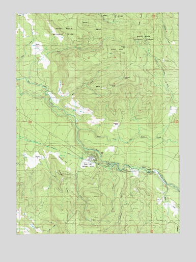
Butte Falls, OR USGS Topographic Map
Click on map above to begin viewing in our Map Viewer.

This topographic map contains these locations and features:
Feature Name Type Latitude Longitude GNIS ID View Map
Beekman FlatFlatN42.5421°W122.5861°1137883View Map
Beekman RidgeRidgeN42.5296°W122.5895°1137884View Map
Big Butte Post Office (historical)Post OfficeN42.5499°W122.6123°1164915View Map
Bill Edmonson Memorial MuseumBuildingN42.5442°W122.5706°2699151View Map
Bowen CreekStreamN42.5282°W122.5109°1138515View Map
Box CreekStreamN42.5760°W122.5995°1138535View Map
Butte FallsPopulated PlaceN42.5432°W122.5656°1139061View Map
Butte FallsFallsN42.5460°W122.5620°1155403View Map
Butte Falls Branch LibraryBuildingN42.5418°W122.5677°2699168View Map
Butte Falls CemeteryCemeteryN42.5507°W122.6039°1139062View Map
Butte Falls City HallBuildingN42.5438°W122.5666°2699169View Map
Butte Falls Elementary SchoolSchoolN42.5428°W122.5700°2440100View Map
Butte Falls Historical Society and Railway Museum CabooseBuildingN42.5418°W122.5677°2699170View Map
Butte Falls Municipal CourtBuildingN42.5438°W122.5666°2699171View Map
Butte Falls Police DeptBuildingN42.5438°W122.5662°2737807View Map
Butte Falls Post OfficePost OfficeN42.5438°W122.5676°1164992View Map
Butte Falls Ranger StationBuildingN42.5410°W122.5650°1159310View Map
Butte Falls Secondary SchoolSchoolN42.5419°W122.5669°2440099View Map
Butte Falls Sewage Treatment PlantLocaleN42.5451°W122.5716°2697103View Map
Butte Falls State Forest StationLocaleN42.5454°W122.5761°1167223View Map
Butte Falls Volunteer Fire DepartmentBuildingN42.5438°W122.5664°2576570View Map
Cobleigh RanchLocaleN42.5843°W122.6011°1139878View Map
Dog CreekStreamN42.5871°W122.6173°1141127View Map
Doubleday CreekStreamN42.5365°W122.5378°1141206View Map
Eighty Acre CreekStreamN42.5540°W122.5186°1141709View Map
Fredenburg ButteSummitN42.5837°W122.5479°1639308View Map
Fredenburg RanchLocaleN42.5626°W122.5475°1158249View Map
Fredenburg SpringSpringN42.5879°W122.5437°1155404View Map
Geppert CreekStreamN42.5429°W122.6150°1159025View Map
Ginger CreekStreamN42.5390°W122.5550°1142746View Map
Hafer FlatFlatN42.5387°W122.5178°1155044View Map
Hukill CreekStreamN42.5468°W122.5723°1143899View Map
Jerry Gotts SpringSpringN42.5901°W122.5470°1155045View Map
Medford AqueductCanalN42.5490°W122.6009°1146071View Map
North Fork Big Butte CreekStreamN42.5585°W122.5773°1146908View Map
Perry SchoolLocaleN42.5460°W122.6198°1147604View Map
Richard CreekStreamN42.5096°W122.5109°1155072View Map
Rocky FlatFlatN42.6062°W122.6084°1148660View Map
Santiam PeakSummitN42.6049°W122.5414°1149068View Map
South Fork Big Butte CreekSwampN42.5449°W122.5936°1149932View Map
Town of Butte FallsCivilN42.5414°W122.5691°2411750View Map

Note: Coordinates in the location and feature list above are referenced to NAD83 datum.


Copyright (C) 2008-2024 Ryan Niemi / Sunset Dynamics ... All Rights Reserved