TopoQuest Logo
Do you find TopoQuest useful?
Help keep TopoQuest running and adding new maps/features by donating!
Bitcoin:  19c7KJd3qBynnjoSw5npx9KScwjBe4ifkT
Litecoin:  LXs6TkuXGGXo1vDsWCkWVdjQX94eUKd6ui
Home View Maps Find Maps Find Places Resources & Links


Obey City, Tennessee Topographic Map

USGS Map Title: Obey City, TN
USGS Map MRC: 36085B2
DRG (GeoTIFF) Download: o36085b2.tif


Neighboring USGS Topographic Map Quads:


  Okalona, TN  
36085C3
 

  Crawford, TN  
36085C2
 

  Wilder, TN  
36085C1
 

  Monterey, TN  
36085B3
 

  Obey City, TN  
36085B2
 

  Clarkrange, TN  
36085B1
 

  Monterey Lake, TN  
36085A3
 

  Campbell Junction, TN  
36085A2
 

  Isoline, TN  
36085A1


Map MRC Location:

N37°
W86°
N37°
W85°
H8 H7 H6 H5 H4 H3 H2 H1
G8 G7 G6 G5 G4 G3 G2 G1
F8 F7 F6 F5 F4 F3 F2 F1
E8 E7 E6 E5 E4 E3 E2 E1
D8 D7 D6 D5 D4 D3 D2 D1
C8 C7 C6 C5 C4 C3 C2 C1
B8 B7 B6 B5 B4 B3 B2 B1
A8 A7 A6 A5 A4 A3 A2 A1
N36°
W86°
N36°
W85°

Obey City, TN USGS 1:24K Topographic Map Preview:
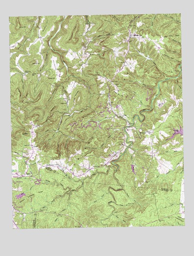
Obey City, TN USGS Topographic Map
Click on map above to begin viewing in our Map Viewer.

This topographic map contains these locations and features:
Feature Name Type Latitude Longitude GNIS ID View Map
Adkins BranchStreamN36.1395°W85.1752°1275478View Map
AndersonPopulated PlaceN36.1728°W85.2347°1275676View Map
Anderson School (historical)SchoolN36.1740°W85.2330°1317262View Map
Austin BranchStreamN36.1959°W85.1475°1275993View Map
Big Sunk CaneBasinN36.2265°W85.1933°1305241View Map
Bill BranchStreamN36.1851°W85.1619°1277456View Map
Blaylock BranchStreamN36.1451°W85.2077°1277673View Map
BonsackPopulated PlaceN36.2076°W85.1736°1314716View Map
Brushy MountainSummitN36.2448°W85.2225°1269386View Map
Buckner ChapelChurchN36.1567°W85.2405°1278882View Map
Bullpen BranchStreamN36.1515°W85.2322°1278972View Map
Camp Monterey LakeReservoirN36.1551°W85.1400°1302397View Map
Camp Monterey Lake DamDamN36.1551°W85.1400°1302396View Map
Carroll BranchStreamN36.1459°W85.1794°1279738View Map
Chapel Hill CemeteryCemeteryN36.2159°W85.1308°1280253View Map
Charlie BranchStreamN36.1690°W85.1677°1280277View Map
City of Monterey LakeReservoirN36.1514°W85.2312°1302395View Map
City of Monterey Water Supply DamDamN36.1535°W85.2288°1302394View Map
Cliff SpringsPopulated PlaceN36.1806°W85.1508°1305969View Map
Columbia HillPopulated PlaceN36.1987°W85.2086°1314872View Map
Columbia Hill ChurchChurchN36.1928°W85.2080°1306051View Map
Copeland MountainSummitN36.2028°W85.2436°1281251View Map
Crawford Division (historical)CensusN36.2295°W85.1836°1648903View Map
Dennis BranchStreamN36.2065°W85.1422°1282337View Map
Doubling SpurLocaleN36.1598°W85.1905°1282715View Map
Flat House HollowValleyN36.1622°W85.2372°1284406View Map
Flower MountainSummitN36.2001°W85.2008°1284507View Map
France CemeteryCemeteryN36.2314°W85.1966°1284798View Map
France MountainSummitN36.2437°W85.2433°1284799View Map
Garrison BranchStreamN36.1456°W85.2105°1285205View Map
Green PondPopulated PlaceN36.2106°W85.1769°1315152View Map
Green Pond MountainSummitN36.2034°W85.1697°1286118View Map
Gunter MountainSummitN36.1842°W85.2039°1286446View Map
Hampton MountainSummitN36.1803°W85.2422°1286706View Map
Hanging LimbPopulated PlaceN36.2370°W85.1619°1286723View Map
Hanging Limb Baptist ChurchChurchN36.2362°W85.1622°1643804View Map
Hanging Limb CemeteryCemeteryN36.2351°W85.1625°1644901View Map
Hanging Limb School (historical)SchoolN36.2370°W85.1591°1317266View Map
HargissPopulated PlaceN36.2217°W85.1664°1315192View Map
Honeycutt EstatesPopulated PlaceN36.1378°W85.2472°1310925View Map
J E Walker LakeReservoirN36.1445°W85.2440°1302389View Map
J E Walker Lake DamDamN36.1459°W85.2418°1302390View Map
Johnson HollowValleyN36.1818°W85.2171°1289620View Map
Laboring BackboneRidgeN36.1926°W85.2205°1290437View Map
Lad LakeReservoirN36.1591°W85.1618°1302398View Map
Lad Lake DamDamN36.1615°W85.1621°1302399View Map
Lick BranchStreamN36.2126°W85.1294°1291195View Map
Long BranchStreamN36.1909°W85.1736°1291888View Map
Looper CemeteryCemeteryN36.2323°W85.2483°1292058View Map
LovejoyPopulated PlaceN36.1901°W85.1680°1306708View Map
Lovejoy CemeteryCemeteryN36.1914°W85.1705°1644910View Map
Marth BranchStreamN36.1326°W85.1780°1292780View Map
Meadow CreekStreamN36.1578°W85.1741°1293499View Map
Mineral HollowValleyN36.1787°W85.2079°1294034View Map
Mineral SpringsPopulated PlaceN36.1617°W85.2252°1315520View Map
Mineral Springs BranchStreamN36.1531°W85.1989°1294039View Map
Mineral Springs First Baptist ChurchChurchN36.1559°W85.2027°1643813View Map
Mountain Volunteer Fire and RescueBuildingN36.2369°W85.1595°2654573View Map
Muddy Pond Volunteer Fire DepartmentBuildingN36.1894°W85.1349°2654575View Map
Negro MountainSummitN36.2137°W85.1819°1295348View Map
Norrod CemeteryCemeteryN36.2209°W85.1955°1295843View Map
Norrod MountainSummitN36.2459°W85.1808°1295845View Map
Obey CityPopulated PlaceN36.1737°W85.1680°1315639View Map
Officer BranchStreamN36.1456°W85.2105°1296246View Map
Officer Orchard RidgeRidgeN36.1434°W85.2366°1296248View Map
Phillips CemeteryCemeteryN36.1845°W85.2319°1297345View Map
Phillips CemeteryCemeteryN36.2009°W85.2094°1297346View Map
Phillips FordCrossingN36.2162°W85.1258°1315707View Map
Pine HollowValleyN36.2144°W85.2072°1297555View Map
Pine Ridge CemeteryCemeteryN36.1814°W85.1275°1644921View Map
Pine Ridge ChurchChurchN36.1812°W85.1269°1297586View Map
Polebridge BranchStreamN36.1545°W85.2364°1303522View Map
Poley HollowValleyN36.1818°W85.2170°1298052View Map
Potato HillSummitN36.2134°W85.2233°1298334View Map
Rocky BarCliffN36.2159°W85.2344°1299844View Map
Round TopSummitN36.2223°W85.2344°1300185View Map
Round TopSummitN36.2373°W85.2039°1300186View Map
Sally HollowValleyN36.2099°W85.2120°1300582View Map
Service BranchStreamN36.1823°W85.1677°1301084View Map
Shaver CemeteryCemeteryN36.1384°W85.1622°1301287View Map
Steward ForkStreamN36.1473°W85.1700°1271355View Map
Sunk Cane BranchStreamN36.2301°W85.1944°1271857View Map
Swallows CemeteryCemeteryN36.1959°W85.1427°1271927View Map
Terry CemeteryCemeteryN36.1334°W85.1761°1272337View Map
Thompson CemeteryCemeteryN36.2081°W85.2186°1304076View Map
Thompson FlatFlatN36.2178°W85.2164°1272542View Map
Tyler MountainSummitN36.1992°W85.2391°1273148View Map
Union Grove ChurchChurchN36.1740°W85.2347°1273227View Map
Union Point CemeteryCemeteryN36.2167°W85.2386°1644925View Map
Union Point ChurchChurchN36.2165°W85.2389°1273246View Map
Whiteoak BranchStreamN36.2498°W85.1430°1274427View Map
Wilson CemeteryCemeteryN36.1826°W85.1661°1274812View Map
Wilson Elementary SchoolSchoolN36.2170°W85.1716°1317276View Map
Wilson HollowValleyN36.2314°W85.2203°1274835View Map
Wolf BranchStreamN36.2120°W85.1341°1274931View Map
Wolf BranchStreamN36.2120°W85.1344°1274932View Map
Yellow BranchStreamN36.1803°W85.2130°1275264View Map

Note: Coordinates in the location and feature list above are referenced to NAD83 datum.


Copyright (C) 2008-2025 Ryan Niemi / Sunset Dynamics ... All Rights Reserved