TopoQuest Logo
Do you find TopoQuest useful?
Help keep TopoQuest running and adding new maps/features by donating!
Bitcoin:  19c7KJd3qBynnjoSw5npx9KScwjBe4ifkT
Litecoin:  LXs6TkuXGGXo1vDsWCkWVdjQX94eUKd6ui
Home View Maps Find Maps Find Places Resources & Links


Ocilla West, Georgia Topographic Map

USGS Map Title: Ocilla West, GA
USGS Map MRC: 31083E3
DRG (GeoTIFF) Download: o31083e3.tif


Neighboring USGS Topographic Map Quads:


  Irwinville, GA  
31083F4
 

  Fitzgerald West, GA  
31083F3
 

  Fitzgerald East, GA  
31083F2
 

  Waterloo, GA  
31083E4
 

  Ocilla West, GA  
31083E3
 

  Ocilla East, GA  
31083E2
 

  Tifton East, GA  
31083D4
 

  Enigma, GA  
31083D3
 

  Alapaha, GA  
31083D2


Map MRC Location:

N32°
W84°
N32°
W83°
H8 H7 H6 H5 H4 H3 H2 H1
G8 G7 G6 G5 G4 G3 G2 G1
F8 F7 F6 F5 F4 F3 F2 F1
E8 E7 E6 E5 E4 E3 E2 E1
D8 D7 D6 D5 D4 D3 D2 D1
C8 C7 C6 C5 C4 C3 C2 C1
B8 B7 B6 B5 B4 B3 B2 B1
A8 A7 A6 A5 A4 A3 A2 A1
N31°
W84°
N31°
W83°

Ocilla West, GA USGS 1:24K Topographic Map Preview:
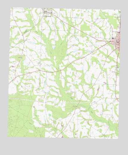
Ocilla West, GA USGS Topographic Map
Click on map above to begin viewing in our Map Viewer.

This topographic map contains these locations and features:
Feature Name Type Latitude Longitude GNIS ID View Map
Cedar Grove ChurchChurchN31.5646°W83.2546°312472View Map
Cumbee ParkParkN31.5882°W83.2502°313211View Map
Duren Lake DamDamN31.6035°W83.3549°337281View Map
E Paulk LakeReservoirN31.6152°W83.3007°337324View Map
E Paulk Lake DamDamN31.6135°W83.3015°337323View Map
Evertt CemeteryCemeteryN31.6118°W83.3038°344956View Map
First Methodist ChurchChurchN31.5941°W83.2521°344957View Map
Fletcher CemeteryCemeteryN31.5641°W83.3679°314220View Map
Gray LakeReservoirN31.5681°W83.2917°337300View Map
Gray Lake DamDamN31.5669°W83.2915°337299View Map
Irwin AcademySchoolN31.6202°W83.3285°315945View Map
Irwin CountyCivilN31.6023°W83.2764°352302View Map
Irwin County CourthouseBuildingN31.5919°W83.2513°344962View Map
Irwin County Detention CenterBuildingN31.5798°W83.2554°2735701View Map
Irwin County Elementary SchoolSchoolN31.5949°W83.2535°344963View Map
Irwin County High SchoolSchoolN31.5974°W83.2582°344964View Map
Irwin County HospitalHospitalN31.6034°W83.2510°344965View Map
Irwin County JailBuildingN31.5910°W83.2504°344966View Map
Irwin County LibraryBuildingN31.5913°W83.2515°344967View Map
Irwin County Sheriff's Department and JailBuildingN31.5911°W83.2502°2734209View Map
Lake BettieReservoirN31.6023°W83.3568°311257View Map
Little CreekStreamN31.5660°W83.3196°317027View Map
Little LakeReservoirN31.5184°W83.3333°337312View Map
Little Lake DamDamN31.5169°W83.3332°337311View Map
MysticPopulated PlaceN31.6221°W83.3357°319187View Map
Mystic CemeteryCemeteryN31.6227°W83.3335°344975View Map
Mystic Post OfficePost OfficeN31.6210°W83.3371°352274View Map
New Valley Grove CemeteryCemeteryN31.5285°W83.2943°344976View Map
New Valley Grove ChurchChurchN31.5271°W83.2932°319554View Map
OcillaPopulated PlaceN31.5944°W83.2504°332555View Map
Ocilla Baptist ChurchChurchN31.5957°W83.2502°344977View Map
Ocilla City HallBuildingN31.5949°W83.2504°344980View Map
Ocilla Country ClubLocaleN31.6205°W83.2554°344312View Map
Ocilla DivisionCivilN31.5630°W83.2695°1936451View Map
Ocilla Hospital (historical)HospitalN31.5949°W83.2510°344981View Map
Ocilla Post OfficePost OfficeN31.5924°W83.2504°352275View Map
Old Valley Grove CemeteryCemeteryN31.5438°W83.3027°344982View Map
Old Valley Grove ChurchChurchN31.5438°W83.3021°320036View Map
PinettaPopulated PlaceN31.5932°W83.3582°326472View Map
Pinetta CemeteryCemeteryN31.5763°W83.3621°344987View Map
Pinetta ChurchChurchN31.5766°W83.3615°320667View Map
Piney Grove CemeteryCemeteryN31.5949°W83.3557°344988View Map
Piney Grove ChurchChurchN31.5949°W83.3557°320702View Map
Pleasant Hill CemeteryCemeteryN31.5032°W83.2982°320855View Map
Pleasant Hill ChurchChurchN31.5302°W83.2971°320871View Map
Royal Singing TabernacleChurchN31.6221°W83.3338°344993View Map
Turk Lake NorthReservoirN31.5963°W83.2989°340867View Map
Turk Lake North DamDamN31.5969°W83.2999°340866View Map
Turk Lake SouthReservoirN31.5843°W83.3005°337292View Map
Turk Lake South DamDamN31.5835°W83.3015°337291View Map
WKAA-FM (Ocilla)TowerN31.5271°W83.3352°352750View Map

Note: Coordinates in the location and feature list above are referenced to NAD83 datum.


Copyright (C) 2008-2025 Ryan Niemi / Sunset Dynamics ... All Rights Reserved