TopoQuest Logo
Do you find TopoQuest useful?
Help keep TopoQuest running and adding new maps/features by donating!
Bitcoin:  19c7KJd3qBynnjoSw5npx9KScwjBe4ifkT
Litecoin:  LXs6TkuXGGXo1vDsWCkWVdjQX94eUKd6ui
Home View Maps Find Maps Find Places Resources & Links


Odell, Illinois Topographic Map

USGS Map Title: Odell, IL
USGS Map MRC: 41088A5
DRG (GeoTIFF) Download: o41088a5.tif


Neighboring USGS Topographic Map Quads:


  Ransom, IL  
41088B6
 

  Kinsman, IL  
41088B5
 

  Mazon, IL  
41088B4
 

  Blackstone, IL  
41088A6
 

  Odell, IL  
41088A5
 

  Dwight, IL  
41088A4
 

  Northwest Pontiac, IL  
40088H6
 

  Northeast Pontiac, IL  
40088H5
 

  Saunemin, IL  
40088H4


Map MRC Location:

N42°
W89°
N42°
W88°
H8 H7 H6 H5 H4 H3 H2 H1
G8 G7 G6 G5 G4 G3 G2 G1
F8 F7 F6 F5 F4 F3 F2 F1
E8 E7 E6 E5 E4 E3 E2 E1
D8 D7 D6 D5 D4 D3 D2 D1
C8 C7 C6 C5 C4 C3 C2 C1
B8 B7 B6 B5 B4 B3 B2 B1
A8 A7 A6 A5 A4 A3 A2 A1
N41°
W89°
N41°
W88°

Odell, IL USGS 1:24K Topographic Map Preview:
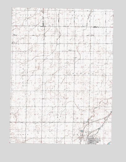
Odell, IL USGS Topographic Map
Click on map above to begin viewing in our Map Viewer.

This topographic map contains these locations and features:
Feature Name Type Latitude Longitude GNIS ID View Map
Adams (historical)Populated PlaceN41.0995°W88.5848°1737535View Map
BuddPopulated PlaceN41.0989°W88.6231°422513View Map
Burquin School (historical)LocaleN41.0045°W88.5678°405257View Map
Conard School (historical)LocaleN41.1217°W88.6051°406434View Map
Interchange 209CrossingN41.0059°W88.5364°1737612View Map
McGreevy School (historical)LocaleN41.0628°W88.5656°413271View Map
NevadaPopulated PlaceN41.0859°W88.5515°423015View Map
Nevada CemeteryCemeteryN41.0797°W88.5474°414376View Map
OdellPopulated PlaceN41.0036°W88.5253°414955View Map
Odell CemeteryCemeteryN41.0111°W88.5281°1719754View Map
Odell Fire Protection DistrictBuildingN41.0022°W88.5255°2682035View Map
Odell Grade SchoolSchoolN41.0031°W88.5209°1737637View Map
Odell High School (historical)SchoolN41.0031°W88.5209°1737638View Map
Odell Post OfficePost OfficeN41.0034°W88.5256°2788287View Map
Saint Paul Catholic ChurchChurchN41.0036°W88.5278°2042131View Map
Saint Paul's Catholic CemeteryCemeteryN41.0222°W88.5278°417698View Map
Sampson School (historical)LocaleN41.0328°W88.6045°417918View Map
Scott School (historical)LocaleN41.1223°W88.5284°418145View Map
Sharp School (historical)LocaleN41.0931°W88.5281°418296View Map
SunburyPopulated PlaceN41.1009°W88.5276°423219View Map
Sunbury Railroad Prairie Nature PreserveParkN41.0848°W88.6142°1993299View Map
Township of NevadaCivilN41.0643°W88.5280°429428View Map
Union CemeteryCemeteryN41.0111°W88.5303°420024View Map
United Methodist Church of OdellChurchN41.0031°W88.5223°2042132View Map
Village of OdellCivilN41.0020°W88.5223°2399558View Map

Note: Coordinates in the location and feature list above are referenced to NAD83 datum.


Copyright (C) 2008-2025 Ryan Niemi / Sunset Dynamics ... All Rights Reserved