TopoQuest Logo
Do you find TopoQuest useful?
Help keep TopoQuest running and adding new maps/features by donating!
Bitcoin:  19c7KJd3qBynnjoSw5npx9KScwjBe4ifkT
Litecoin:  LXs6TkuXGGXo1vDsWCkWVdjQX94eUKd6ui
Home View Maps Find Maps Find Places Resources & Links


Northeast Pontiac, Illinois Topographic Map

USGS Map Title: Northeast Pontiac, IL
USGS Map MRC: 40088H5
DRG (GeoTIFF) Download: o40088h5.tif


Neighboring USGS Topographic Map Quads:


  Blackstone, IL  
41088A6
 

  Odell, IL  
41088A5
 

  Dwight, IL  
41088A4
 

  Northwest Pontiac, IL  
40088H6
 

  Northeast Pontiac, IL  
40088H5
 

  Saunemin, IL  
40088H4
 

  Southwest Pontiac, IL  
40088G6
 

  Southeast Pontiac, IL  
40088G5
 

  Forrest North, IL  
40088G4


Map MRC Location:

N41°
W89°
N41°
W88°
H8 H7 H6 H5 H4 H3 H2 H1
G8 G7 G6 G5 G4 G3 G2 G1
F8 F7 F6 F5 F4 F3 F2 F1
E8 E7 E6 E5 E4 E3 E2 E1
D8 D7 D6 D5 D4 D3 D2 D1
C8 C7 C6 C5 C4 C3 C2 C1
B8 B7 B6 B5 B4 B3 B2 B1
A8 A7 A6 A5 A4 A3 A2 A1
N40°
W89°
N40°
W88°

Northeast Pontiac, IL USGS 1:24K Topographic Map Preview:
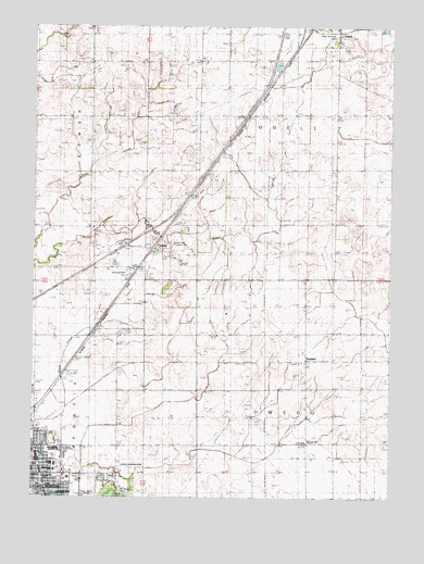
Northeast Pontiac, IL USGS Topographic Map
Click on map above to begin viewing in our Map Viewer.

This topographic map contains these locations and features:
Feature Name Type Latitude Longitude GNIS ID View Map
Bashore School (historical)SchoolN40.9764°W88.5287°403953View Map
Brick School (historical)SchoolN40.8881°W88.5951°404846View Map
Calvary Baptist ChurchChurchN40.8809°W88.5959°1719382View Map
CayugaPopulated PlaceN40.9411°W88.5837°405724View Map
Center School (historical)SchoolN40.8886°W88.5295°405827View Map
Chase School (historical)SchoolN40.9759°W88.6062°405989View Map
Dargan ParkParkN40.8798°W88.6215°1719388View Map
Enterprise School (historical)SchoolN40.9186°W88.6056°408043View Map
First Christian ChurchChurchN40.8881°W88.6098°1737588View Map
Fitzgerald School (historical)SchoolN40.9148°W88.5681°408412View Map
Grove School (historical)SchoolN40.9478°W88.6062°409546View Map
Jaycee ParkParkN40.8795°W88.6103°1719397View Map
Lions ParkParkN40.8845°W88.6248°1719418View Map
Livingston CountyCivilN40.8916°W88.5577°424254View Map
Livingston County CourthouseBuildingN40.8800°W88.5045°1719401View Map
McCulley SubdivisionPopulated PlaceN40.8798°W88.6001°1737621View Map
Memorial Park CemeteryCemeteryN40.9339°W88.5989°413390View Map
Miller Memorial ParkParkN40.9981°W88.5198°1719403View Map
Mund School (historical)SchoolN40.9486°W88.5262°414232View Map
Owego SchoolSchoolN40.8898°W88.5281°1719405View Map
Owego TownhallBuildingN40.8898°W88.5292°1719406View Map
Pontiac Church of GodChurchN40.8881°W88.6228°1737644View Map
Pontiac High SchoolSchoolN40.8875°W88.6167°1719412View Map
Pontiac Junior High SchoolSchoolN40.8836°W88.6167°1737647View Map
Pontiac Municipal AirportAirportN40.9221°W88.6246°427701View Map
Porter School (historical)SchoolN40.8753°W88.5676°416051View Map
Saint James HospitalHospitalN40.8784°W88.6226°1737663View Map
Saint Mary's Catholic CemeteryCemeteryN40.8770°W88.5945°417566View Map
Schott AirportAirportN40.8832°W88.5925°427704View Map
SwygertPopulated PlaceN40.9117°W88.5295°423226View Map
Swygert CemeteryCemeteryN40.9109°W88.5337°1737688View Map
Swygert School (historical)SchoolN40.9195°W88.5303°419497View Map
Township of OdellCivilN40.9768°W88.5285°429476View Map
Township of OwegoCivilN40.8894°W88.5284°429517View Map
Wakey School (historical)SchoolN40.9761°W88.5684°420385View Map
Washington Elementary SchoolSchoolN40.8823°W88.6173°1719424View Map
WJEZ-FM (Pontiac)TowerN40.8753°W88.6031°428276View Map
Wolf Creek Country ClubLocaleN40.9425°W88.5759°1719426View Map
WPOK-AM (Pontiac)TowerN40.8753°W88.6031°428069View Map

Note: Coordinates in the location and feature list above are referenced to NAD83 datum.


Copyright (C) 2008-2024 Ryan Niemi / Sunset Dynamics ... All Rights Reserved