TopoQuest Logo
Do you find TopoQuest useful?
Help keep TopoQuest running and adding new maps/features by donating!
Bitcoin:  19c7KJd3qBynnjoSw5npx9KScwjBe4ifkT
Litecoin:  LXs6TkuXGGXo1vDsWCkWVdjQX94eUKd6ui
Home View Maps Find Maps Find Places Resources & Links


Old Dock, North Carolina Topographic Map

USGS Map Title: Old Dock, NC
USGS Map MRC: 34078B5
DRG (GeoTIFF) Download: o34078b5.tif


Neighboring USGS Topographic Map Quads:


  Whiteville, NC  
34078C6
 

  Lake Waccamaw West, NC  
34078C5
 

  Lake Waccamaw East, NC  
34078C4
 

  Nakina, NC  
34078B6
 

  Old Dock, NC  
34078B5
 

  Juniper Creek, NC  
34078B4
 

  Pireway, NC  
34078A6
 

  Freeland, NC  
34078A5
 

  Exum, NC  
34078A4


Map MRC Location:

N35°
W79°
N35°
W78°
H8 H7 H6 H5 H4 H3 H2 H1
G8 G7 G6 G5 G4 G3 G2 G1
F8 F7 F6 F5 F4 F3 F2 F1
E8 E7 E6 E5 E4 E3 E2 E1
D8 D7 D6 D5 D4 D3 D2 D1
C8 C7 C6 C5 C4 C3 C2 C1
B8 B7 B6 B5 B4 B3 B2 B1
A8 A7 A6 A5 A4 A3 A2 A1
N34°
W79°
N34°
W78°

Old Dock, NC USGS 1:24K Topographic Map Preview:
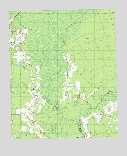
Old Dock, NC USGS Topographic Map
Click on map above to begin viewing in our Map Viewer.

This topographic map contains these locations and features:
Feature Name Type Latitude Longitude GNIS ID View Map
Bear BranchStreamN34.1643°W78.5814°1004817View Map
Blackmon CemeteryCemeteryN34.1757°W78.5964°1004716View Map
Boggy SwampSwampN34.2027°W78.5775°981685View Map
Buck IslandIslandN34.2216°W78.5358°982107View Map
Clewis CemeteryCemeteryN34.1871°W78.5600°1004717View Map
Clifton IslandIslandN34.1524°W78.5761°983285View Map
Cross SwampSwampN34.1310°W78.5625°983793View Map
Crusoe Community HallLocaleN34.1838°W78.5583°983812View Map
Duncan CemeteryCemeteryN34.1529°W78.5978°1004718View Map
Etheridge CemeteryCemeteryN34.1868°W78.5600°1004715View Map
Formyduval CemeteryCemeteryN34.1404°W78.5950°1004719View Map
Gum SwampSwampN34.1404°W78.5775°986240View Map
Gum Swamp RunStreamN34.1624°W78.5803°986249View Map
Honey FieldLocaleN34.2193°W78.6178°987011View Map
Juniper CreekStreamN34.1404°W78.5456°987851View Map
Lee LakeSwampN34.2468°W78.6089°988300View Map
Little SwampSwampN34.1679°W78.5122°1004826View Map
Macedonia ChurchChurchN34.1702°W78.5592°1024897View Map
Magnolia ChurchChurchN34.1893°W78.5572°989234View Map
Mark Pine BaySwampN34.2038°W78.6200°989342View Map
Mark Pine CanalStreamN34.2049°W78.5945°989343View Map
Mill BranchStreamN34.1552°W78.5250°989858View Map
Myrtle Head CemeteryCemeteryN34.1571°W78.5175°1004721View Map
Myrtle Head ChurchChurchN34.1449°W78.5095°990831View Map
Old DockPopulated PlaceN34.1679°W78.5972°991543View Map
Old Dock - Cypress Creek Volunteer Fire Department and AuxiliaryBuildingN34.1904°W78.6039°2638321View Map
Old Dock ChurchChurchN34.1663°W78.5933°1004713View Map
Old Dock Elementary SchoolSchoolN34.1943°W78.6089°1006495View Map
Old Dock SchoolSchoolN34.1646°W78.5936°1004714View Map
Palmyra ChurchChurchN34.1610°W78.5961°991808View Map
Pine IslandIslandN34.1449°W78.5903°992257View Map
Ready BranchStreamN34.1482°W78.5161°993088View Map
RiverviewPopulated PlaceN34.1877°W78.5581°1019876View Map
Ross CemeteryCemeteryN34.1313°W78.5883°1004720View Map
Schulkens PondLakeN34.1807°W78.6122°1004639View Map
Shiloh ChurchChurchN34.2304°W78.6206°994682View Map
Snake IslandIslandN34.1985°W78.6042°995041View Map
South Old DockLocaleN34.1421°W78.5975°995183View Map
Sweetgum IslandIslandN34.1277°W78.5914°995782View Map
The FishpondsLakeN34.2057°W78.5641°995971View Map
Township of LeesCivilN34.1780°W78.6142°1026577View Map
White MarshStreamN34.1702°W78.5772°1025787View Map

Note: Coordinates in the location and feature list above are referenced to NAD83 datum.


Copyright (C) 2008-2024 Ryan Niemi / Sunset Dynamics ... All Rights Reserved